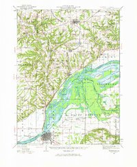
1944 Map of Beardstown
USGS Topo · Published 1966About this map
The Sangamon River and the Illinois River converge near Beardstown, creating a complex network of backwaters and sloughs that define this Central Illinois landscape. The 1940s culture revision reveals a countryside densely dotted with community institutions such as Onion School, Hawkeye School, and Good Hope School. These rural landmarks, often positioned at crossroads near family farms, reflect a decentralized settlement pattern common before post-war school consolidations.
Find a feature on this map
161 named features on this map. Tap any name to fly to it.
Don’t see what you’re looking for? This feature index may not catch every label — zoom into the map to look around manually.
Map Details
Editions of this 1944 Beardstown Map
2 editions found

Other maps of this area

1912 · Macomb
USGS Topo · 1:62,500

1914 · Macomb
USGS Topo · 1:62,500

1918 · Vermont
USGS Topo · 1:62,500

1921 · Vermont
USGS Topo · 1:62,500

1923 · Rushville
USGS Topo · 1:62,500

1925 · Havana
USGS Topo · 1:62,500

1926 · Beardstown
USGS Topo · 1:62,500

1926 · Rushville
USGS Topo · 1:62,500

1928 · Meredosia
USGS Topo · 1:62,500

1929 · Arenzville
USGS Topo · 1:62,500