Old Maps of Schuyler County, Illinois for Hiking & Exploration
Hike through history with 147 historic maps of Schuyler County. Explore old trails, ghost towns, and forgotten backroads — perfect for outdoor adventurers and local explorers.
- Rediscover forgotten places: Map out old mining camps, roads, and footpaths that no longer exist on modern maps.
- Layer with modern tools: Combine with LiDAR or satellite views to plan hikes through historical terrain.
- Made for exploration: Popular among hikers, overlanders, and local history lovers.
Use these maps to find adventure and explore the hidden past of Schuyler County.
Schuyler County, IL maps
(147)- 1912 Map of Macomb, 1966 Print
 1912 Macomb1966 Print · USGSMcDonough County during the early twentieth century shows a landscape of scattered farmsteads and one-room schoolhouses. Genealogists can trace family landmarks like Runkle School and Pennington Point or follow the path of the Waubonsie Trail.
 - 1913 Map of Colchester
 1913 Colchester1913 Print · USGSWestern Illinois at the start of the twentieth century was a landscape of dense rural school districts and prairie rail towns. Trace the early footprints of Colchester and Tennessee, or locate forgotten sites like Vishnu Sprs and the Clay Mine.3 unique versions available
 - 1914 Map of Macomb
 1914 Macomb1914 Print · USGSWestern Illinois before the Great War is captured here through its dense network of rural school districts and burgeoning rail lines. Genealogists can locate specific family landmarks such as Pennington Point, the Town Hall, and the path of the historic Waubonsie Trail.4 unique versions available
 - 1918 Map of Vermont
 1918 Vermont1918 Print · USGSThe rural prairie of McDonough and Fulton counties is captured here just after the Great War, during the height of the railroad era. Genealogists can locate specific homestead sites near New Philadelphia or trace the many rural schoolhouses like Mud Acre School and Harvey School.2 unique versions available
 - 1921 Map of Vermont
 1921 Vermont1921 Print · USGSWestern Illinois prairie and river breaks are documented here just after the Great War, showing a landscape defined by small family farms. Researchers can trace rural school districts and pioneer churches like Mud Acre School, Mt Pleasant Church, and the settlement at Bernadotte.2 unique versions available
 - 1923 Map of Rushville, 1958 Print
 1923 Rushville1958 Print · USGSSchuyler County's agricultural and social landscape is captured here in the early 1920s, centered on the rail terminus at Rushville. Genealogists and historians can trace numerous rural schools and churches, including Muley School, Ebenezer Church, and Pokeberry School.
 - 1926 Map of Beardstown
 1926 Beardstown1926 Print · USGSThe Illinois River valley and its surrounding bluffs are shown in the mid-1920s, centered on the river hub of Beardstown. Genealogists can trace family ties to dozens of local landmarks, from Griggs Chapel and Mt Zion Church to rural schools like Good Hope School and Biren School.2 unique versions available
 - 1926 Map of Rushville
 1926 Rushville1926 Print · USGSSchuyler and Brown counties appear in the mid-1920s as a landscape of small farmsteads and rural social hubs. Genealogists and historians can trace an extraordinary density of local institutions, from White Frame School to the Ebenezer Church and the rails of the Chicago Burlington and Quincy.2 unique versions available
 - 1928 Map of Meredosia, 1958 Print
 1928 Meredosia1958 Print · USGSThe Illinois River valley in the late 1920s was a bustling corridor of river locks, pumping stations, and rail lines. Genealogists and local historians can trace family roots through numerous rural landmarks like Ham Sch, Reich Landing, and the Perry Spring's Sta rail stop.2 unique versions available
 - 1930 Map of Chandlerville
 1930 Chandlerville1930 Print · USGSThe confluence of the Illinois and Sangamon rivers defines this Depression-era landscape of floodplains and island farms. Genealogists can trace family footprints across Grand Island or locate rural landmarks like Mt Olive Ch and the Chicago and Illinois Midland RR.2 unique versions available
 - 1931 Map of Meredosia
 1931 Meredosia1931 Print · USGSThe Illinois River valley in the late twenties is captured here at a peak of rail and river activity. Genealogists can trace family roots through numerous country schools like Sand Ridge Sch and the important La Grange Locks complex.2 unique versions available
 - 1932 Map of Chandlerville
 1932 Chandlerville1932 Print · USGSIn the 1930s, the Illinois River valley was a labyrinth of sloughs and landings centered around the Sangamon confluence. Genealogists can trace family roots through numerous rural schools like Blackjack Sch or explore old river sites like Snicarte and Matanzas Beach.2 unique versions available
 - 1944 Map of Beardstown, 1959 Print
 1944 Beardstown1959 Print · USGSBeardstown and the Illinois River valley are shown here in the mid-forties, capturing a landscape of shifting river channels and rural school districts. Genealogists can trace family names through landmarks like Griggs Chapel, McClung School, and Sheldons Grove.2 unique versions available
 - 1946 Map of Augusta, 1957 Print
 1946 Augusta1957 Print · USGSWestern Illinois farm country at the end of the 1940s is detailed here as the rail-and-river economy transitions. Genealogists can trace family names at Sherwood Cem and Woodland Cem, or locate rural landmarks like Mt Horeb Ch and Timewell PO.2 unique versions available
 - 1947 Map of Vermont, 1979 Print
 1947 Vermont1979 Print · USGSIn the mid-century period, the area around Vermont and Table Grove was shaped by military activity and mining. Local historians can locate the Camp Ellis Military Reservation and historic schoolhouses like Harvey Sch and Cox Sch.
 - 1948 Map of Quincy
 1948 Quincy1948 Print · USGSThe Mississippi and Illinois River valleys are captured at a post-war crossroads as rail and river travel met the expanding highway system. Genealogists can trace family settlements from Quincy to Hannibal and smaller towns like Vandalia and Jerseyville.2 unique versions available
 - 1948 Map of Vermont
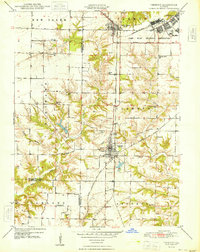 1948 Vermont1948 Print · USGSWestern Illinois was transitioning into the post-war era when this survey recorded the massive Camp Ellis Military Reservation alongside established farming townships. Genealogists can locate family-named landmarks like Easley Cem and Mud Acre Sch.2 unique versions available
 - 1949 Map of Augusta
 1949 Augusta1949 Print · USGSWestern Illinois at the end of the 1940s reveals a landscape of tight-knit rural communities and school districts. Genealogists can trace family footprints across dozens of local landmarks like Sulphur Springs Sch, Woodland Cem, and Mound Station Timewell PO.
 - 1949 Map of Vermont
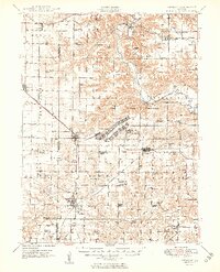 1949 Vermont1949 Print · USGSFulton County and the surrounding tri-county area appear here shortly after the war, centered on the massive Camp Ellis Military Reservation. Researchers can trace the vanished barracks and rail spurs of the camp alongside rural landmarks like the Little Brick School and Bernadotte Bridge.2 unique versions available
 - 1956 Map of Quincy, 1967 Print
 1956 Quincy1967 Print · USGSThe river and rail corridors of the Illinois-Missouri border are documented here during the mid-1950s. Researchers can trace historic river landings and regional transit hubs from Quincy and Hannibal to smaller settlements like Meredosia and Roodhouse.3 unique versions available
 - 1958 Map of Burlington, 1968 Print
 1958 Burlington1968 Print · USGSThe tri-state river country of Iowa, Illinois, and Missouri is captured here in the mid-fifties, dominated by the Mississippi River and major rail lines. Genealogists and historians can trace the development of river towns like Keokuk or locate the sprawling Iowa Army Ammunition Plant.4 unique versions available
 - 1961 Map of Burlington
 1961 Burlington1961 Print · USGSThe tri-state borderlands along the Mississippi River are captured here during the late fifties and early sixties, showing the vital river-and-rail economy of Iowa, Illinois, and Missouri. Genealogists and historians can trace the development of major hubs like Galesburg and Macomb alongside landmark sites such as the Iowa Ordnance Plant and the historic river town of Nauvoo.
 - 1963 Map of Burlington
 1963 Burlington1963 Print · USGSThe tri-state river country of the Mississippi and Illinois valleys comes alive in this mid-century survey. Genealogists and historians can trace the industrial and academic growth of the region, from the Iowa Ordnance Plant to campuses like Knox College and Western Illinois University.
 - 1974 Map of Doddsville, 1977 Print
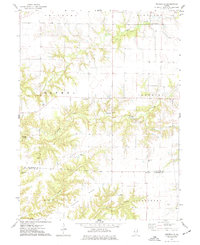 1974 Doddsville1977 Print · USGSThe McDonough and Schuyler County line in the mid-1970s is a landscape of winding creek valleys and high ridges. Researchers can trace local history through numerous burial sites like Stoneking Cem and Pennington Cem or locate the Strip Mine near Grindstone Creek.
 - 1974 Map of Industry, 1977 Print
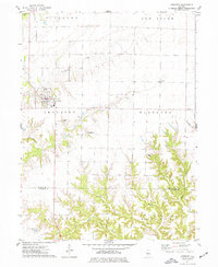 1974 Industry1977 Print · USGSMcDonough and Schuyler Counties in the mid-seventies show a landscape of traditional township farming and rural church life. Genealogists can trace family names through sites like Peck Cem, Standard Cem, and the West Prairie Ch.
Showing maps 1-25 of 147
Top cities of Schuyler County
- Rushville historical maps
- Brooklyn historical maps
- Littleton historical maps
- Frederick historical maps
- Huntsville historical maps
- Birmingham historical maps
See more
Frequently asked questions
- What are the different types of historical maps available for Schuyler County?
- What is the oldest map of Schuyler County?
- Where can I purchase historical maps of Schuyler County for my home or office?
- Where can I download high-res historical maps of Schuyler County?
- Are there historical topographic maps available for Schuyler County?
- Is there historical aerial imagery available for Schuyler County?
- Where are historical maps of Schuyler County sourced from?