1990s Maps of Stark County, Illinois
Explore 3 historic maps of Stark County from the 1990s. These maps offer a rare glimpse into what life looked like during the 1990s — showing old roads, neighborhoods, homes, and landmarks that have changed or disappeared over time.
Whether you're researching your family's past, planning a metal detecting trip, or studying how Stark County's landscape evolved across the 1990s, these high-resolution maps are a powerful tool for exploring the history of this region.
- Focus on a specific era: All maps on this page are from the 1990s, giving you a focused view of this time period.
- See what’s changed: Compare century-old streets, trails, and buildings to today's modern landscape using overlays and satellite layers.
- Research with precision: Use these maps for genealogy, historical research, land use analysis, or educational projects.
- View, download, or print: Maps are fully viewable online in high resolution, and can be downloaded or printed for your own records.
Start exploring Stark County's history through authentic maps from the 1990s. This is your window into the past.
Stark County, IL maps
(3)- 1990 Map of Peoria
 1990 Peoria1990 Print · USGSCentral Illinois at the start of the nineties reveals a landscape of industrial river towns and sprawling university campuses. Researchers can trace the legacy of major institutions like Chanute Air Force Base and the University of Illinois alongside regional landmarks such as Sand Ridge State Forest.
 - 1998 Map of Castleton, 2001 Print
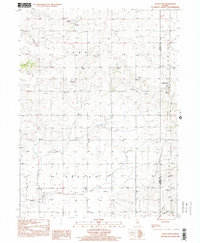 1998 Castleton2001 Print · USGSThe rural border of Stark and Marshall counties is captured in the late nineties, showcasing a prairie landscape defined by small settlements and family farms. Researchers can trace the path of the Old Railroad Grade and find local landmarks like St Timothy Ch and the Valley Sch.
 - 1998 Map of Edelstein, 2001 Print
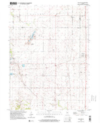 1998 Edelstein2001 Print · USGSPeoria and Stark counties at the turn of the millennium show a landscape evolving from rail-based industry to modern trails. Genealogists can trace family names through several rural burial grounds like Streitmatter Cem and Lawn Ridge Cem, while the Old Rock Island State Trail marks the area's changing transportation legacy.
End of results
Showing maps 1-3 of 3
Top cities of Stark County
- Wyoming historical maps
- Toulon historical maps
- Osceola historical maps
- Bradford historical maps
- Elmira historical maps
- West Jersey historical maps
Frequently asked questions
- What are the different types of historical maps available for Stark County?
- What is the oldest map of Stark County?
- Where can I purchase historical maps of Stark County for my home or office?
- Where can I download high-res historical maps of Stark County?
- Are there historical topographic maps available for Stark County?
- Is there historical aerial imagery available for Stark County?
- Where are historical maps of Stark County sourced from?