1980s Maps of Stark County, Illinois
Explore 12 historic maps of Stark County from the 1980s. These maps offer a rare glimpse into what life looked like during the 1980s — showing old roads, neighborhoods, homes, and landmarks that have changed or disappeared over time.
Whether you're researching your family's past, planning a metal detecting trip, or studying how Stark County's landscape evolved across the 1980s, these high-resolution maps are a powerful tool for exploring the history of this region.
- Focus on a specific era: All maps on this page are from the 1980s, giving you a focused view of this time period.
- See what’s changed: Compare century-old streets, trails, and buildings to today's modern landscape using overlays and satellite layers.
- Research with precision: Use these maps for genealogy, historical research, land use analysis, or educational projects.
- View, download, or print: Maps are fully viewable online in high resolution, and can be downloaded or printed for your own records.
Start exploring Stark County's history through authentic maps from the 1980s. This is your window into the past.
Stark County, IL maps
(12)- 1982 Map of Edelstein, 1983 Print
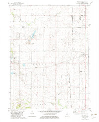 1982 Edelstein1983 Print · USGSPeoria County farming communities thrived along the rail corridors of central Illinois during the early nineteen-eighties. Genealogists can locate several family-named burial sites like Hitchcock Cem and Prospect Cem or trace the Old Railroad Grade near the village of Stark.
 - 1982 Map of Laura, 1983 Print
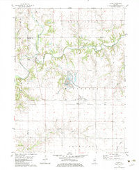 1982 Laura1983 Print · USGSThe Spoon River valley at the start of the 1980s reveals a landscape of industrial strip mining and quiet rural hamlets. Local historians can trace rail history along the Atchison Topeka and Santa Fe and locate family sites at French Grove Cem or Elmore.
 - 1982 Map of Princeville, 1983 Print
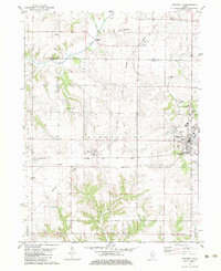 1982 Princeville1983 Print · USGSPeoria County's agricultural heartland is documented here in the early eighties, showcasing the vital rail junction at Princeville. Researchers can locate old burial grounds like Stringtown Cem and trace the paths of the Burlington Northern and Atchison Topeka and Santa Fe railroads.
 - 1983 Map of Castleton, 1984 Print
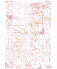
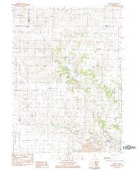
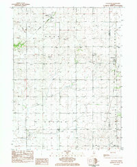 1983 Castleton1984 Print · USGSStark County farm country is captured here during the early eighties, showing the steady rhythm of rural life across Penn and Valley townships. Researchers can trace family history at Eagleston Cem or locate the old Burlington Northern and Chicago and North Western rail lines.
 - 1983 Map of Wyoming, 1984 Print
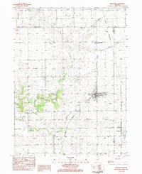
 1983 Wyoming1984 Print · USGSSmall-town Illinois life and prairie agriculture define the landscape in the early 1980s. Researchers can trace family sites at St Dominics Cem and Sheets Cem or follow the Burlington Northern line between Toulon and Wyoming.
 - 1983 Map of Bradford, 1984 Print
 1983 Bradford1984 Print · USGSStark County and Bureau County agriculture and rail networks are well-defined in the early 1980s. Researchers can trace family history through sites like St Johns Cem and Smith Cem or explore the rail hubs of Bradford and Lombardville.2 unique versions available
 - 1983 Map of Kewanee South, 1984 Print
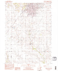 1983 Kewanee South1984 Print · USGSKewanee and the surrounding prairies of Henry and Stark Counties are shown in the early 1980s as the city expands southward into Wethersfield. Researchers can trace local genealogy and civic growth through sites like Evergreen Memory Garden, Visitation School, and the Burlington Northern rail line.2 unique versions available
 - 1983 Map of La Fayette, 1984 Print
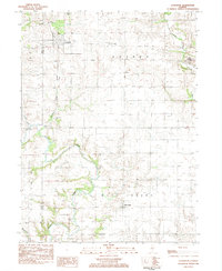 1983 La Fayette1984 Print · USGSSettlement patterns and rural life in Stark County are documented here in the early 1980s. Genealogists can locate family landmarks like McClenahan Cem and trace the Old Railroad Grade near La Fayette.
 - 1983 Map of Elmira, 1984 Print
 1983 Elmira1984 Print · USGSStark County's agricultural and mining landscape is captured here in the early eighties as rural life centered around the Spoon River. Researchers can locate ancestral sites at Osceola Cem and trace the small-town footprints of Elmira and Modena.
 - 1985 Map of Kewanee
 1985 Kewanee1985 Print · USGSNorth-central Illinois in the mid-eighties shows a landscape of river-valley industry and prairie transit. Researchers can trace family roots through Evergreen Memory Garden or follow the historic Hennepin Canal past Tiskilwa and Wyanet.2 unique versions available
 - 1985 Map of Peoria
 1985 Peoria1985 Print · USGSThe Illinois River valley and the Tri-County area are captured here in the mid-1980s as industry and infrastructure reshaped the heart of the state. Researchers can trace the grounds of Jubilee College, locate the Stark Mine near Elmwood, or follow the busy tracks of the Norfolk and Western Railroad.
 - 1989 Map of Peoria
 1989 Peoria1989 Print · USGSThe Illinois River valley thrived as a regional center of industry, education, and transport during the late eighties. Researchers can trace the extensive rail networks of the Peoria and Pekin Union Railway or locate landmarks like Bradley University and the Peoria Air National Guard Base.
End of results
Showing maps 1-12 of 12
Top cities of Stark County
- Wyoming historical maps
- Toulon historical maps
- Osceola historical maps
- Bradford historical maps
- Elmira historical maps
- West Jersey historical maps
Frequently asked questions
- What are the different types of historical maps available for Stark County?
- What is the oldest map of Stark County?
- Where can I purchase historical maps of Stark County for my home or office?
- Where can I download high-res historical maps of Stark County?
- Are there historical topographic maps available for Stark County?
- Is there historical aerial imagery available for Stark County?
- Where are historical maps of Stark County sourced from?