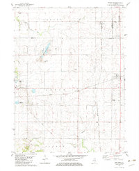
1982 Map of Edelstein
USGS Topo · Published 1983About this map
The rolling agricultural landscape north of Princeville is defined by a dense network of early transportation routes and scattered rural hamlets. The village of Edelstein serves as a local hub, situated at the crossing of the Atchison Topeka and Santa Fe and the Chicago and North Western rail lines. This intersection highlights the importance of the railroad to the economy of central Illinois, where rail transport facilitated the movement of goods from small communities like Speer, Akron, and West Hallock.
Find a feature on this map
34 named features on this map. Tap any name to fly to it.
Don’t see what you’re looking for? This feature index may not catch every label — zoom into the map to look around manually.
Map Details
Editions of this 1982 Edelstein Map
This is the sole edition of this map. No revisions or reprints were ever made.
Other maps of this area

1893 · Dunlap
USGS Topo · 1:62,500

1898 · Dunlap
USGS Topo · 1:62,500

1932 · Dunlap
USGS Topo · 1:62,500

1933 · Dunlap
USGS Topo · 1:62,500

1933 · Camp Grove
USGS Topo · 1:48,000

1937 · Dunlap
USGS Topo · 1:62,500

1944 · Kewanee
USGS Topo · 1:62,500

1944 · Elmwood
USGS Topo · 1:62,500

1945 · Bradford
USGS Topo · 1:62,500

1948 · Elmwood
USGS Topo · 1:62,500