Old Maps of Stephenson County, Illinois
Explore 148 old maps of Stephenson County, spanning from 1893 to today. These high-resolution historic maps reveal how streets, neighborhoods, landmarks, and natural features evolved over time — perfect for genealogy, metal detecting, research, and local history exploration.
What you can do with these maps:
- See how Stephenson County changed over time: Compare historical maps to modern-day views to trace roads, homesites, rail lines & more.
- View detailed metadata: Each map includes creators, publishers, year, scale, and archive source.
- Overlay maps with satellite & LiDAR: Visualize the past alongside modern tools to explore terrain & human change.
- Trusted historical sources: Maps sourced from the USGS, Library of Congress, and other archives.
- Access maps your way: View online, download high-res files, or order prints for personal or research use.
Start exploring old maps of Stephenson County to uncover forgotten places, hidden landmarks, and the deep history beneath your feet.
Stephenson County, IL maps
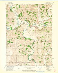
(148)- 1893 Map of Brodhead
 1893 Brodhead1893 Print · USGSSouthern Wisconsin is captured in the late nineteenth century as rail lines and river valleys shaped the landscape. Genealogists and historians can trace early village sites like Brodhead, Magnolia Station, and Orford along the Chicago Milwaukee and Saint Paul Railroad.5 unique versions available
 - 1920 Map of Monroe, 1960 Print
 1920 Monroe1960 Print · USGSGreen County at the start of the twenties was a landscape of thriving rail towns and dozens of country schoolhouses. Genealogists can trace family footprints near named sites like Hardscrabble School, the County Farm, or along the Sugar River valley.
 - 1922 Map of Monroe
 1922 Monroe1922 Print · USGSGreen County at the start of the twenties reveals a landscape of thriving rural school districts and busy rail lines. Genealogists can locate family-named landmarks like Hardscrabble School, the County Farm, and the early village of Juda.
 - 1922 Map of Oregon, 1967 Print
 1922 Oregon1967 Print · USGSNorthern Illinois at the start of the twenties reveals a landscape of thriving rail towns and numerous one-room schoolhouses. Genealogists can trace family footprints at Wessels School, Ebenezer Church, and early village sites like Adeline and Egan.
 - 1923 Map of South Wayne
 1923 South Wayne1923 Print · USGSSouthern Wisconsin and northern Illinois are shown in the early twenties as a landscape of interconnected river valleys and rail lines. Genealogists can trace dozens of country schoolhouses and churches, including Apple Grove Church, Reed School, and the community at South Wayne.3 unique versions available
 - 1924 Map of Oregon
 1924 Oregon1924 Print · USGSOgle County's rural landscape is captured here in the early twenties, showing a network of river-valley settlements and busy rail lines. Researchers can trace family history through numerous landmarks like the German Valley PO and station, St Thomas Church, and Mount Morris.3 unique versions available
 - 1932 Map of Pecatonica
 1932 Pecatonica1932 Print · USGSThe Pecatonica River valley at the start of the 1930s shows a landscape of busy rail towns and a remarkable density of rural schoolhouses. Genealogists can locate family landmarks like Woodruff Corners, Pioneer Cem, and the Twelvemile Grove Ch.3 unique versions available
 - 1936 Map of Pecatonica
 1936 Pecatonica1936 Print · USGSNorthern Illinois agriculture and river life thrive in the 1930s along the winding Pecatonica River and the Wisconsin border. Genealogists can trace hundreds of rural homes and a dense grid of schoolhouses including College Sch, Irish Grove Sch, and Twelvemile Grove Ch.2 unique versions available
 - 1937 Map of Lena
 1937 Lena1937 Print · USGSNorthwestern Illinois at the close of the Depression era shows a landscape dense with rural life and rail activity. Genealogists can trace family roots through numerous landmarks like Chelsea Ch, Blair Cem, and the Blackhawk Battlefield and Monument.
 - 1939 Map of Freeport
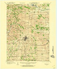
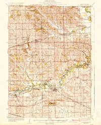
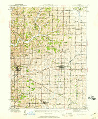
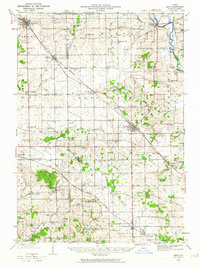
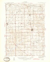
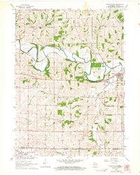
 1939 Freeport1939 Print · USGSStephenson County in the late thirties is a landscape of thriving rail junctions and rural school districts. Genealogists can trace family roots through dozens of local landmarks like St James Cem, Browns Mill, and small hubs like Orangeville or Pearl City.2 unique versions available
 - 1942 Map of Mt Carroll, 1959 Print
 1942 Mt Carroll1959 Print · USGSNorthwest Illinois farmland is mapped here just after the start of the war, showing a landscape tightly connected by rail and rural schools. Genealogists can locate family landmarks like Sabin Ch, the Spring Valley Cem, or rail stops at Ashdale Junc and Kittredge.2 unique versions available
 - 1942 Map of Lena, 1963 Print
 1942 Lena1963 Print · USGSNorthwestern Illinois is documented here just as the rural rail-and-school network reached its peak. Genealogists and historians can trace family roots through numerous country schools like Eells Sch and historic sites such as the Blackhawk Battlefield and Monument.
 - 1942 Map of Forreston, 1965 Print
 1942 Forreston1965 Print · USGSForreston and the surrounding Ogle County prairie are shown during a height of rail activity in the 1940s. Genealogists can trace family roots through numerous country schools like White Oak Sch and rural landmarks such as Prairie Dell Ch and Shelly Cem.2 unique versions available
 - 1943 Map of Lena
 1943 Lena1943 Print · USGSNorthwestern Illinois during the early years of the war shows a landscape shaped by two major railroads and small farming townships. Genealogists can locate dozens of family-named schools and churches, including Puckett Sch, St Marys Ch, and the Blackhawk Battlefield And Monument.2 unique versions available
 - 1944 Map of Mt Carroll
 1944 Mt Carroll1944 Print · USGSThe Carroll County landscape during the mid-1940s was defined by a dense network of country schools and the vital crossroads of the Milwaukee Road. Genealogists and historians can trace old homesteads near St Wendelin Cem, Ashdale Junc, and Loran.2 unique versions available
 - 1944 Map of Freeport
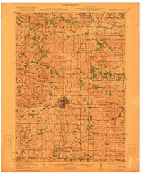
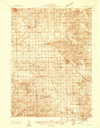
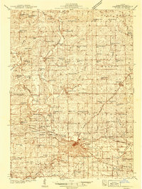
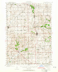
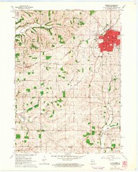
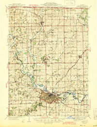 1944 Freeport1944 Print · USGSThe Stephenson County seat and its outlying townships are shown in the 1940s at the peak of their rail-and-river connectivity. Researchers can trace rural school districts like Champion Hill Sch or locate ancestors at Oakland Cem and St James Cem.
 - 1945 Map of Forreston
 1945 Forreston1945 Print · USGSIn the mid-1940s, the rural landscapes of Ogle and Stephenson counties were defined by a sprawling network of one-room schoolhouses and busy rail lines. Genealogists and historians can trace family roots at West Grove Ch, Maryland, and schools like Wall Sch or Good Sch.2 unique versions available
 - 1954 Map of Rockford
 1954 Rockford1954 Print · USGSThe Rock River valley and the Illinois-Wisconsin borderlands are captured here in the mid-1950s during a period of robust industrial and agricultural activity. Genealogists and historians can trace rail-era corridors like the Illinois Central RR and locate landmarks from Big Foot Prairie to Lake Geneva.
 - 1955 Map of Rockford
 1955 Rockford1955 Print · USGSThe Rock River valley and southern Wisconsin dairy country are shown here in the mid-fifties as the region's manufacturing centers grew. Genealogists and historians can trace the paths of the Chicago and North Western RR and Illinois Central RR through hubs like Rockford and Beloit.
 - 1958 Map of Rockford, 1974 Print
 1958 Rockford1974 Print · USGSNorthern Illinois and southern Wisconsin are shown here in the mid-twentieth century as rail-dependent industrial towns began to interface with growing lakefront communities. Genealogists can trace family roots through settlements like Saylesville and Tess Corners or locate historical landmarks like the Rockford Ordnance Depot.4 unique versions available
 - 1962 Map of Brodhead West, 1964 Print
 1962 Brodhead West1964 Print · USGSBrodhead and the Sugar River valley are shown in the early 1960s as the regional rail and river network supported a busy agricultural landscape. Researchers can locate vanished landmarks like Poplar Grove Sch, trace the Chicago Milwaukee St Paul and Pacific rail line, and find family names at Clarence Cem or Oakley.3 unique versions available
 - 1962 Map of Juda, 1964 Print
 1962 Juda1964 Print · USGSThe Wisconsin-Illinois borderlands come to life in this early 1960s survey, detailing the rural landscape around Juda and Twin Grove. Genealogists and historians can trace family locations near several rural landmarks including Fairfield Cemetery, Fairfield Church, and the winding Richland Creek.3 unique versions available
 - 1962 Map of Browntown, 1964 Print
 1962 Browntown1964 Print · USGSThe Pecatonica River valley at the Wisconsin-Illinois border is shown here in the early sixties, defined by its riverside rail towns. Researchers can trace local heritage through sites like Martintown, La Due Cem, and the Lattice Bridge.2 unique versions available
 - 1962 Map of South Wayne, 1964 Print
 1962 South Wayne1964 Print · USGSLafayette County dairy and river country is captured here in the early sixties, centered on the junction of the Pecatonica River and the railroad. Genealogists and local historians can trace rural schoolhouse locations like Mud Hollow Sch and family burial sites such as Hoffman Cem.
 - 1962 Map of Monroe, 1964 Print
 1962 Monroe1964 Print · USGSMonroe and the surrounding Green County dairy country are captured in the early sixties as the city expanded along its vital rail lines. Genealogists can locate family-named sites like Staver's Church and Franklin Cemetery or trace old rural schoolhouses such as Uttley School.2 unique versions available
Showing maps 1-25 of 148
Top cities of Stephenson County
- Freeport historical maps
- Lena historical maps
- Loran historical maps
- Rock Grove historical maps
- Oneco historical maps
- Florence historical maps
See more
Frequently asked questions
- What are the different types of historical maps available for Stephenson County?
- What is the oldest map of Stephenson County?
- Where can I purchase historical maps of Stephenson County for my home or office?
- Where can I download high-res historical maps of Stephenson County?
- Are there historical topographic maps available for Stephenson County?
- Is there historical aerial imagery available for Stephenson County?
- Where are historical maps of Stephenson County sourced from?