1960s Maps of Stephenson County, Illinois
Explore 9 historic maps of Stephenson County from the 1960s. These maps offer a rare glimpse into what life looked like during the 1960s — showing old roads, neighborhoods, homes, and landmarks that have changed or disappeared over time.
Whether you're researching your family's past, planning a metal detecting trip, or studying how Stephenson County's landscape evolved across the 1960s, these high-resolution maps are a powerful tool for exploring the history of this region.
- Focus on a specific era: All maps on this page are from the 1960s, giving you a focused view of this time period.
- See what’s changed: Compare century-old streets, trails, and buildings to today's modern landscape using overlays and satellite layers.
- Research with precision: Use these maps for genealogy, historical research, land use analysis, or educational projects.
- View, download, or print: Maps are fully viewable online in high resolution, and can be downloaded or printed for your own records.
Start exploring Stephenson County's history through authentic maps from the 1960s. This is your window into the past.
Stephenson County, IL maps
(9)- 1962 Map of Brodhead West, 1964 Print
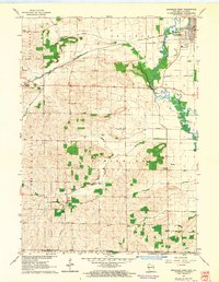 1962 Brodhead West1964 Print · USGSBrodhead and the Sugar River valley are shown in the early 1960s as the regional rail and river network supported a busy agricultural landscape. Researchers can locate vanished landmarks like Poplar Grove Sch, trace the Chicago Milwaukee St Paul and Pacific rail line, and find family names at Clarence Cem or Oakley.3 unique versions available
 - 1962 Map of Juda, 1964 Print
 1962 Juda1964 Print · USGSThe Wisconsin-Illinois borderlands come to life in this early 1960s survey, detailing the rural landscape around Juda and Twin Grove. Genealogists and historians can trace family locations near several rural landmarks including Fairfield Cemetery, Fairfield Church, and the winding Richland Creek.3 unique versions available
 - 1962 Map of Browntown, 1964 Print
 1962 Browntown1964 Print · USGSThe Pecatonica River valley at the Wisconsin-Illinois border is shown here in the early sixties, defined by its riverside rail towns. Researchers can trace local heritage through sites like Martintown, La Due Cem, and the Lattice Bridge.2 unique versions available
 - 1962 Map of South Wayne, 1964 Print
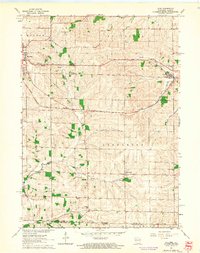
 1962 South Wayne1964 Print · USGSLafayette County dairy and river country is captured here in the early sixties, centered on the junction of the Pecatonica River and the railroad. Genealogists and local historians can trace rural schoolhouse locations like Mud Hollow Sch and family burial sites such as Hoffman Cem.
 - 1962 Map of Monroe, 1964 Print
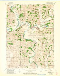
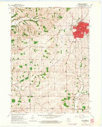 1962 Monroe1964 Print · USGSMonroe and the surrounding Green County dairy country are captured in the early sixties as the city expanded along its vital rail lines. Genealogists can locate family-named sites like Staver's Church and Franklin Cemetery or trace old rural schoolhouses such as Uttley School.2 unique versions available
 - 1962 Map of Monroe, 1964 Print
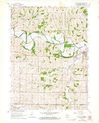
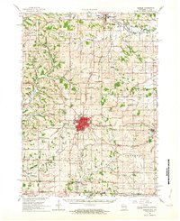 1962 Monroe1964 Print · USGSGreen County in the early sixties remains a center of rail-and-river commerce where the Illinois Central meets the Monroe city limits. Genealogists can trace family footprints through numerous rural sites like Dutch Hollow Sch, Calvary Cem, and the village of Monticello.2 unique versions available
 - 1962 Map of Brodhead, 1964 Print
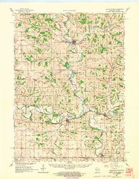
 1962 Brodhead1964 Print · USGSSouthern Wisconsin at the start of the sixties reveals a thriving network of rail-side towns and river valleys. Genealogists and local historians can trace family roots at Greenwood Cem, locate the Peebles Sch, or follow the old Chicago and North Western line.2 unique versions available
 - 1962 Map of South Wayne, 1964 Print
 1962 South Wayne1964 Print · USGSCrossing the Illinois border in the 1960s, this area of Lafayette and Green Counties features a landscape shaped by the Pecatonica River and its many tributaries. Researchers can locate numerous rural schoolhouses and family cemeteries like Porter Sch and the Sauterman Cem.
 - 1963 Map of Rockford
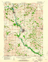
 1963 Rockford1963 Print · USGSThe mid-century industrial corridor along the Rock River is shown here during a period of rapid post-war growth. Researchers can trace the extensive rail lines of the Chicago and North Western or locate local landmarks like the Rockford Ordnance Depot and Holy Hill.
End of results
Showing maps 1-9 of 9
Top cities of Stephenson County
- Freeport historical maps
- Lena historical maps
- Loran historical maps
- Rock Grove historical maps
- Oneco historical maps
- Florence historical maps
See more
Frequently asked questions
- What are the different types of historical maps available for Stephenson County?
- What is the oldest map of Stephenson County?
- Where can I purchase historical maps of Stephenson County for my home or office?
- Where can I download high-res historical maps of Stephenson County?
- Are there historical topographic maps available for Stephenson County?
- Is there historical aerial imagery available for Stephenson County?
- Where are historical maps of Stephenson County sourced from?