1980s Maps of Woodford County, Illinois
Explore 10 historic maps of Woodford County from the 1980s. These maps offer a rare glimpse into what life looked like during the 1980s — showing old roads, neighborhoods, homes, and landmarks that have changed or disappeared over time.
Whether you're researching your family's past, planning a metal detecting trip, or studying how Woodford County's landscape evolved across the 1980s, these high-resolution maps are a powerful tool for exploring the history of this region.
- Focus on a specific era: All maps on this page are from the 1980s, giving you a focused view of this time period.
- See what’s changed: Compare century-old streets, trails, and buildings to today's modern landscape using overlays and satellite layers.
- Research with precision: Use these maps for genealogy, historical research, land use analysis, or educational projects.
- View, download, or print: Maps are fully viewable online in high resolution, and can be downloaded or printed for your own records.
Start exploring Woodford County's history through authentic maps from the 1980s. This is your window into the past.
Woodford County, IL maps
(10)- 1981 Map of Gridley
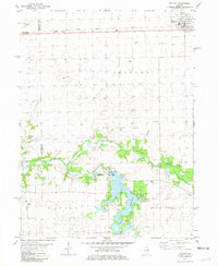 1981 Gridley1981 Print · USGSThe rail-and-river landscape of McLean County comes to life in the early 1980s. Genealogists and local historians can trace family ties at Messer Cem and Wilcox Cem or explore the mid-century recreation sites around Lake Bloomington.
 - 1983 Map of Dana, 1984 Print
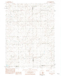
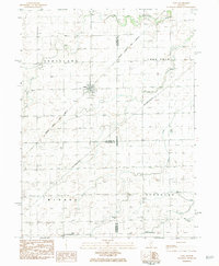 1983 Dana1984 Print · USGSDana and the surrounding Illinois prairie are captured here in the early eighties as the rail-centered economy evolved. Researchers can trace family roots through the St Petri Ch, locate the Bauman Cem, and find the rail junction at Dana.
 - 1983 Map of Roanoke, 1984 Print
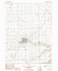 1983 Roanoke1984 Print · USGSRoanoke and the surrounding Woodford County prairie are captured here in the early 1980s. Researchers can locate several burial grounds and religious sites including Roanoke Cem, the Mennonite Ch, and the industrial Mine Dump east of town.
 - 1983 Map of Benson, 1984 Print
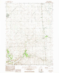 1983 Benson1984 Print · USGSCentral Illinois prairie life and rail networks are well-documented here in the early eighties. Genealogists can trace family plots at St John Cem and St Marys Cem, while following the path of the Illinois Central Gulf through Panola.
 - 1983 Map of Flanagan SW, 1984 Print
 1983 Flanagan SW1984 Print · USGSCentral Illinois farmland at the dawn of the eighties reveals a network of rural townships and private aviation. Trace family sites near Baughman Cem or locate landmarks like the Historical Monument and Pfister Landing Strip.
 - 1983 Map of La Rose, 1984 Print
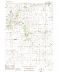 1983 La Rose1984 Print · USGSCentral Illinois farmland meets the winding Crow Creek drainage during the early eighties. Genealogists can locate family burial grounds like Hallenback Cem or trace the Atchison Topeka and Santa Fe line through La Rose.
 - 1983 Map of Minonk, 1984 Print
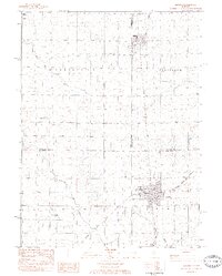 1983 Minonk1984 Print · USGSCentral Illinois prairie and rail crossroads come alive in the early 1980s. Genealogists and historians can trace the foundations of Minonk and Rutland, including local sites like St Patricks Sch and the regional mine dump.
 - 1985 Map of Peoria
 1985 Peoria1985 Print · USGSThe Illinois River valley and the Tri-County area are captured here in the mid-1980s as industry and infrastructure reshaped the heart of the state. Researchers can trace the grounds of Jubilee College, locate the Stark Mine near Elmwood, or follow the busy tracks of the Norfolk and Western Railroad.
 - 1985 Map of Fairbury
 1985 Fairbury1985 Print · USGSCentral Illinois in the mid-1980s reveals a landscape shaped by the Illinois Central Gulf rail network and the Vermilion River basin. Trace the roots of local communities from Fairbury to Pontiac, and locate landmarks like the State Correctional Center and High Chapel.2 unique versions available
 - 1989 Map of Peoria
 1989 Peoria1989 Print · USGSThe Illinois River valley thrived as a regional center of industry, education, and transport during the late eighties. Researchers can trace the extensive rail networks of the Peoria and Pekin Union Railway or locate landmarks like Bradley University and the Peoria Air National Guard Base.
End of results
Showing maps 1-10 of 10
Top cities of Woodford County
- Eureka historical maps
- El Paso historical maps
- Metamora historical maps
- Germantown Hills historical maps
- Minonk historical maps
- Roanoke historical maps
See more
Frequently asked questions
- What are the different types of historical maps available for Woodford County?
- What is the oldest map of Woodford County?
- Where can I purchase historical maps of Woodford County for my home or office?
- Where can I download high-res historical maps of Woodford County?
- Are there historical topographic maps available for Woodford County?
- Is there historical aerial imagery available for Woodford County?
- Where are historical maps of Woodford County sourced from?