2020s Maps of Bartholomew County, Indiana
Explore 11 historic maps of Bartholomew County from the 2020s. These maps offer a rare glimpse into what life looked like during the 2020s — showing old roads, neighborhoods, homes, and landmarks that have changed or disappeared over time.
Whether you're researching your family's past, planning a metal detecting trip, or studying how Bartholomew County's landscape evolved across the 2020s, these high-resolution maps are a powerful tool for exploring the history of this region.
- Focus on a specific era: All maps on this page are from the 2020s, giving you a focused view of this time period.
- See what’s changed: Compare century-old streets, trails, and buildings to today's modern landscape using overlays and satellite layers.
- Research with precision: Use these maps for genealogy, historical research, land use analysis, or educational projects.
- View, download, or print: Maps are fully viewable online in high resolution, and can be downloaded or printed for your own records.
Start exploring Bartholomew County's history through authentic maps from the 2020s. This is your window into the past.
Bartholomew County, IN maps
(11)- 2022 Map of Azalia, 2022 Print
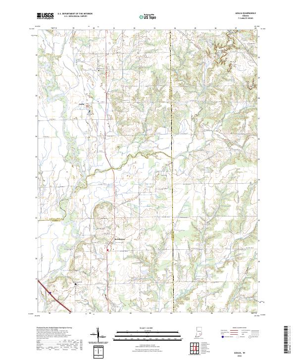 2022 Azalia2022 Print · USGSThe Bartholomew and Jennings County borderlands are mapped here in the early 2020s, showing a rural landscape defined by the East Fork White River. Genealogists can locate Sandcreek Cem and Glasson Cem among the farms near Azalia.
 - 2022 Map of Grammer, 2022 Print
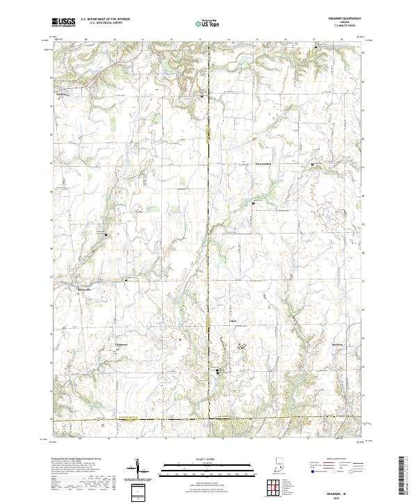 2022 Grammer2022 Print · USGSThe rural crossroads of Bartholomew and Decatur counties are captured here in the early twenty-first century, showing a landscape of dispersed hamlets and family cemeteries. Genealogists can locate legacy sites like Wynn Cem and Asbury Cem or trace the small-town layouts of Grammer and Burnsville.
 - 2022 Map of Edinburgh, 2022 Print
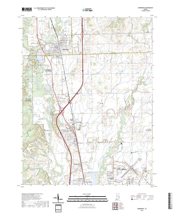 2022 Edinburgh2022 Print · USGSThe confluence of the Big Blue and Driftwood rivers south of Edinburgh is captured in this contemporary survey of the Indiana heartland. Genealogists can trace family sites at Rest Haven Cem and Tannehill Cem or explore the rail corridor of the L & I RR.
 - 2022 Map of Elizabethtown, 2022 Print
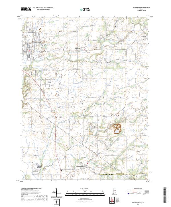 2022 Elizabethtown2022 Print · USGSBartholomew County comes into focus in this recent survey of the lands between the Columbus outskirts and the Bartholomew and Jennings County line. Family historians can locate several local burial grounds including Sharon Cemetery and Sand Hill Cemetery near Petersville.
 - 2022 Map of Hartsville, 2022 Print
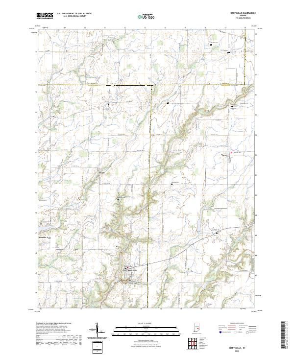 2022 Hartsville2022 Print · USGSBartholomew and Decatur counties come together in this modern survey of south-central Indiana’s rural heartland. Researchers can trace family history through several small burial grounds like Galbraith Cem and explore the historic layout of Hartsville and Rugby.
 - 2022 Map of Waymansville, 2022 Print
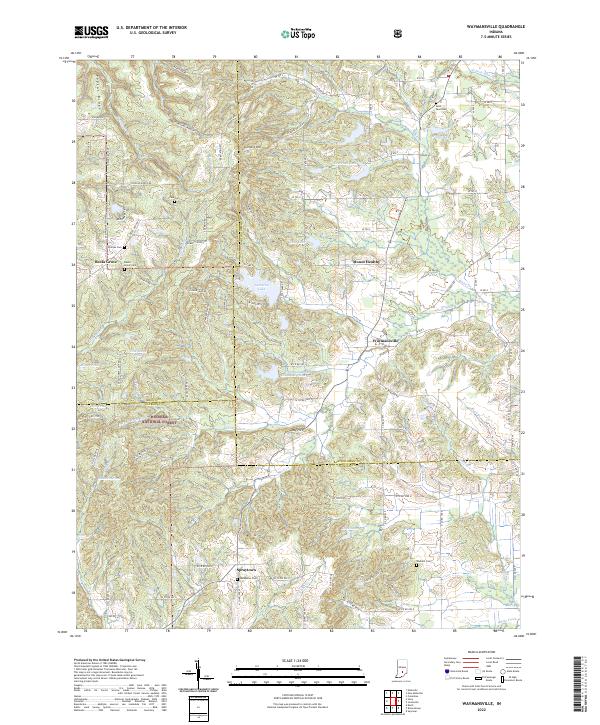 2022 Waymansville2022 Print · USGSBartholomew and Jackson Counties are shown here during the early 2020s, where the rural settlements of the Indiana hills meet the Hoosier National Forest. Genealogists can trace family landmarks and burial sites like Saint Paul Cem, Becks Grove Cem, and the historic crossroads at Spraytown.
 - 2022 Map of Columbus, 2022 Print
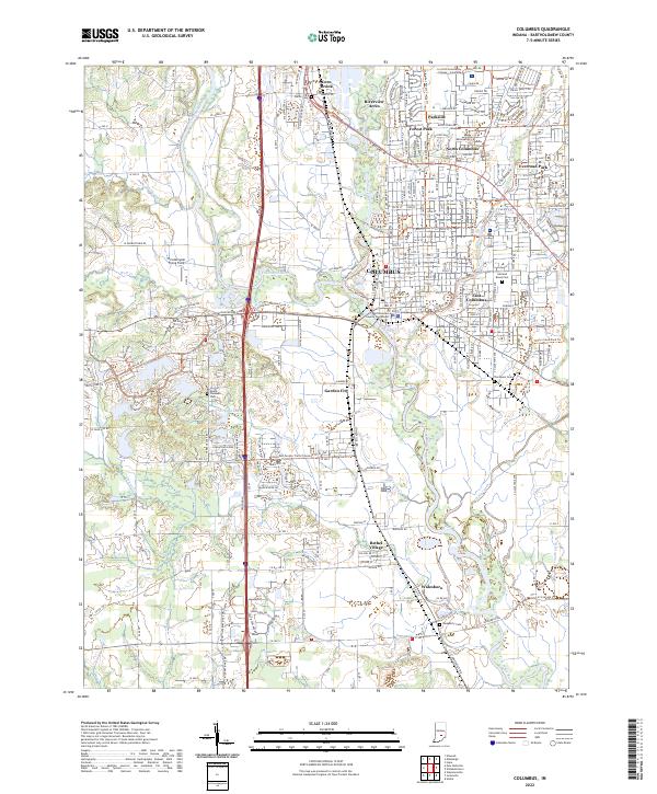 2022 Columbus2022 Print · USGSColumbus and its southern neighbors in Bartholomew County are captured here in a period of modern growth at the river forks. Researchers can trace family sites from Garland Brook Cem to Walesboro, while locating landmarks like the Bartholomew County Courthouse.
 - 2022 Map of Hope, 2022 Print
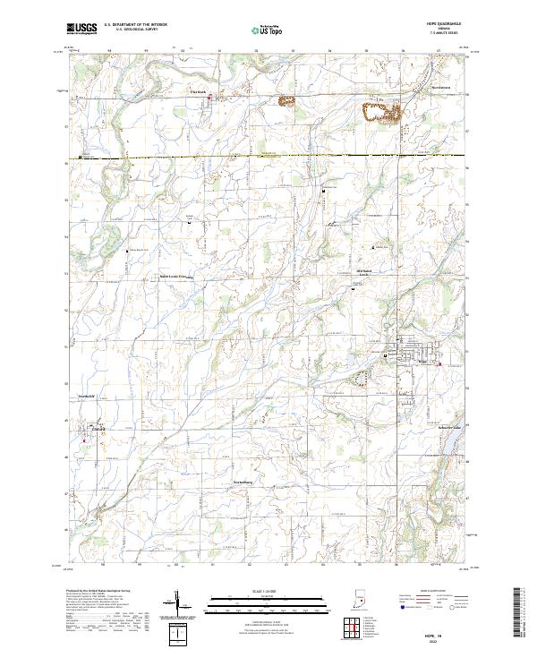 2022 Hope2022 Print · USGSBartholomew County farm country and the established town of Hope are captured in this modern survey. Genealogists can locate family burial sites like Moravian Cem and Simmons Cem or trace the early settlements of Old Saint Louis and Flat Rock.
 - 2022 Map of Jonesville, 2022 Print
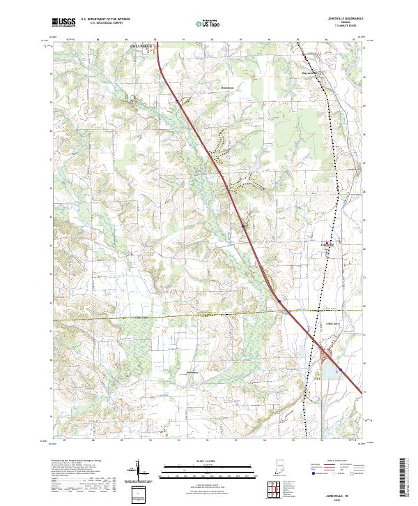 2022 Jonesville2022 Print · USGSThe borderlands of Bartholomew and Jackson counties are captured here in the early twenty-first century. Genealogists and local historians can trace family land and rural intersections near Jonesville, Bobtown, and the banks of the East Fork White River.
 - 2022 Map of New Bellsville, 2022 Print
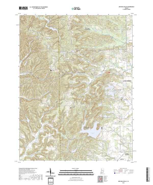 2022 New Bellsville2022 Print · USGSThe hill country west of Columbus Indiana comes into focus during this early 2020s survey. Genealogists can locate family sites like Dobbs Cem and Haisup Cem among the ridges of Stony Lonesome and Grandview Lake.
 - 2022 Map of Nineveh, 2022 Print
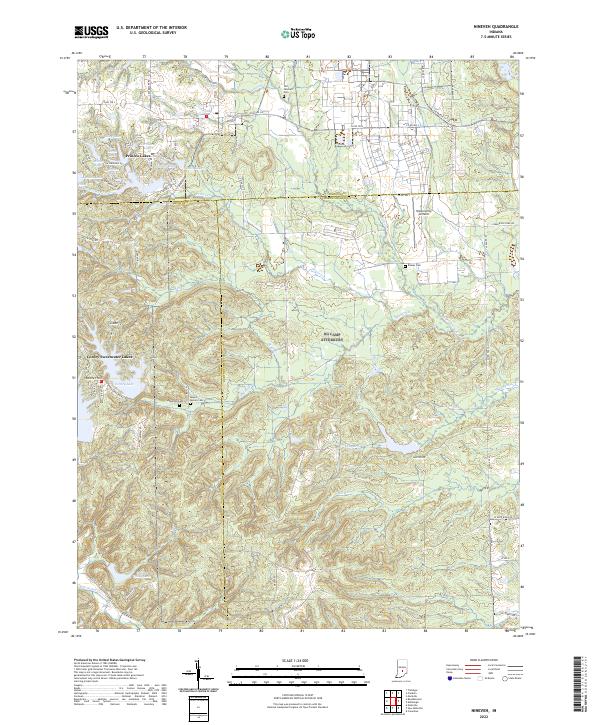 2022 Nineveh2022 Print · USGSBartholomew and Johnson counties are captured here in a period of established lakeside communities and rural aviation. Researchers can trace family history through sites like Old Nineveh Cemetery and Kansas Cemetery, or locate the Himsel Army Airfield.
End of results
Showing maps 1-11 of 11
Top cities of Bartholomew County
- Columbus historical maps
- Hope historical maps
- Elizabethtown historical maps
- Hartsville historical maps
- Clifford historical maps
- Jonesville historical maps
Frequently asked questions
- What are the different types of historical maps available for Bartholomew County?
- What is the oldest map of Bartholomew County?
- Where can I purchase historical maps of Bartholomew County for my home or office?
- Where can I download high-res historical maps of Bartholomew County?
- Are there historical topographic maps available for Bartholomew County?
- Is there historical aerial imagery available for Bartholomew County?
- Where are historical maps of Bartholomew County sourced from?