1900s (20th Century) Maps of Cannelburg, Indiana
Explore 11 historic maps of Cannelburg from the 1900s (20th Century). These maps offer a rare glimpse into what life looked like during the 1900s — showing old roads, neighborhoods, homes, and landmarks that have changed or disappeared over time.
Whether you're researching your family's past, planning a metal detecting trip, or studying how Cannelburg's landscape evolved across the 1900s, these high-resolution maps are a powerful tool for exploring the history of this region.
- Focus on a specific era: All maps on this page are from the 1900s, giving you a focused view of this time period.
- See what’s changed: Compare century-old streets, trails, and buildings to today's modern landscape using overlays and satellite layers.
- Research with precision: Use these maps for genealogy, historical research, land use analysis, or educational projects.
- View, download, or print: Maps are fully viewable online in high resolution, and can be downloaded or printed for your own records.
Start exploring Cannelburg's history through authentic maps from the 1900s. This is your window into the past.
Cannelburg, IN maps
(11)- 1944 Map of Montgomery
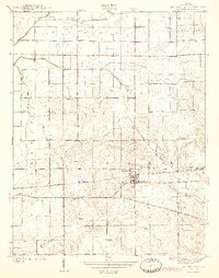 1944 Montgomery1944 Print · USGSDaviess County during the mid-1940s reveals a landscape defined by small-town life and the busy Baltimore and Ohio rail line. Researchers can locate family landmarks like St Peters Cem, Black Oak, and numerous rural schools including Ryan Sch.2 unique versions available
 - 1956 Map of Loogootee, 1957 Print
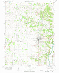 1956 Loogootee1957 Print · USGSLoogootee and Cannelburg sit at the heart of this mid-fifties survey of the Daviess and Martin County border. Researchers can trace ancestral roots at St Johns Cemetery, locate the rail-side industry of a Strip Mine, or follow the banks of the East Fork White River.2 unique versions available
 - 1956 Map of Vincennes, 1967 Print
 1956 Vincennes1967 Print · USGSSouthern Indiana and the Illinois borderlands are captured here in the mid-fifties, showing the region's dense network of river towns and rail lines. Researchers can trace historic river crossings along the Wabash River or locate landmarks like Wyandotte Cave and Lincoln State Park.4 unique versions available
 - 1957 Map of Vincennes
 1957 Vincennes1957 Print · USGSSouthwest Indiana and the Illinois borderlands come alive in the late 1950s, a period of heavy rail traffic and expanding state forests. Genealogists and historians can trace the riverfronts and rail lines of Vincennes, New Harmony, and the vast Crane Naval Ammunition Depot.
 - 1957 Map of Montgomery, 1958 Print
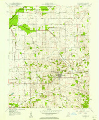 1957 Montgomery1958 Print · USGSDaviess County during the late 1950s shows a landscape of small railway towns and scattered oil extraction sites. Genealogists can locate family landmarks like Stoll Cem, Antioch Ch, and the rural Parsons Sch along the Baltimore and Ohio line.
 - 1958 Map of Vincennes
 1958 Vincennes1958 Print · USGSSouthern Indiana and the Illinois borderlands are captured during a mid-century period of heavy rail traffic and military activity. Researchers can trace the sprawling bounds of the Crane Naval Ammunition Depot or locate historic settlements like New Harmony and French Lick.2 unique versions available
 - 1974 Map of Loogootee, 1976 Print
 1974 Loogootee1976 Print · USGSLoogootee and the surrounding Indiana countryside are captured here in the mid-seventies as recreation and industry balanced against traditional farming life. Genealogists can locate family sites at St Johns Cemetery or Houghton Cem while tracing the Baltimore and Ohio rail line.2 unique versions available
 - 1979 Map of Montgomery
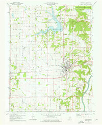
 1979 Montgomery1979 Print · USGSDaviess County farmland and small-town life are captured in the late seventies along the busy Baltimore and Ohio railroad. Genealogists can trace local roots through rural landmarks like St Peters Cem, Berea Ch, and the Pleasant View Sch.
 - 1986 Map of Bedford
 1986 Bedford1986 Print · USGSSouthern Indiana in the mid-eighties remains a landscape of deep forests, limestone quarries, and vital rail junctions. Genealogists and historians can trace the rural networks connecting French Lick, the Crane Naval Weapons Support Center, and the historic Becks Mill.
 - 1986 Map of Vincennes
 1986 Vincennes1986 Print · USGSThe Wabash River valley in the mid-1980s shows a landscape defined by deep-rooted river towns and heavy industry. Researchers can trace the legacy of regional rail lines like the Conrail system or locate landmarks such as Vincennes University and St Francisville Church.2 unique versions available
 - 1990 Map of Bedford, 1991 Print
 1990 Bedford1991 Print · USGSSouthern Indiana in the early nineties reveals a complex landscape of military reservations, resort towns, and heavy industry. Genealogists and historians can trace family sites like Old Union Cem and Trinity Springs or locate the limestone quarries surrounding Oolitic.
End of results
Showing maps 1-11 of 11
Top cities near Cannelburg
- Washington historical maps
- Loogootee historical maps
- Odon historical maps
- Shoals historical maps
- Elnora historical maps
- Plainville historical maps
See more
Frequently asked questions
- What are the different types of historical maps available for Cannelburg?
- What is the oldest map of Cannelburg?
- Where can I purchase historical maps of Cannelburg for my home or office?
- Where can I download high-res historical maps of Cannelburg?
- Are there historical topographic maps available for Cannelburg?
- Is there historical aerial imagery available for Cannelburg?
- Where are historical maps of Cannelburg sourced from?