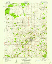
1957 Map of Montgomery
USGS Topo · Published 1958About this map
Montgomery and Cannelburg anchor this mid-century survey of Daviess County, where the southern Indiana landscape is defined by the east-west corridor of the Baltimore and Ohio railroad. The map reveals a deeply established rural network of townships including Bogard, Van Buren, and Barr, characterized by frequent country churches such as St Peters Ch and St Michaels Ch.
Find a feature on this map
32 named features on this map. Tap any name to fly to it.
Don’t see what you’re looking for? This feature index may not catch every label — zoom into the map to look around manually.
Map Details
Editions of this 1957 Montgomery Map
This is the sole edition of this map. No revisions or reprints were ever made.
Other maps of this area

1943 · Plainville
USGS Topo · 1:24,000

1943 · Epsom
USGS Topo · 1:24,000

1944 · Montgomery
USGS Topo · 1:24,000

1944 · Glendale
USGS Topo · 1:24,000

1944 · Washington
USGS Topo · 1:24,000

1945 · Sandy Hook
USGS Topo · 1:24,000

1950 · Odon
USGS Topo · 1:24,000

1956 · Alfordsville
USGS Topo · 1:24,000

1956 · Loogootee
USGS Topo · 1:24,000

1956 · Vincennes
USGS Topo · 1:250,000