2020s Maps of Kokomo, Indiana
Explore 4 historic maps of Kokomo from the 2020s. These maps offer a rare glimpse into what life looked like during the 2020s — showing old roads, neighborhoods, homes, and landmarks that have changed or disappeared over time.
Whether you're researching your family's past, planning a metal detecting trip, or studying how Kokomo's landscape evolved across the 2020s, these high-resolution maps are a powerful tool for exploring the history of this region.
- Focus on a specific era: All maps on this page are from the 2020s, giving you a focused view of this time period.
- See what’s changed: Compare century-old streets, trails, and buildings to today's modern landscape using overlays and satellite layers.
- Research with precision: Use these maps for genealogy, historical research, land use analysis, or educational projects.
- View, download, or print: Maps are fully viewable online in high resolution, and can be downloaded or printed for your own records.
Start exploring Kokomo's history through authentic maps from the 2020s. This is your window into the past.
Kokomo, IN maps
(4)- 2022 Map of Miami, 2022 Print
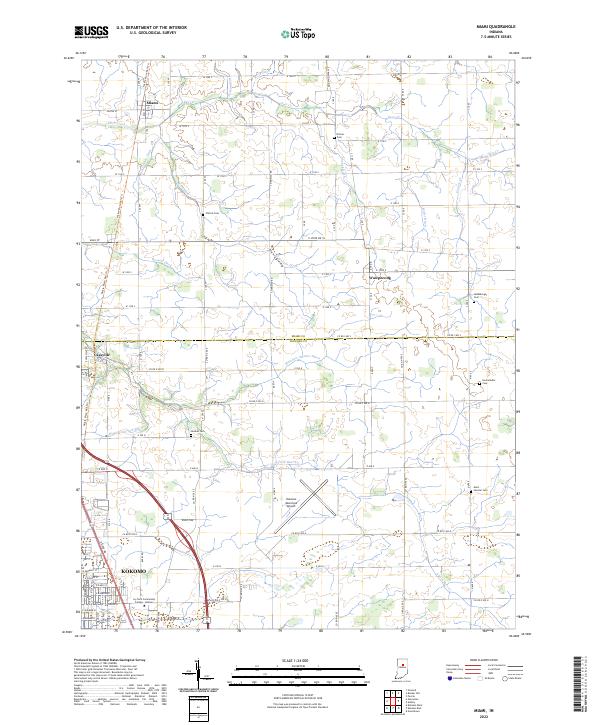 2022 Miami2022 Print · USGSThe northern edge of the Kokomo area is captured here during a period of modern growth and historical preservation. Genealogists can locate several family burial sites like Chitick Cem and Hochstedler Cem alongside the route of the Nickle Plate Rail-Trl.
 - 2022 Map of Kokomo West, 2022 Print
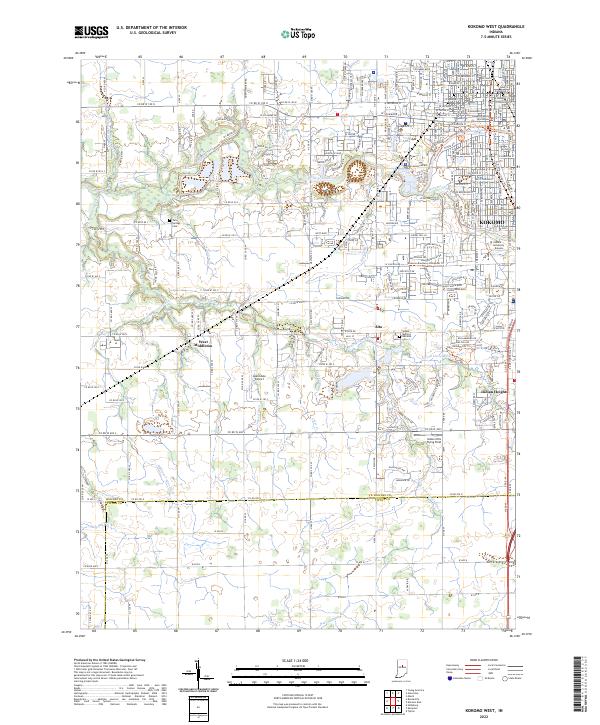 2022 Kokomo West2022 Print · USGSWestern Howard County is captured here in the early 2020s, showcasing the expansion of Kokomo alongside long-standing rural townships. Researchers can find specific family landmarks and community centers ranging from the Twin Springs Cem to West Middleton.
 - 2022 Map of Galveston, 2022 Print
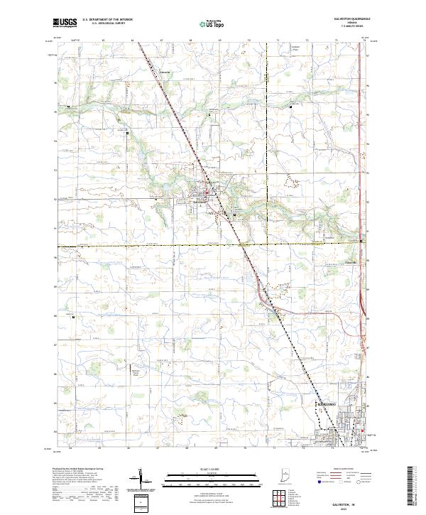 2022 Galveston2022 Print · USGSThe rural crossroads of Cass and Miami counties are captured in this modern survey, showing the agricultural heart of north-central Indiana. Genealogists and local researchers can trace family-named drainage ditches and historic burial sites like Patterson Cem and Old Galveston Cem.
 - 2022 Map of Kokomo East, 2022 Print
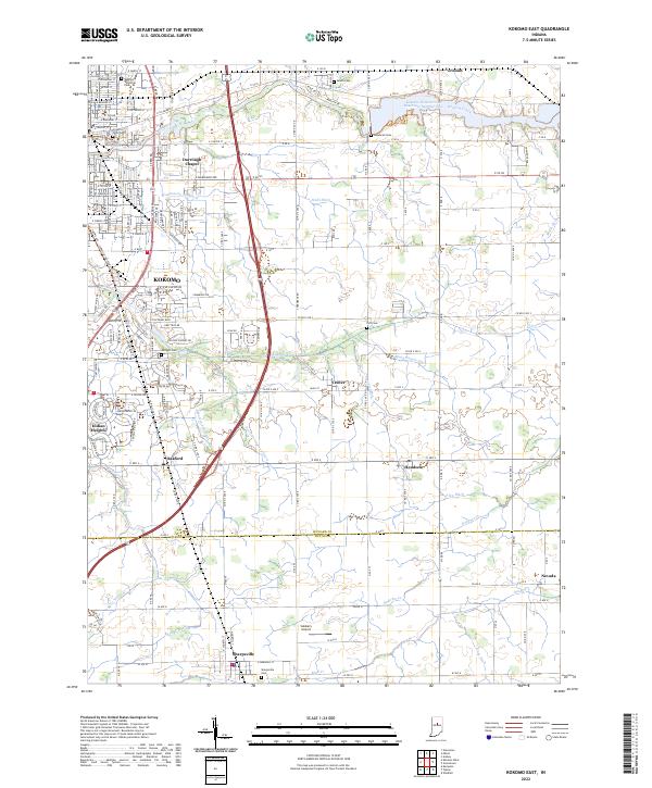 2022 Kokomo East2022 Print · USGSHoward and Tipton Counties are shown here during their modern development, where the eastern edges of Kokomo meet rural townships. Genealogists can trace family sites at Crown Point Cem and Albright Cem, while following the paths of Wildcat Creek and Finn Ditch.
End of results
Showing maps 1-4 of 4
Top cities near Kokomo
- Tipton historical maps
- Greentown historical maps
- Galveston historical maps
- Russiaville historical maps
- Bunker Hill historical maps
- Forest historical maps
See more
Top neighborhoods of Kokomo
- Alto historical maps
- Darrough Chapel historical maps
- Indian Heights historical maps
- Oakford historical maps
Frequently asked questions
- What are the different types of historical maps available for Kokomo?
- What is the oldest map of Kokomo?
- Where can I purchase historical maps of Kokomo for my home or office?
- Where can I download high-res historical maps of Kokomo?
- Are there historical topographic maps available for Kokomo?
- Is there historical aerial imagery available for Kokomo?
- Where are historical maps of Kokomo sourced from?