1960s Maps of Macy, Indiana
Explore 2 historic maps of Macy from the 1960s. These maps offer a rare glimpse into what life looked like during the 1960s — showing old roads, neighborhoods, homes, and landmarks that have changed or disappeared over time.
Whether you're researching your family's past, planning a metal detecting trip, or studying how Macy's landscape evolved across the 1960s, these high-resolution maps are a powerful tool for exploring the history of this region.
- Focus on a specific era: All maps on this page are from the 1960s, giving you a focused view of this time period.
- See what’s changed: Compare century-old streets, trails, and buildings to today's modern landscape using overlays and satellite layers.
- Research with precision: Use these maps for genealogy, historical research, land use analysis, or educational projects.
- View, download, or print: Maps are fully viewable online in high resolution, and can be downloaded or printed for your own records.
Start exploring Macy's history through authentic maps from the 1960s. This is your window into the past.
Macy, IN maps
(2)- 1960 Map of Macy, 1963 Print
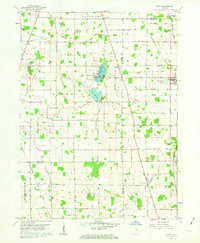 1960 Macy1963 Print · USGSMiami and Fulton counties are captured here in the early 1960s, a period when the rural landscape was defined by its railroad crossings and small townships. Researchers can trace the junction of two major lines at Macy or locate ancestral sites like Mud Lake Chapel and Plainview Cemetery.3 unique versions available
 - 1960 Map of Deedsville, 1963 Print
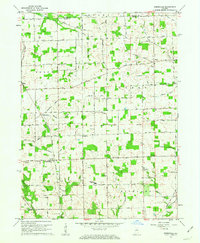 1960 Deedsville1963 Print · USGSMiami County, Indiana, is captured at the dawn of the 1960s, showing a rural landscape defined by the Old Indian Treaty Boundary and the Chicago and St Louis RR. Genealogists and local historians can trace the foundations of Deedsville and find scattered landmarks like Ebenezer Ch and Yike Cem.2 unique versions available
End of results
Showing maps 1-2 of 2
Top cities near Macy
- Logansport historical maps
- Peru historical maps
- Rochester historical maps
- Walnut historical maps
- Akron historical maps
- Mentone historical maps
See more
Frequently asked questions
- What are the different types of historical maps available for Macy?
- What is the oldest map of Macy?
- Where can I purchase historical maps of Macy for my home or office?
- Where can I download high-res historical maps of Macy?
- Are there historical topographic maps available for Macy?
- Is there historical aerial imagery available for Macy?
- Where are historical maps of Macy sourced from?