1960s Maps of Mooresville, Indiana
Explore 4 historic maps of Mooresville from the 1960s. These maps offer a rare glimpse into what life looked like during the 1960s — showing old roads, neighborhoods, homes, and landmarks that have changed or disappeared over time.
Whether you're researching your family's past, planning a metal detecting trip, or studying how Mooresville's landscape evolved across the 1960s, these high-resolution maps are a powerful tool for exploring the history of this region.
- Focus on a specific era: All maps on this page are from the 1960s, giving you a focused view of this time period.
- See what’s changed: Compare century-old streets, trails, and buildings to today's modern landscape using overlays and satellite layers.
- Research with precision: Use these maps for genealogy, historical research, land use analysis, or educational projects.
- View, download, or print: Maps are fully viewable online in high resolution, and can be downloaded or printed for your own records.
Start exploring Mooresville's history through authentic maps from the 1960s. This is your window into the past.
Mooresville, IN maps
(4)- 1962 Map of Indianapolis
 1962 Indianapolis1962 Print · USGSCentral Indiana and the Illinois borderlands are captured here in the early sixties, showing the region's dense rail networks and growing urban centers. Genealogists and historians can locate family-named landmarks and institutions like Crown Hill Cem, Indiana University, and the Indianapolis Motor Speedway.
 - 1965 Map of Mooresville West, 1966 Print
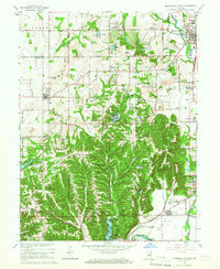 1965 Mooresville West1966 Print · USGSThe White River valley south of Mooresville is captured here in the mid-sixties, showing a landscape of state forests, rural parishes, and summer camps. Researchers can locate the Goethe Link Observatory, trace the Pennsylvania rail line, or find family roots at Bethesda Cem and Wilbur.3 unique versions available
 - 1965 Map of Mooresville East, 1966 Print
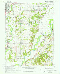 1965 Mooresville East1966 Print · USGSMid-century Morgan County is captured here as the White River corridor undergoes post-war growth. Researchers can locate family sites at Mackenzie Cem, trace the Pennsylvania RR line, or find the old Waverly Sch.3 unique versions available
 - 1966 Map of Bridgeport, 1969 Print
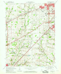 1966 Bridgeport1969 Print · USGSMarion and Hendricks counties are captured here during a period of suburban transition in the mid-1960s. Researchers can trace the layout of Weir Cook Municipal Airport and find local history at Friends Cem and West Newton.4 unique versions available
End of results
Showing maps 1-4 of 4
Top cities near Mooresville
- Indianapolis historical maps
- Greenwood historical maps
- Plainfield historical maps
- Brownsburg historical maps
- Avon historical maps
- Speedway historical maps
See more
Top neighborhoods of Mooresville
Frequently asked questions
- What are the different types of historical maps available for Mooresville?
- What is the oldest map of Mooresville?
- Where can I purchase historical maps of Mooresville for my home or office?
- Where can I download high-res historical maps of Mooresville?
- Are there historical topographic maps available for Mooresville?
- Is there historical aerial imagery available for Mooresville?
- Where are historical maps of Mooresville sourced from?