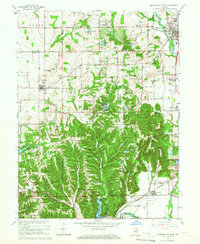
1965 Map of Mooresville West
USGS Topo · Published 1966About this map
Mooresville and the winding course of the White River dominate the northeastern landscape of this mid-1960s survey, where the river valley meets the rolling uplands of central Indiana. The terrain is deeply carved by drainage systems like Sycamore Creek and Gold Creek, which flow through the Morgan-Monroe State Forest Reservation. A dense concentration of organized camps, including Camp Gallahue and Camp Bradford, highlights the region's role as a recreational hub for nearby communities.
Find a feature on this map
72 named features on this map. Tap any name to fly to it.
Don’t see what you’re looking for? This feature index may not catch every label — zoom into the map to look around manually.
Map Details
Editions of this 1965 Mooresville West Map
3 editions found
Other maps of this area

1942 · Franklin
USGS Topo · 1:125,000

1953 · Bridgeport
USGS Topo · 1:24,000

1953 · Clayton
USGS Topo · 1:24,000

1953 · Plainfield
USGS Topo · 1:24,000

1953 · Indianapolis
USGS Topo · 1:250,000

1955 · Hall
USGS Topo · 1:24,000

1955 · Cope
USGS Topo · 1:24,000

1955 · Mooresville West
USGS Topo · 1:24,000

1955 · Martinsville
USGS Topo · 1:24,000

1955 · Mooresville East
USGS Topo · 1:24,000