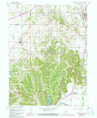
1965 Map of Mooresville West
USGS Topo · Published 1991About this map
The White River and Lick Creek valley define the eastern boundary of this Morgan County landscape, where the town of Mooresville serves as a primary hub. The map reveals a mid-century rural-to-suburban shift, evidenced by residential developments like Sundown Manor and Brookmoor alongside established agricultural townships like Gregg and Monroe. Cultural and community centers are well-represented, including the Goethe Link Observatory and numerous youth camps such as Camp Riley and Camp Bradford.
Find a feature on this map
81 named features on this map. Tap any name to fly to it.
Don’t see what you’re looking for? This feature index may not catch every label — zoom into the map to look around manually.
Map Details
Editions of this 1965 Mooresville West Map
3 editions found
Other maps of this area

1942 · Franklin
USGS Topo · 1:125,000

1953 · Bridgeport
USGS Topo · 1:24,000

1953 · Clayton
USGS Topo · 1:24,000

1953 · Plainfield
USGS Topo · 1:24,000

1953 · Indianapolis
USGS Topo · 1:250,000

1955 · Hall
USGS Topo · 1:24,000

1955 · Cope
USGS Topo · 1:24,000

1955 · Mooresville West
USGS Topo · 1:24,000

1955 · Martinsville
USGS Topo · 1:24,000

1955 · Mooresville East
USGS Topo · 1:24,000