2020s Maps of Orange County, Indiana
Explore 12 historic maps of Orange County from the 2020s. These maps offer a rare glimpse into what life looked like during the 2020s — showing old roads, neighborhoods, homes, and landmarks that have changed or disappeared over time.
Whether you're researching your family's past, planning a metal detecting trip, or studying how Orange County's landscape evolved across the 2020s, these high-resolution maps are a powerful tool for exploring the history of this region.
- Focus on a specific era: All maps on this page are from the 2020s, giving you a focused view of this time period.
- See what’s changed: Compare century-old streets, trails, and buildings to today's modern landscape using overlays and satellite layers.
- Research with precision: Use these maps for genealogy, historical research, land use analysis, or educational projects.
- View, download, or print: Maps are fully viewable online in high resolution, and can be downloaded or printed for your own records.
Start exploring Orange County's history through authentic maps from the 2020s. This is your window into the past.
Orange County, IN maps
(12)- 2022 Map of Valeene, 2022 Print
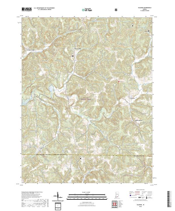 2022 Valeene2022 Print · USGSThe rural uplands of Orange County are shown in detail here, where the Patoka River meets the protected woods of the Hoosier National Forest. Trace family histories and local routes through communities like Valeene and Bacon, or locate historic sites such as the Little Africa Cem.
 - 2022 Map of Huron, 2022 Print
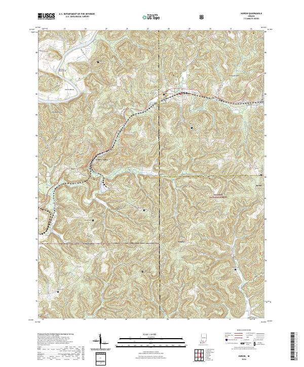 2022 Huron2022 Print · USGSSouthern Indiana ridge country comes into focus in the early 2020s, showing the intersection of public lands and long-settled farmsteads. Family historians can locate numerous burial grounds such as Union Chapel Cem, Elliott Cem, and the secluded Acre Cem.
 - 2022 Map of Hillham, 2022 Print
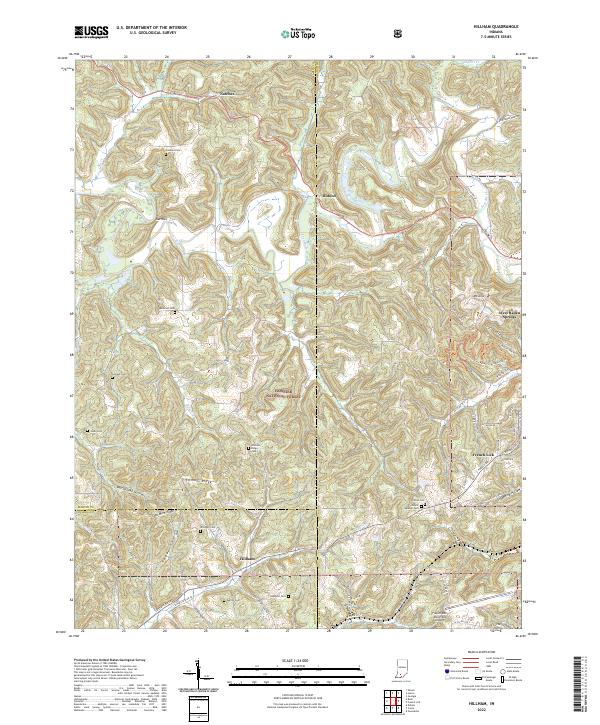 2022 Hillham2022 Print · USGSThe crossroads at Hillham and the resort grounds of French Lick are shown here as they appeared in the early 2020s. Genealogists can locate family landmarks like Hawkins Cem and Emmons Ridge Cem within the Hoosier National Forest.
 - 2022 Map of Hardinsburg, 2022 Print
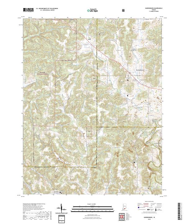 2022 Hardinsburg2022 Print · USGSSouthern Indiana's karst landscape is captured in high detail during the early 2020s, showing the rural communities near the Hoosier National Forest. Researchers can trace family roots at Hardinsburg Cemetery, Totten Cemetery, or the old settlement of Rego.
 - 2022 Map of Campbellsburg, 2022 Print
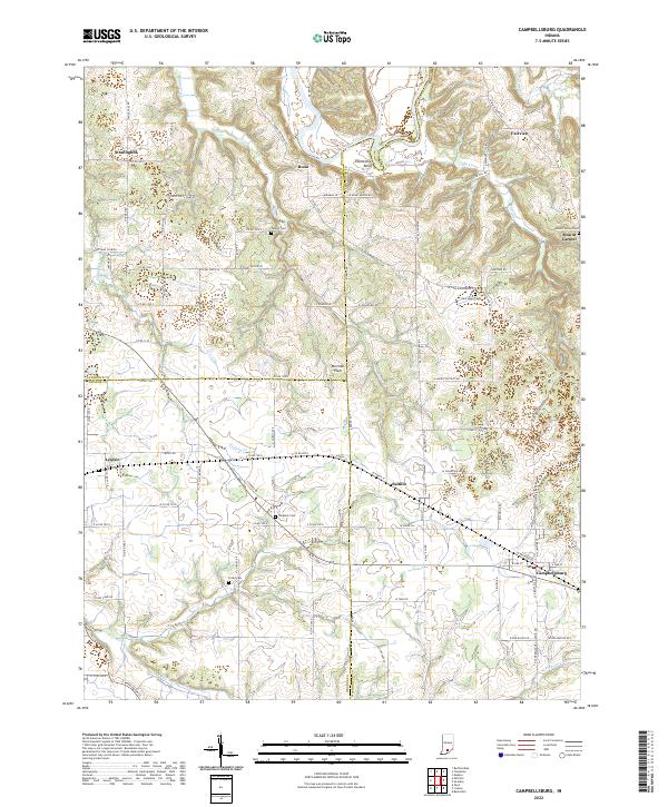 2022 Campbellsburg2022 Print · USGSSouthern Indiana's rail and river corridor comes to life in this recent survey of the Washington County landscape. Genealogists and local historians can trace family roots through numerous burial sites like Mount Carmel Cem and Freed Cem, or follow the CSX line through Campbellsburg and Saltillo.
 - 2022 Map of Mitchell, 2022 Print
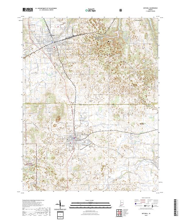 2022 Mitchell2022 Print · USGSSouthern Indiana's karst landscape comes alive in this contemporary view of the limestone plateau between Mitchell and Orleans. Genealogists and historians can trace local family roots at Freedom Cemetery or explore the historic layout of Spring Mill Village.
 - 2022 Map of Greenbrier, 2022 Print
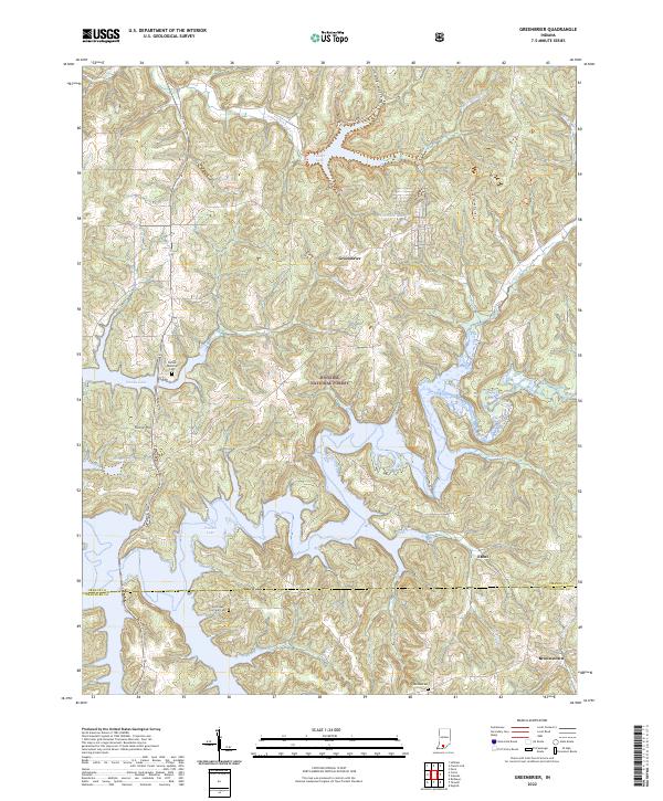 2022 Greenbrier2022 Print · USGSThe intricate shoreline of Patoka Lake and the deep woods of the Hoosier National Forest define this corner of southern Indiana. Genealogists and local historians can locate old burial grounds like Jericho Cem and small communities such as Greenbrier or Ethel.
 - 2022 Map of Livonia, 2022 Print
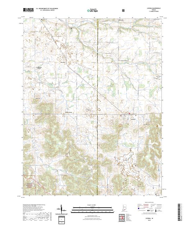 2022 Livonia2022 Print · USGSThe rural border of Orange and Washington counties comes to life in this contemporary survey of Livonia and the Mitchell Plain. Family historians and researchers can locate several local burial grounds like Sinking Spring Cem and trace the winding Lost River.
 - 2022 Map of Paoli, 2022 Print
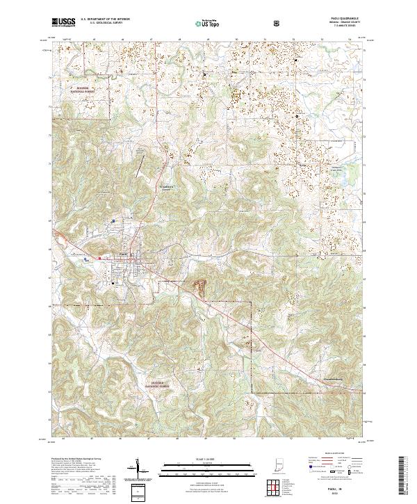 2022 Paoli2022 Print · USGSOrange County's seat and surrounding timberlands are documented here in the early 2020s. Genealogists and local historians can locate several burial grounds like Scott Cem and Lewis Cem, or trace the rural settlements of Syria and Chambersburg.
 - 2022 Map of Georgia, 2022 Print
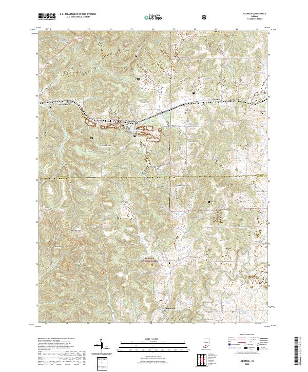 2022 Georgia2022 Print · USGSSouthern Indiana's ridges and hollows are detailed in this contemporary look at the border of Lawrence and Orange Counties. Genealogists can locate family landmarks like Georgia Cem and Bethel Cem or trace the rural crossroads of Hindostan.
 - 2022 Map of Cuzco, 2022 Print
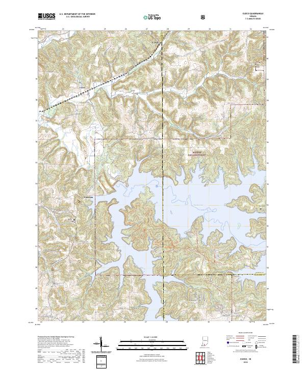 2022 Cuzco2022 Print · USGSSouthern Indiana's reservoir landscape is on full display in this modern survey of the area around Patoka Lake. Researchers can trace the rural layout of Cuzco and Norton, find the Swift Cem, and explore trails winding through the Hoosier National Forest.
 - 2022 Map of French Lick, 2022 Print
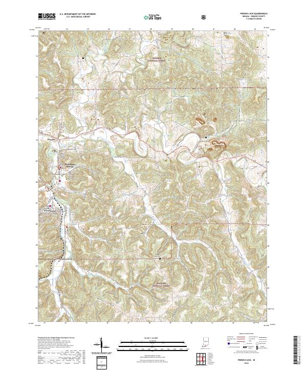 2022 French Lick2022 Print · USGSThe iconic resort towns of French Lick and West Baden Springs are shown in detail during the early 2020s as they interface with the Hoosier National Forest. Researchers can trace rural lineages through landmarks like Moores Ridge, Sulphur Creek Cem, and the various hollows of the Lost River basin.
End of results
Showing maps 1-12 of 12
Top cities of Orange County
- Paoli historical maps
- Orleans historical maps
- French Lick historical maps
- Stampers Creek historical maps
- Orangeville historical maps
- West Baden Springs historical maps
Frequently asked questions
- What are the different types of historical maps available for Orange County?
- What is the oldest map of Orange County?
- Where can I purchase historical maps of Orange County for my home or office?
- Where can I download high-res historical maps of Orange County?
- Are there historical topographic maps available for Orange County?
- Is there historical aerial imagery available for Orange County?
- Where are historical maps of Orange County sourced from?