Old Maps of Orange County, Indiana for Metal Detecting
Plan your next treasure hunt with 104 historic maps of Orange County. Find old homesites, ghost towns, trails, and gathering spots that may be lost to time — perfect for identifying promising metal detecting locations.
- Locate forgotten sites: Uncover places like long-lost settlements, abandoned rail lines, or gathering spots.
- Plan better hunts: Use map overlays combined with LiDAR or satellite views to narrow in on historically rich areas.
- Made for detectorists: Thousands of hobbyists use these maps to discover relics, coins, and hidden history.
Use these historic maps to boost your research and find new opportunities beneath the surface of Orange County.
Orange County, IN maps
(104)- 1947 Map of Hardinsburg, 1966 Print
 1947 Hardinsburg1966 Print · USGSSouthern Indiana's rural landscape is captured here in the late 1940s, showing a patchwork of small farms and family-named creek crossings. Genealogists can trace family roots at Oak Grove Ch, Walton Cem, and early schools like School No 6.
 - 1948 Map of Huron, 1960 Print
 1948 Huron1960 Print · USGSMartin County in the late 1940s is characterized by its deep forest tracts and the busy rail line through the village of Huron. Researchers can trace early rural life through surviving landmarks like Scarlet Chapel, Wiesbach Sch, and the Baltimore and Ohio railroad.
 - 1949 Map of Hardinsburg
 1949 Hardinsburg1949 Print · USGSSouthern Indiana at the end of the 1940s reveals a patchwork of rural school districts and county-line settlements. Genealogists can trace family footprints across Hardinsburg and Marengo or find ancestral sites like Old Unity Cem and Baptist Hill Ch.2 unique versions available
 - 1949 Map of Georgia, 1962 Print
 1949 Georgia1962 Print · USGSThe rural borders of Lawrence and Orange Counties come alive in this post-war survey of a landscape shaped by the Baltimore and Ohio railroad. Local researchers can trace family roots through the many country churches and schools like Bonds Chapel, Georgia Ch, and the Hindostan Sch.
 - 1950 Map of Mitchell
 1950 Mitchell1950 Print · USGSMitchell and Orleans sit at a critical railroad junction in southern Indiana during the mid-twentieth century. Researchers can trace the karst landscape of Spring Mill State Park or locate family roots near Liberty Ch and Lawrenceport Cem.2 unique versions available
 - 1950 Map of Huron
 1950 Huron1950 Print · USGSSouthern Indiana's timbered hills and rail corridors are captured here in the mid-twentieth century. Genealogists and hikers can trace the Baltimore and Ohio line past Willow Tunnel or find the remote Acre Cem and Wiesbach Sch.
 - 1950 Map of Valeene, 1952 Print
 1950 Valeene1952 Print · USGSSouthern Indiana's rural landscape at the edge of the Hoosier National Forest is preserved here in the mid-twentieth century. Researchers can trace the family histories of communities like Valeene and Fargo through local landmarks such as Cooks Ch and Perkiser Cem.3 unique versions available
 - 1951 Map of Hillham
 1951 Hillham1951 Print · USGSSouthern Indiana hills and the winding course of the Lost River define this rural landscape during the early fifties. Genealogists and local historians can locate remote family plots like Wininger Cem and Hawkins Cem alongside the tracks of the Southern railroad.
 - 1951 Map of French Lick
 1951 French Lick1951 Print · USGSOrange County was a bustling resort and transit hub at mid-century, defined by its famous mineral spring towns and a dense network of rail lines. Researchers can trace the layout of French Lick, find West Baden College, or locate rural sites like Abydel and Ames Chapel.
 - 1951 Map of Georgia
 1951 Georgia1951 Print · USGSSouthern Indiana's rural landscape is captured here in the early fifties, where the Baltimore and Ohio rail line links the settlements of Georgia and Moorestown. Genealogists and local historians can trace family roots through numerous landmarks, from the Hindostan Sch to the Georgia Cem and Bonds Chapel.
 - 1956 Map of Greenbrier, 1957 Print
 1956 Greenbrier1957 Print · USGSThe Orange and Crawford County line comes to life in the mid-fifties, showing the deeply wooded hollows and rural communities of the Hoosier National Forest. Genealogists and researchers can trace family landmarks like Lowe Cem, the Spears Lookout Tower, and the remote Newton Stewart settlement.2 unique versions available
 - 1956 Map of Vincennes, 1967 Print
 1956 Vincennes1967 Print · USGSSouthern Indiana and the Illinois borderlands are captured here in the mid-fifties, showing the region's dense network of river towns and rail lines. Researchers can trace historic river crossings along the Wabash River or locate landmarks like Wyandotte Cave and Lincoln State Park.4 unique versions available
 - 1957 Map of Vincennes
 1957 Vincennes1957 Print · USGSSouthwest Indiana and the Illinois borderlands come alive in the late 1950s, a period of heavy rail traffic and expanding state forests. Genealogists and historians can trace the riverfronts and rail lines of Vincennes, New Harmony, and the vast Crane Naval Ammunition Depot.
 - 1957 Map of Campbellsburg, 1958 Print
 1957 Campbellsburg1958 Print · USGSSouthern Indiana farming and rail life are captured here in the late fifties, showing the Monon line threading through small towns. Genealogists can locate family landmarks like Stonington Ch, Fairview Sch, and the Freedom Cem.2 unique versions available
 - 1957 Map of Cuzco, 1958 Print
 1957 Cuzco1958 Print · USGSThe rural landscapes of Orange and Dubois counties are frozen in time during the late fifties, centered on the Patoka River valley. Genealogists and researchers can locate family landmarks like Cane Creek Ch, Bender Sch, and the small settlement of Newton Stewart.2 unique versions available
 - 1957 Map of Livonia, 1958 Print
 1957 Livonia1958 Print · USGSSouthern Indiana's rural landscape at the midpoint of the century reveals a network of small crossroads and community burial grounds. Genealogists can trace family names at Posey Chapel Cem and Sinken Spring Cem or locate the former sites of Lynd Sch and Bromer.
 - 1957 Map of Paoli, 1958 Print
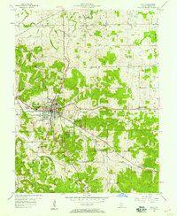 1957 Paoli1958 Print · USGSSouthern Indiana's karst landscape and timberlands are captured here in the mid-fifties, centered on the historic crossroads of Paoli. Trace the Monon railroad line past Braxtons Siding or locate vanished local landmarks like the Drive-in Theater and Throop Memorial Sch.
 - 1958 Map of Vincennes
 1958 Vincennes1958 Print · USGSSouthern Indiana and the Illinois borderlands are captured during a mid-century period of heavy rail traffic and military activity. Researchers can trace the sprawling bounds of the Crane Naval Ammunition Depot or locate historic settlements like New Harmony and French Lick.2 unique versions available
 - 1960 Map of Mitchell, 1961 Print
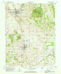 1960 Mitchell1961 Print · USGSSouthern Indiana at the dawn of the sixties shows a landscape shaped by karst geology and early transit lines. Genealogists can trace family roots through Freedom Cem and Union Chapel, or explore the historic Spring Mill Village.5 unique versions available
 - 1965 Map of Hillham, 1966 Print
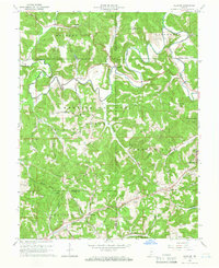 1965 Hillham1966 Print · USGSSouthern Indiana's ridges and valleys are meticulously detailed in the mid-1960s as the Hoosier National Forest surrounds the Lost River. Genealogists and local historians can locate remote family sites like Anderson Cem and Hawkins Cem or trace the path of the Southern railroad through the Burton Tunnel.2 unique versions available
 - 1965 Map of Georgia, 1966 Print
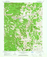 1965 Georgia1966 Print · USGSLawrence and Orange Counties are shown in the mid-1960s as the rail-driven town of Georgia anchors the northern valleys. Researchers can trace historic church sites like Bonds Chapel and Mt Horeb Ch or locate family burial grounds including Isom Cem and Hall Cem.2 unique versions available
 - 1965 Map of French Lick, 1966 Print
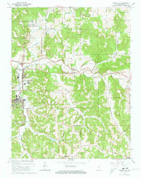 1965 French Lick1966 Print · USGSThe Orange County resort towns of French Lick and West Baden Springs are shown in the mid-1960s, surrounded by the growing Hoosier National Forest. Researchers can trace the Old Indian Treaty Boundary or locate rural sites like Ames Chapel and the Sulphur Creek Cem.4 unique versions available
 - 1965 Map of Huron, 1966 Print
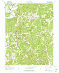 1965 Huron1966 Print · USGSThe hill country of Martin and Lawrence Counties is captured here in the mid-1960s, showing the intersection of heavy rail and deep timberlands. You can trace early family roots through Huron Cem and Baxter Cem or locate the engineering of the Willow Tunnel.3 unique versions available
 - 1966 Map of Hardinsburg, 1968 Print
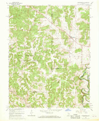 1966 Hardinsburg1968 Print · USGSSouthern Indiana's rural landscape is captured in the mid-sixties, showing the transition from agricultural tracts to protected woodlands. Genealogists can trace family sites at Baptist Hill Ch, Old Unity Ch, and the crossing at Totten Ford Bridge.2 unique versions available
 - 1970 Map of Paoli, 1972 Print
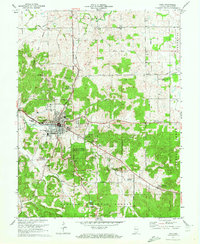 1970 Paoli1972 Print · USGSIndiana's hilly southern interior is captured here in the early seventies, centered on the historic crossroads of Paoli. Local researchers can trace old property lines against the Old Indian Treaty Boundary or locate rural landmarks like Braxtons Siding, Stouts Chapel, and Syria.3 unique versions available
Showing maps 1-25 of 104
Top cities of Orange County
- Paoli historical maps
- Orleans historical maps
- French Lick historical maps
- Stampers Creek historical maps
- Orangeville historical maps
- West Baden Springs historical maps
Frequently asked questions
- What are the different types of historical maps available for Orange County?
- What is the oldest map of Orange County?
- Where can I purchase historical maps of Orange County for my home or office?
- Where can I download high-res historical maps of Orange County?
- Are there historical topographic maps available for Orange County?
- Is there historical aerial imagery available for Orange County?
- Where are historical maps of Orange County sourced from?