1960s Maps of Pike County, Indiana
Explore 11 historic maps of Pike County from the 1960s. These maps offer a rare glimpse into what life looked like during the 1960s — showing old roads, neighborhoods, homes, and landmarks that have changed or disappeared over time.
Whether you're researching your family's past, planning a metal detecting trip, or studying how Pike County's landscape evolved across the 1960s, these high-resolution maps are a powerful tool for exploring the history of this region.
- Focus on a specific era: All maps on this page are from the 1960s, giving you a focused view of this time period.
- See what’s changed: Compare century-old streets, trails, and buildings to today's modern landscape using overlays and satellite layers.
- Research with precision: Use these maps for genealogy, historical research, land use analysis, or educational projects.
- View, download, or print: Maps are fully viewable online in high resolution, and can be downloaded or printed for your own records.
Start exploring Pike County's history through authentic maps from the 1960s. This is your window into the past.
Pike County, IN maps
(11)- 1960 Map of Folsomville, 1963 Print
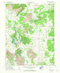 1960 Folsomville1963 Print · USGSSouthern Indiana's coal country comes into focus in the early 1960s, showing a landscape defined by the Tecumseh Mine and widespread Strip Mines. Genealogists and historians can trace local landmarks like Dickeyville, the Old Indian Treaty Boundary, and several rural cemeteries.3 unique versions available
 - 1960 Map of Lynnville, 1968 Print
 1960 Lynnville1968 Print · USGSSouthwestern Indiana's coal country comes into sharp focus during the 1960s as industrial excavation meets rural tradition. Researchers can trace the massive Strip Mines alongside local landmarks like Barnetta Chapel, St Pauls Cem, and Graham Valley.5 unique versions available
 - 1961 Map of Otwell, 1962 Print
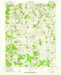
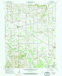 1961 Otwell1962 Print · USGSSouthern Indiana rural life is captured here in the early sixties, centered on the crossroads village of Otwell. Researchers can trace family history through numerous country landmarks like Traylor Union Ch, Chapel Cem, and the Otwell Holiness Camp.3 unique versions available
 - 1961 Map of Velpen, 1962 Print
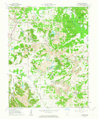
 1961 Velpen1962 Print · USGSThe border of Pike and Dubois counties comes alive in the early sixties as a landscape of timbered ridges, coal-country oil wells, and quiet hamlets. Genealogists and hikers can locate family landmarks like Stillwell Cem, the local Covered Bridge, and the community of Pikeville.2 unique versions available
 - 1961 Map of Holland, 1962 Print
 1961 Holland1962 Print · USGSThe crossroads of Dubois, Warrick, and Spencer counties come alive in the early sixties as rural life meets emerging industry. Researchers can trace the Old Indian Treaty Boundary and locate family burial sites like St James Cem or the Strip Mine near Selvin.3 unique versions available
 - 1961 Map of Petersburg, 1963 Print
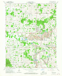
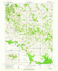
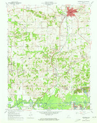 1961 Petersburg1963 Print · USGSPike County at the start of the sixties shows a landscape defined by the White River and a deep network of coal and rail infrastructure. Genealogists can locate numerous rural burial grounds like Old Town Cem and family chapels including Gladish Chapel.3 unique versions available
 - 1961 Map of Francisco, 1963 Print
 1961 Francisco1963 Print · USGSGibson County at the start of the sixties reveals a landscape of rural townships and evolving industry. Genealogists and local historians can trace family church sites like Providence Ch, explore the small town of Francisco, and locate the Old Indian Treaty Boundary.3 unique versions available
 - 1961 Map of Augusta, 1963 Print
 1961 Augusta1963 Print · USGSSouthern Indiana in the early sixties reveals a landscape of transition between coal extraction and conservation. Genealogists and historians can locate family landmarks like Ashby Ch, the Odd Fellows Cem, and the historic Indian Treaty Boundary.5 unique versions available
 - 1961 Map of Union, 1963 Print
 1961 Union1963 Print · USGSPike and Gibson counties in the early sixties reveal a landscape of river bottoms and rural crossroads. Genealogists and historians can trace family locations through sites like Bethlehem Cem, the Miller Sch grounds, and the settlement at Wheeling.3 unique versions available
 - 1961 Map of Winslow, 1963 Print
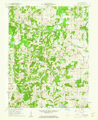
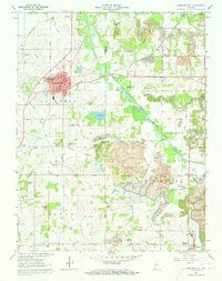
 1961 Winslow1963 Print · USGSPike County was a landscape of industrial extraction and quiet rural life in the early sixties. Genealogists and historians can trace the paths of the Algiers Winslow and Western railroad or locate family plots at Sunset Cem and Beadles Cem.3 unique versions available
 - 1961 Map of Oakland City, 1963 Print
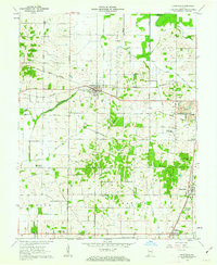
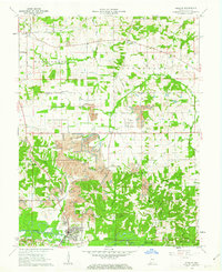
 1961 Oakland City1963 Print · USGSOakland City and the surrounding townships of Gibson and Pike counties are captured here in the early sixties as a center of coal mining and rail transit. Genealogists and historians can trace family locations near Williams Cem, Blackfoot Ch, and the historic Wabash and Erie Canal.4 unique versions available
End of results
Showing maps 1-11 of 11
Top cities of Pike County
Frequently asked questions
- What are the different types of historical maps available for Pike County?
- What is the oldest map of Pike County?
- Where can I purchase historical maps of Pike County for my home or office?
- Where can I download high-res historical maps of Pike County?
- Are there historical topographic maps available for Pike County?
- Is there historical aerial imagery available for Pike County?
- Where are historical maps of Pike County sourced from?