2020s Maps of Pike County, Indiana
Explore 15 historic maps of Pike County from the 2020s. These maps offer a rare glimpse into what life looked like during the 2020s — showing old roads, neighborhoods, homes, and landmarks that have changed or disappeared over time.
Whether you're researching your family's past, planning a metal detecting trip, or studying how Pike County's landscape evolved across the 2020s, these high-resolution maps are a powerful tool for exploring the history of this region.
- Focus on a specific era: All maps on this page are from the 2020s, giving you a focused view of this time period.
- See what’s changed: Compare century-old streets, trails, and buildings to today's modern landscape using overlays and satellite layers.
- Research with precision: Use these maps for genealogy, historical research, land use analysis, or educational projects.
- View, download, or print: Maps are fully viewable online in high resolution, and can be downloaded or printed for your own records.
Start exploring Pike County's history through authentic maps from the 2020s. This is your window into the past.
Pike County, IN maps
(15)- 2022 Map of Iona, 2022 Print
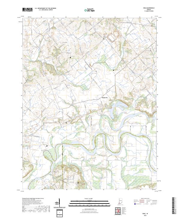 2022 Iona2022 Print · USGSThe rural borders of Knox, Gibson, and Pike counties come into focus in this contemporary survey of the White River valley. Genealogists can locate numerous historic burial sites such as Odd Fellows Cem and Saint Peter Lutheran Cem near the settlements of Iona and Giro.
 - 2022 Map of Velpen, 2022 Print
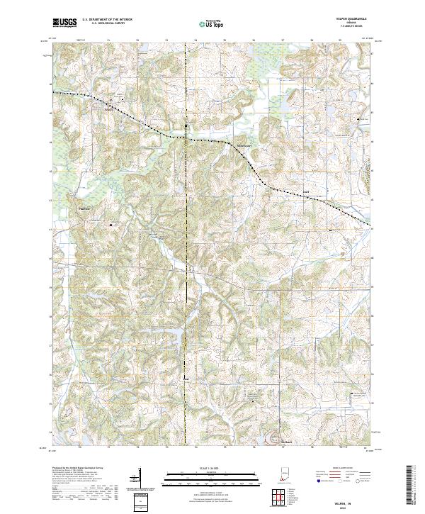 2022 Velpen2022 Print · USGSDubois and Pike counties are captured here in the early twenty-first century, showing a landscape defined by the Patoka River and historic crossroads. Researchers can locate numerous family burial grounds like Payne Cem and Mayo Cem alongside established communities such as Velpen and Holland.
 - 2022 Map of Oakland City, 2022 Print
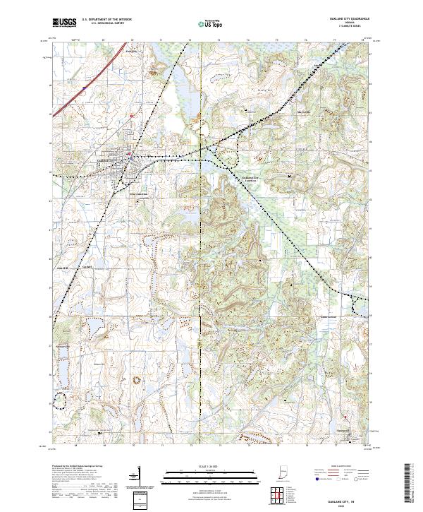 2022 Oakland City2022 Print · USGSOakland City and the surrounding Gibson County coal and farm lands are captured here in the early twenty-first century. Genealogists can trace family names across Montgomery Cem and Union Cem or locate the historic Old McCullough Mine.
 - 2022 Map of Otwell, 2022 Print
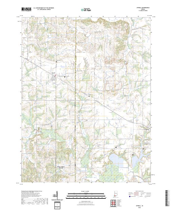 2022 Otwell2022 Print · USGSOtwell and the rural townships of Pike and Dubois Counties are captured here in the early 2020s. Genealogists can trace family footprints at Otwell Cem, Mount Zion Cem, and Armstrong Cem or follow the waters of Flat Creek to the Patoka River.
 - 2022 Map of Glendale, 2022 Print
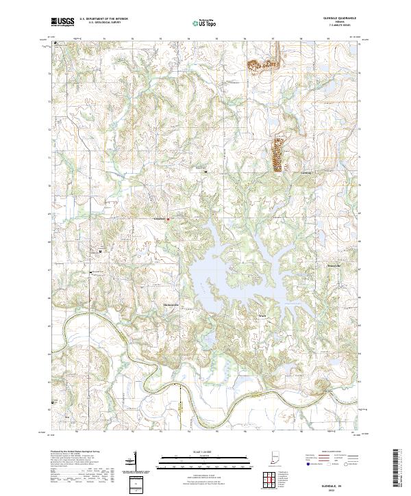 2022 Glendale2022 Print · USGSDaviess County's rural landscape is captured here in the early twenty-first century, showing the enduring layout of river-border settlements. Genealogists can locate family burial grounds at East Union Cem and Ebenezer Cem or trace the old roads connecting Hudsonville and Waco.
 - 2022 Map of Francisco, 2022 Print
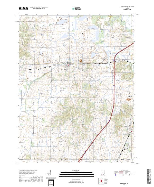 2022 Francisco2022 Print · USGSGibson County in the early twenty-first century reveals a landscape where organized township grids meet winding waterways like Halfmoon Cr. Genealogists and local historians can pinpoint the IOOF Cem and explore the rural outskirts of Francisco, Somerville, and Mackey.
 - 2022 Map of Holland, 2022 Print
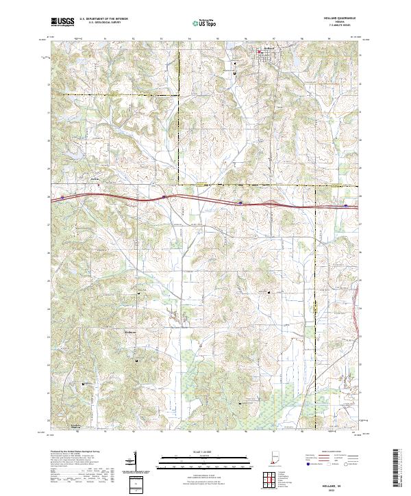 2022 Holland2022 Print · USGSThis Southern Indiana landscape at the turn of the 2020s shows a rural region shaped by agricultural drainage and local tradition. Genealogists can trace family sites at Augustana Cem and Selvin Cem or explore the crossroads of Heilman and Loafers Station.
 - 2022 Map of Union, 2022 Print
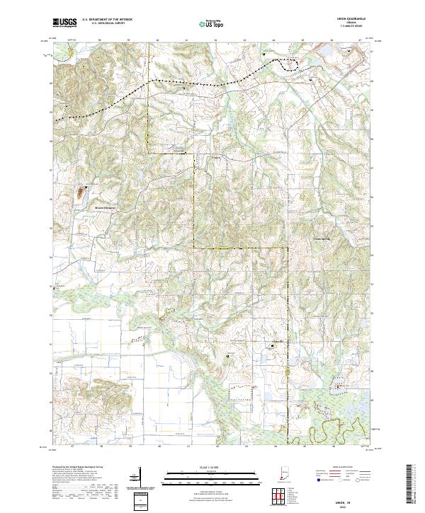 2022 Union2022 Print · USGSIndiana's Gibson and Pike counties meet along the meandering Patoka River in this detailed modern topographic survey. Researchers can locate numerous historic burial grounds including Bethlehem Cem, Frederick Cem, and the Richardson Cem while tracing the rural settlements of Union and Oatsville.
 - 2022 Map of Sandy Hook, 2022 Print
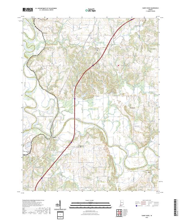 2022 Sandy Hook2022 Print · USGSSouthwestern Indiana's river junctions and rural hamlets are documented in this recent survey of the White River valley. Genealogists and local researchers can locate family sites near Rogers, Cumback, and several rural burial grounds like Arnold Cem and Bethel Cem.
 - 2022 Map of Monroe City, 2022 Print
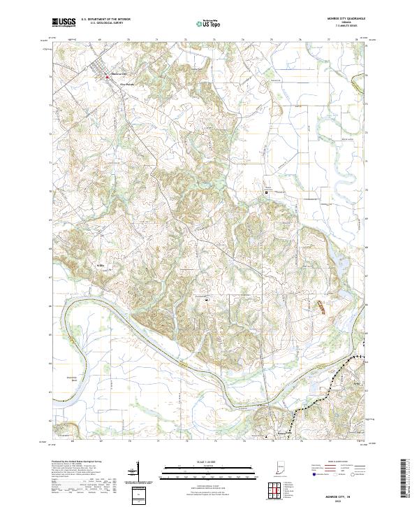 2022 Monroe City2022 Print · USGSMonroe City and the winding White River valley are documented here in the early 2020s, showing a landscape shaped by water and agriculture. Genealogists and local researchers can locate quiet landmarks like Walnut Grove Cem, The Bluffs, and the small settlement of Willis.
 - 2022 Map of Winslow, 2022 Print
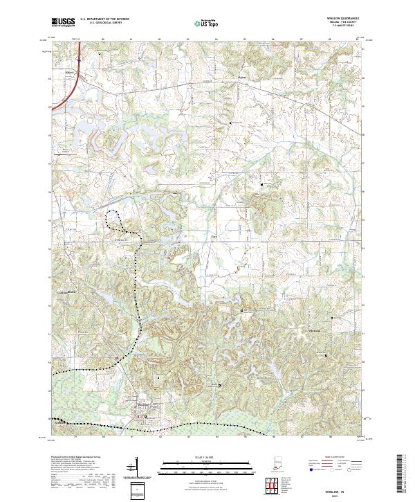 2022 Winslow2022 Print · USGSPike County settlements and river valleys are captured here in the early 2020s, centered on the community of Winslow. Genealogists and local historians can trace family locations through numerous sites like Beadles Cem, Hays Cem, and the rural village of Algiers.
 - 2022 Map of Petersburg, 2022 Print
 2022 Petersburg2022 Print · USGSPike County comes into focus in this recent survey, showcasing the hub of Petersburg and its surrounding river lowlands. Genealogists can locate over a dozen burial sites including Indian Mound Cem and Old Town Cem near West Petersburg.
 - 2022 Map of Augusta, 2022 Print
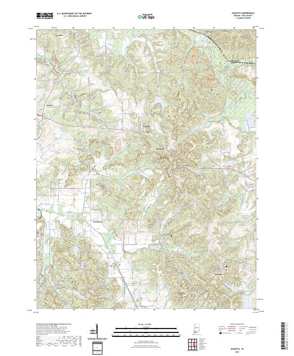 2022 Augusta2022 Print · USGSPike County in the early twenty-first century remains a landscape of river bottoms and small farming communities. Researchers can trace family sites at Augusta Cem, locate the Hoskins Pits, and explore the rural road network connecting Stendal and Augusta.
 - 2022 Map of Folsomville, 2022 Print
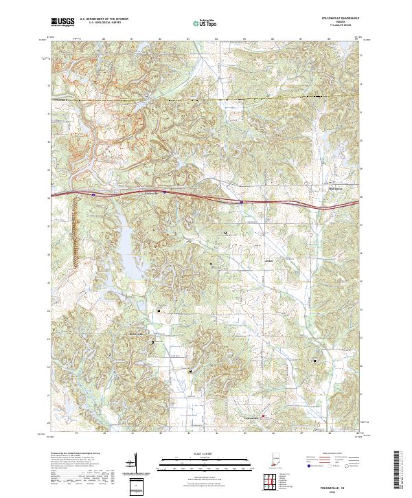 2022 Folsomville2022 Print · USGSWarrick County in the 2020s remains a landscape of tightly-knit rural communities and family legacies. Researchers can trace ancestral roots through numerous local burial sites like Shiloh Cem and Hull Cem or locate the centers of Folsomville and Scalesville.
 - 2023 Map of Lynnville, 2023 Print
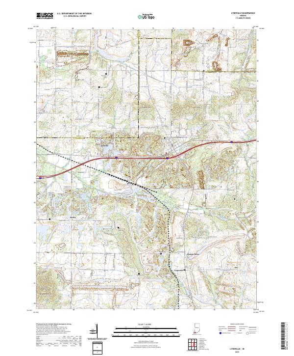 2023 Lynnville2023 Print · USGSModern Warrick County settlement patterns emerge around Lynnville in this recent survey. Local historians can trace family roots through numerous burial sites like Mount Olive Cem and Saint Pauls Cem or locate rural hamlets like Eby and Stanley.
End of results
Showing maps 1-15 of 15
Top cities of Pike County
Frequently asked questions
- What are the different types of historical maps available for Pike County?
- What is the oldest map of Pike County?
- Where can I purchase historical maps of Pike County for my home or office?
- Where can I download high-res historical maps of Pike County?
- Are there historical topographic maps available for Pike County?
- Is there historical aerial imagery available for Pike County?
- Where are historical maps of Pike County sourced from?