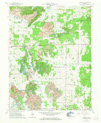
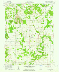
1960 Map of Folsomville
USGS Topo · Published 1963About this map
Strip mines dominate the northern and western reaches of this landscape near the Pike and Warrick County line. The mid-century terrain is defined by the heavy extraction industry, particularly at the Tecumseh Mine, which is served by the New York Central railroad corridor. While industrial activity reshapes the earth, established rural communities like Folsomville and Dickeyville maintain their local character through a network of country churches and burial grounds, including Shiloh Ch and the Leslie Cem.
Find a feature on this map
53 named features on this map. Tap any name to fly to it.
Don’t see what you’re looking for? This feature index may not catch every label — zoom into the map to look around manually.
Map Details
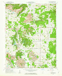
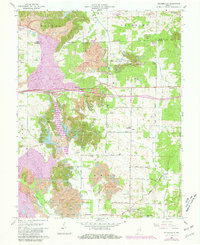
Editions of this 1960 Folsomville Map
3 editions found
Other maps of this area

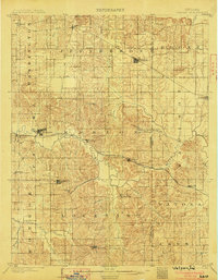
1900 · De Gonia Springs
USGS Topo · 1:62,500

1902 · Ditney
USGS Topo · 1:125,000

1902 · Degonia Springs
USGS Topo · 1:62,500

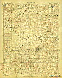
1902 · Boonville
USGS Topo · 1:62,500
1903 · Velpen
USGS Topo · 1:62,500
1903 · Petersburg
USGS Topo · 1:62,500

1956 · Vincennes
USGS Topo · 1:250,000

1957 · Vincennes
USGS Topo · 1:250,000

1958 · Vincennes
USGS Topo · 1:250,000
1960 · De Gonia Springs
USGS Topo · 1:24,000