Old Maps of Saint Joseph County, Indiana for Metal Detecting
Plan your next treasure hunt with 143 historic maps of Saint Joseph County. Find old homesites, ghost towns, trails, and gathering spots that may be lost to time — perfect for identifying promising metal detecting locations.
- Locate forgotten sites: Uncover places like long-lost settlements, abandoned rail lines, or gathering spots.
- Plan better hunts: Use map overlays combined with LiDAR or satellite views to narrow in on historically rich areas.
- Made for detectorists: Thousands of hobbyists use these maps to discover relics, coins, and hidden history.
Use these historic maps to boost your research and find new opportunities beneath the surface of Saint Joseph County.
Saint Joseph County, IN maps
(143)- 1927 Map of Niles
 1927 Niles1927 Print · USGSBerrien County and the Michigan-Indiana borderlands are captured here during the late 1920s, showing a landscape of river-powered towns and rural school districts. Genealogists can trace family roots through dozens of local landmarks like Ruggles Cem, Salem Ch, and Emmanuel Missionary College.
 - 1930 Map of Three Oaks
 1930 Three Oaks1930 Print · USGSSouthwest Michigan's lakeshore and interior townships are captured in detail during the late twenties. Genealogists and historians can trace family roots through numerous rural schoolhouses like California Sch or visit the settled blocks of Three Oaks and New Buffalo.3 unique versions available
 - 1930 Map of Niles
 1930 Niles1930 Print · USGSBerrien County's rural heartland is captured here at the onset of the 1930s, showing the agricultural and riverine landscape before modern development. Genealogists can trace family roots through numerous country schools like Bedinger Sch and landmark sites such as Salem Ch or Pennellwood.4 unique versions available
 - 1943 Map of Niles
 1943 Niles1943 Print · USGSThe St. Joseph River valley in the early 1940s was a landscape defined by small townships and numerous rural school districts. Genealogists can trace family footprints across Berrien Springs and Buchanan, locating family-named sites like Ruggles Cem and Kelsey Sch.
 - 1944 Map of Three Oaks
 1944 Three Oaks1944 Print · USGSCoastal Berrien County at the height of the Second World War shows a vibrant mix of lakeside resorts and rural farming communities. Researchers can trace ancestral roots at Forest Lawn Cem or locate vintage schoolhouses like Riverside Sch and California Sch along the Pere Marquette rail line.
 - 1945 Map of Cassopolis, 1967 Print
 1945 Cassopolis1967 Print · USGSSouthwestern Michigan's rural landscape is captured here in the mid-1940s, showing a dense network of country schools and family-named cemeteries. Genealogists can trace property roots near Barron Lake Cem, Crystal Springs Campground, and numerous landmarks like Morris Chapel.3 unique versions available
 - 1947 Map of Cassopolis
 1947 Cassopolis1947 Print · USGSSouthwest Michigan's lake country is captured here just after the war, showing the busy rail-and-river hubs and rural townships. Researchers can locate dozens of neighborhood schoolhouses like Brooklyn Sch and country churches such as Smith Chapel.2 unique versions available
 - 1953 Map of Chicago, 1964 Print
 1953 Chicago1964 Print · USGSThe southern Lake Michigan shoreline was rapidly modernizing in the mid-fifties, balancing heavy industry with its famous academic centers. Researchers can trace the footprints of Notre Dame University or locate vanished sites like the Kingsbury Ordnance Plant and Meigs Field.5 unique versions available
 - 1957 Map of Chicago
 1957 Chicago1957 Print · USGSThe industrial heartland and southern Great Lakes shoreline are captured here during the peak of mid-century growth. Researchers can trace the massive Gary Steel Works, the grounds of the University of Notre Dame, and the early paths of the Tri-State Tollway.
 - 1958 Map of South Bend East, 1959 Print
 1958 South Bend East1959 Print · USGSSouth Bend and Mishawaka are shown during a period of significant mid-century growth along the St Joseph River. Researchers can trace the sprawling campus of the University of Notre Dame or locate family sites near St Joseph Valley Memorial Park Cemetery and Harris Prairie Cem.
 - 1958 Map of South Bend West, 1959 Print
 1958 South Bend West1959 Print · USGSSouth Bend enters the jet age in the late fifties as suburban development and industrial expansion push west toward the airport. Genealogists and historians can trace neighborhood growth through dozens of local institutions like St Marys College, Highland Cemetery, and Washington High Sch.
 - 1958 Map of Lydick, 1960 Print
 1958 Lydick1960 Print · USGSSt. Joseph County's industrial and rural character is caught here in the late fifties as transport networks expanded across the Indiana-Michigan line. Researchers can trace historic family landmarks like Hamilton Cem, the Gordon Airport, and the localized STUDEBAKER PROVING GROUNDS.
 - 1958 Map of Bremen, 1960 Print
 1958 Bremen1960 Print · USGSBremen and the surrounding Marshall County countryside are captured here in the late fifties as a bustling hub of rail and road commerce. Genealogists and local historians can trace family locations near Indiana Chapel, Bremen Cemetery, and the shoreline of Lake of the Woods.5 unique versions available
 - 1958 Map of La Paz, 1960 Print
 1958 La Paz1960 Print · USGSNorthern Indiana's rural landscape is captured here in the late fifties, centered on the strategic rail crossing at Lapaz Junction. Genealogists and local historians can trace the foundations of the community through sites like Township High Sch, Fairmount Cem, and the village of Linkville.
 - 1958 Map of Nappanee West, 1960 Print
 1958 Nappanee West1960 Print · USGSNorthern Indiana farm country is captured here in the late fifties, showing the rural grid where Marshall and Elkhart counties meet. Genealogists can trace family footprints through Borkholder Sch, South Union Chapel, and Sarah Hershberger Road.3 unique versions available
 - 1958 Map of Hamlet, 1960 Print
 1958 Hamlet1960 Print · USGSRailroad hubs and reclaimed marshlands define this part of Starke County in the late fifties. Genealogists and local historians can trace the intricate network of family-named drainage lines like Amy Kelley Ditch and rail stops at Hamlet and Grovertown.
 - 1958 Map of Osceola, 1960 Print
 1958 Osceola1960 Print · USGSOsceola and the St. Joseph River valley are shown here in the late fifties as the region balanced its agrarian roots with modern infrastructure. Researchers can trace the legacy of local families through Carlton Cem, Salem Ch, and the many schools like Frank Sch dotting the landscape.
 - 1958 Map of Walkerton, 1960 Print
 1958 Walkerton1960 Print · USGSWalkerton was a bustling rail hub in the late fifties where three major lines intersected amidst the fertile northern Indiana plains. Genealogists and local historians can trace family ties at Barber Cem, identify the location of the Township Sch, or explore the mid-century layout of Koontz Lake and Tyner.
 - 1958 Map of Stillwell, 1961 Print
 1958 Stillwell1961 Print · USGSLaPorte County in the late fifties shows a landscape of strategic industrial sites and critical rail junctions during the height of the Cold War. Genealogists and historians can trace the footprint of the Kingsbury Ordnance Plant and the rail corridors of the Wabash and New York Chicago and St Louis.
 - 1958 Map of North Liberty, 1961 Print
 1958 North Liberty1961 Print · USGSSt. Joseph County's agricultural heartland is documented here in the late fifties as the rail and river economy transitioned. Genealogists and local historians can trace property near North Liberty, find the Liberty Ch, or locate the Purdue Research Farm.2 unique versions available
 - 1958 Map of Lakeville, 1964 Print
 1958 Lakeville1964 Print · USGSLakeville and south-central St. Joseph County are shown in the late fifties as a bustling intersection of rail lines and rural townships. Genealogists and historians can locate family plots at Southlawn Cem or trace the path of the Pennsylvania Railroad through Pine Station.
 - 1958 Map of New Carlisle, 1964 Print
 1958 New Carlisle1964 Print · USGSThe Indiana-Michigan state line comes alive in the late fifties, showing a landscape of glacial lakes and growing rail corridors. Genealogists can locate family sites like Sauktown Cem, St Johns Ch, and the St Joseph Novitiate near New Carlisle.2 unique versions available
 - 1961 Map of Wakarusa, 1963 Print
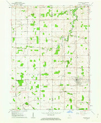 1961 Wakarusa1963 Print · USGSIn the early 1960s, the rural borderlands of Elkhart and St. Joseph counties remained a landscape of family-named drainage ditches and country congregations. Genealogists and local researchers can trace the vicinity of Wakarusa to find Holdeman Ch, Resthaven Cem, and Township High Sch.3 unique versions available
 - 1961 Map of Wyatt, 1964 Print
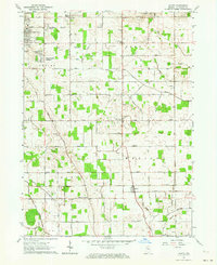 1961 Wyatt1964 Print · USGSSt. Joseph County's rural townships and growing suburban additions are captured in the early 1960s. Researchers can trace local lineage through Union Church Cemetery and landmark institutions like Tamarack Grange or Hay School.2 unique versions available
 - 1969 Map of South Bend East, 1971 Print
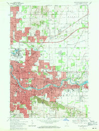 1969 South Bend East1971 Print · USGSSouth Bend and Mishawaka are seen here at the close of the 1960s, a period of major collegiate expansion and urban density along the St Joseph River. Researchers can trace the mid-century footprints of the University of Notre Dame and identify local landmarks like the Grand Trunk rail lines and Cedar Grove Cem.4 unique versions available
Showing maps 1-25 of 143
Top cities of Saint Joseph County
- South Bend historical maps
- Mishawaka historical maps
- Granger historical maps
- Notre Dame historical maps
- Olive historical maps
- Osceola historical maps
See more
Frequently asked questions
- What are the different types of historical maps available for Saint Joseph County?
- What is the oldest map of Saint Joseph County?
- Where can I purchase historical maps of Saint Joseph County for my home or office?
- Where can I download high-res historical maps of Saint Joseph County?
- Are there historical topographic maps available for Saint Joseph County?
- Is there historical aerial imagery available for Saint Joseph County?
- Where are historical maps of Saint Joseph County sourced from?