Old Maps of Blocher, Indiana for Academic Research
Study the evolution of Blocher with 11 high-resolution historic maps. Whether you're teaching, researching, or modeling changes in land use, these maps provide essential visual documentation of urban, environmental, and geographic change.
- Analyze long-term change: Track patterns in development, transportation, and natural features.
- Ideal for environmental or urban studies: Support academic projects with primary historical map data.
- Use in the classroom or lab: Educators and researchers rely on these maps to bring historical context to life.
These maps are a powerful tool for teaching, research, and visualizing how Blocher has changed over the decades.
Blocher, IN maps
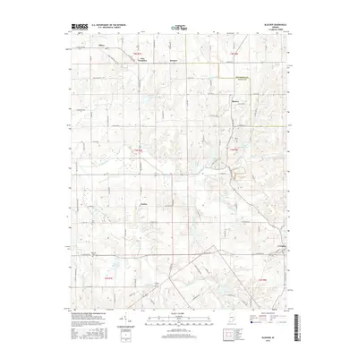
(11)- 1956 Map of Blocher, 1957 Print
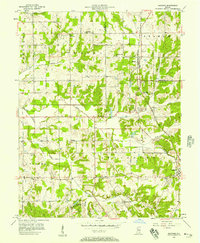 1956 Blocher1957 Print · USGSSouthern Indiana's rural landscape is captured here in the mid-fifties as the Baltimore and Ohio railroad passes through Blocher. Researchers can trace family history through sites like Scaffold Lick Ch and the extensive Clark Military Grant.
 - 1956 Map of Louisville, 1971 Print
 1956 Louisville1971 Print · USGSThe Ohio River valley and the Kentucky Bluegrass are captured here during a period of rapid mid-century growth and industrial activity. Genealogists and historians can trace rail-centered towns and military land use at Fort Knox and the Jefferson Proving Ground.2 unique versions available
 - 1964 Map of Louisville
 1964 Louisville1964 Print · USGSThe Ohio River valley and Kentucky Bluegrass are captured in the mid-1960s, showing a region balanced between industrial growth and its agrarian roots. Genealogists and historians can trace the development of county seats like Shelbyville and Paris, or locate established institutions such as Georgetown College and Bernheim Forest.
 - 1968 Map of Blocher, 1971 Print
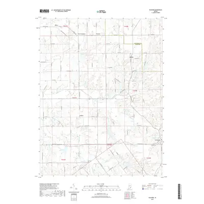
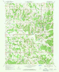 1968 Blocher1971 Print · USGSSoutheastern Indiana's rural crossroads and rail towns are captured here in the late sixties. Researchers can pinpoint long-standing community landmarks like Scaffold Lick Ch, the Baltimore and Ohio rail line, and Lexington Cem.4 unique versions available
 - 1986 Map of Madison
 1986 Madison1986 Print · USGSSouthern Indiana and Northern Kentucky are shown here in the mid-eighties, centered on the river corridor and the sprawling Jefferson Proving Ground. Genealogists and historians can trace rail lines like the Seaboard System and locate river towns from Madison to Bethlehem.
 - 1990 Map of Madison, 1991 Print
 1990 Madison1991 Print · USGSThe Ohio River valley and the southern Indiana plains are documented here in the final decade of the twentieth century. Genealogists and historians can trace family-named crossroads and established rail towns like Dudleytown, Austin, and Crothersville along the P C RR line.
 - 2010 Map of Blocher, 2010 Print
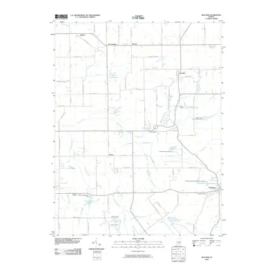 2010 Blocher2010 Print · USGSCovers Blocher, including Lexington, Wooster, and other nearby areas
 - 2013 Map of Blocher, 2013 Print
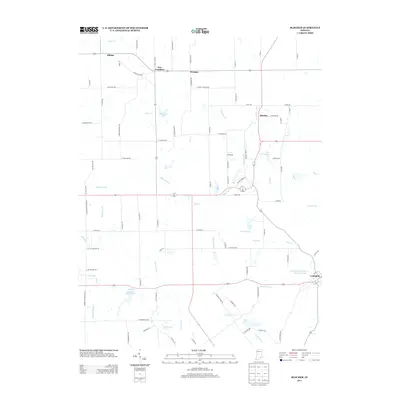 2013 Blocher2013 Print · USGSCovers Blocher, including Lexington, Wooster, and other nearby areas
 - 2016 Map of Blocher, 2016 Print
 2016 Blocher2016 Print · USGSCovers Blocher, including Lexington, Wooster, and other nearby areas
 - 2019 Map of Blocher, 2019 Print
 2019 Blocher2019 Print · USGSCovers Blocher, including Lexington, Wooster, and other nearby areas
 - 2022 Map of Blocher, 2022 Print
 2022 Blocher2022 Print · USGSScott County, Indiana, is captured here in the early 2020s, showcasing a landscape of small agricultural settlements and winding creek drainages. Researchers can trace family history through numerous rural burial sites like Estil Cem and Bridgewater Cem or locate the old crossroads of New Frankfort and Goshen.
End of results
Showing maps 1-11 of 11
Top cities near Blocher
- Seymour historical maps
- Madison historical maps
- Vienna historical maps
- Scottsburg historical maps
- Austin historical maps
- Hanover historical maps
See more
Frequently asked questions
- What are the different types of historical maps available for Blocher?
- What is the oldest map of Blocher?
- Where can I purchase historical maps of Blocher for my home or office?
- Where can I download high-res historical maps of Blocher?
- Are there historical topographic maps available for Blocher?
- Is there historical aerial imagery available for Blocher?
- Where are historical maps of Blocher sourced from?