Old Maps of Buena Vista County, Iowa for Metal Detecting
Plan your next treasure hunt with 125 historic maps of Buena Vista County. Find old homesites, ghost towns, trails, and gathering spots that may be lost to time — perfect for identifying promising metal detecting locations.
- Locate forgotten sites: Uncover places like long-lost settlements, abandoned rail lines, or gathering spots.
- Plan better hunts: Use map overlays combined with LiDAR or satellite views to narrow in on historically rich areas.
- Made for detectorists: Thousands of hobbyists use these maps to discover relics, coins, and hidden history.
Use these historic maps to boost your research and find new opportunities beneath the surface of Buena Vista County.
Buena Vista County, IA maps
(125)- 1954 Map of Fort Dodge, 1968 Print
 1954 Fort Dodge1968 Print · USGSNorthwest Iowa is shown here during a period of steady industrial and rail activity in the mid-fifties. Researchers can trace the extensive rail lines connecting Fort Dodge to mining and manufacturing sites like Gypsum and Industry Station.3 unique versions available
 - 1957 Map of Fort Dodge
 1957 Fort Dodge1957 Print · USGSWest-central Iowa thrived as a network of rail-linked agricultural hubs and river towns during the mid-fifties. Researchers can trace the development of the Des Moines River valley and locate historic landmarks in Fort Dodge, Storm Lake, and Lehigh.
 - 1958 Map of Fort Dodge
 1958 Fort Dodge1958 Print · USGSWestern Iowa in the mid-1950s reveals a productive landscape of river-valley industry and prairie agricultural hubs. Researchers can trace the development of the Des Moines River corridor through Fort Dodge and locate vanished local landmarks near Coalville or Storm Lake.
 - 1969 Map of Aurelia, 1971 Print
 1969 Aurelia1971 Print · USGSAurelia and its surrounding townships are captured in the late sixties as a thriving rail-centered agricultural community. Researchers can trace family sites near Pleasant Hill Cem, follow the Illinois Central line, or locate the Campground Larson Lake County Park.
 - 1969 Map of Galva, 1971 Print
 1969 Galva1971 Print · USGSAgricultural life in Ida County centered on Galva during the late sixties, where the railroad and river valleys shaped the local landscape. Genealogists and researchers can locate family plots at Diamond Cem or trace the course of the Chicago and North Western line.
 - 1971 Map of Sioux Rapids SE
 1971 Sioux Rapids SE1971 Print · USGSBuena Vista County was a landscape of structured agriculture and river-fed industry in the early seventies. Genealogists and researchers can trace township boundaries like Lincoln and follow the Chicago and North Western rail line past Marathon Poland Park.
 - 1971 Map of Albert City, 1973 Print
 1971 Albert City1973 Print · USGSThe agricultural heart of Buena Vista County is captured here in the early seventies, dominated by the rail-centric layouts of Marathon and Albert City. Genealogists can locate several family burial sites including Smith Cem and Fairfield Cem along the quiet section lines.
 - 1971 Map of Rembrandt, 1973 Print
 1971 Rembrandt1973 Print · USGSRembrandt and the surrounding townships of Buena Vista County are captured here in the early 1970s. Genealogists and local historians can locate the Little Sioux Valley Cem, Center Grove Ch, and the CHICAGO AND NORTH WESTERN rail line.
 - 1971 Map of Sioux Rapids, 1973 Print
 1971 Sioux Rapids1973 Print · USGSNorthwest Iowa's river valleys and rail corridors are captured here in the early seventies as the local landscape balanced industry and tradition. Researchers can pinpoint rural burial sites like Fanny Fern Cem, the community of Linn Grove, and the Old RR Grade.
 - 1971 Map of Peterson SW, 1973 Print
 1971 Peterson SW1973 Print · USGSThe borderlands of Cherokee and Buena Vista counties come into focus during the early 1970s, featuring the sharp valley of the Little Sioux River. Genealogists and researchers can trace rural homesteads near the Spring Cemetery, Immanuel Church, and the quiet grounds of Afton Cemetery.
 - 1971 Map of Rush Lake West, 1973 Print
 1971 Rush Lake West1973 Print · USGSNorthwest Iowa's agricultural heartland is documented here in the early 1970s, centered on the rail junction at Leverett. Researchers can trace the intersecting lines of the Milwaukee Road and the Rock Island near Silver Lake and Pickerel Lake.
 - 1971 Map of Peterson SE, 1973 Print
 1971 Peterson SE1973 Print · USGSBuena Vista County was a tapestry of productive farmland and quiet rural parishes in the early seventies. Genealogists and local historians can trace family ties through sites like the Childrens Home, Elk Cem, and Immanuel Ch.
 - 1971 Map of Peterson, 1973 Print
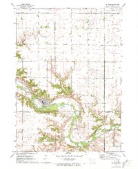 1971 Peterson1973 Print · USGSPeterson and the surrounding river bluffs are captured in detail in the early 1970s, as the town serves the local farming and rail economy. Genealogists and historians can trace the Chicago and North Western line, locate Oakland Cem, and explore the wooded grounds of Wanata State Park.
 - 1971 Map of Webb, 1973 Print
 1971 Webb1973 Print · USGSThe town of Webb and the surrounding prairies of northwest Iowa are captured here during the early 1970s. Local researchers can trace a dense network of railroads including the Milwaukee Road and locate the Burr Oak Cem along the Little Sioux River.
 - 1971 Map of Sutherland East, 1973 Print
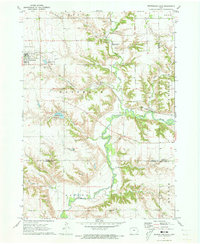 1971 Sutherland East1973 Print · USGSSutherland and the Little Sioux River valley are captured here in the early 1970s, showing a landscape defined by prairie agriculture and river bluffs. Researchers can locate Waterman Cem, the Chicago and North Western line, and Indian Village State Park.
 - 1979 Map of Lakeside
 1979 Lakeside1979 Print · USGSThe southern shores of Storm Lake come into focus during the late seventies, showing a landscape of lakeside recreation and steady agricultural growth. Genealogists and local historians can locate Chase Cem, Immanuel Ch, and the grounds of Iowa Central Community College.
 - 1979 Map of Storm Lake
 1979 Storm Lake1979 Print · USGSStorm Lake and its surrounding Buena Vista County townships are captured in the late seventies as a thriving rail and educational hub. Genealogists and local historians can locate early schools like North School, the St Marys Cem, and the small community of Truesdale.
 - 1979 Map of Varina
 1979 Varina1979 Print · USGSVarina and the surrounding Pocahontas County farmland are shown here in the late 1970s, organized by the iron rails and section lines. Researchers can trace the Milwaukee Road rail line or locate family sites at St John Ch Cem and the Sunken Grove State Game Management Area.
 - 1979 Map of Newell West
 1979 Newell West1979 Print · USGSAgricultural progress and rail connectivity define this Buena Vista County landscape in the late 1970s. Trace the paths of the Illinois Central Gulf through Newell or locate the Iowa State University Allee Experimental Farm.
 - 1979 Map of Alta
 1979 Alta1979 Print · USGSAlta and the surrounding Buena Vista County farmlands are captured in the late seventies, showing the area's transition into a modern agricultural hub. Researchers can trace family origins at the Scandinavian Cem or follow the path of the Illinois Central Gulf railroad.2 unique versions available
 - 1979 Map of Schaller North
 1979 Schaller North1979 Print · USGSBuena Vista and Sac counties are captured here in the late seventies, showing the agricultural heart of the Maple Valley. Genealogists and local historians can trace the environs of Schaller and Hanover, locating landmarks like St John Sch and the Chicago and North Western railroad.
 - 1979 Map of Storm Lake NE
 1979 Storm Lake NE1979 Print · USGSBuena Vista County in the late seventies is a landscape of productive farmsteads and engineered prairie drainage systems. Researchers can locate rural landmarks such as Zion Ch and St Johns Ch or trace the route of the Illinois Central Gulf railroad.
 - 1979 Map of Newell East
 1979 Newell East1979 Print · USGSBuena Vista County farming and rail transport are in focus during the late seventies as the town of Newell expands. Researchers can trace land divisions across Cedar and Douglas townships or locate specific landmarks like Sunken Island Lake and the local Cem.
 - 1984 Map of Humboldt, 1985 Print
 1984 Humboldt1985 Print · USGSNorth Central Iowa in the mid-eighties shows a deeply integrated landscape of agricultural drainage and rail-connected settlements. Trace the rural layout of the era via the Chicago and North Western line, Rush Lake, and Lizard Lake County Park.2 unique versions available
 - 1985 Map of Storm Lake
 1985 Storm Lake1985 Print · USGSNorthwest Iowa's agricultural heartland is documented here in the mid-eighties, showing the vital rail-and-river network of the Little Sioux valley. Researchers can trace the legacy of regional hubs and smaller rail towns like Sutherland, Paullina, and Cherokee.3 unique versions available
Showing maps 1-25 of 125
Top cities of Buena Vista County
- Storm Lake historical maps
- Alta historical maps
- Newell historical maps
- Sioux Rapids historical maps
- Lakeside historical maps
- Albert City historical maps
See more
Frequently asked questions
- What are the different types of historical maps available for Buena Vista County?
- What is the oldest map of Buena Vista County?
- Where can I purchase historical maps of Buena Vista County for my home or office?
- Where can I download high-res historical maps of Buena Vista County?
- Are there historical topographic maps available for Buena Vista County?
- Is there historical aerial imagery available for Buena Vista County?
- Where are historical maps of Buena Vista County sourced from?