2020s Maps of Cerro Gordo County, Iowa
Explore 16 historic maps of Cerro Gordo County from the 2020s. These maps offer a rare glimpse into what life looked like during the 2020s — showing old roads, neighborhoods, homes, and landmarks that have changed or disappeared over time.
Whether you're researching your family's past, planning a metal detecting trip, or studying how Cerro Gordo County's landscape evolved across the 2020s, these high-resolution maps are a powerful tool for exploring the history of this region.
- Focus on a specific era: All maps on this page are from the 2020s, giving you a focused view of this time period.
- See what’s changed: Compare century-old streets, trails, and buildings to today's modern landscape using overlays and satellite layers.
- Research with precision: Use these maps for genealogy, historical research, land use analysis, or educational projects.
- View, download, or print: Maps are fully viewable online in high resolution, and can be downloaded or printed for your own records.
Start exploring Cerro Gordo County's history through authentic maps from the 2020s. This is your window into the past.
Cerro Gordo County, IA maps
(16)- 2022 Map of Clear Lake East, 2022 Print
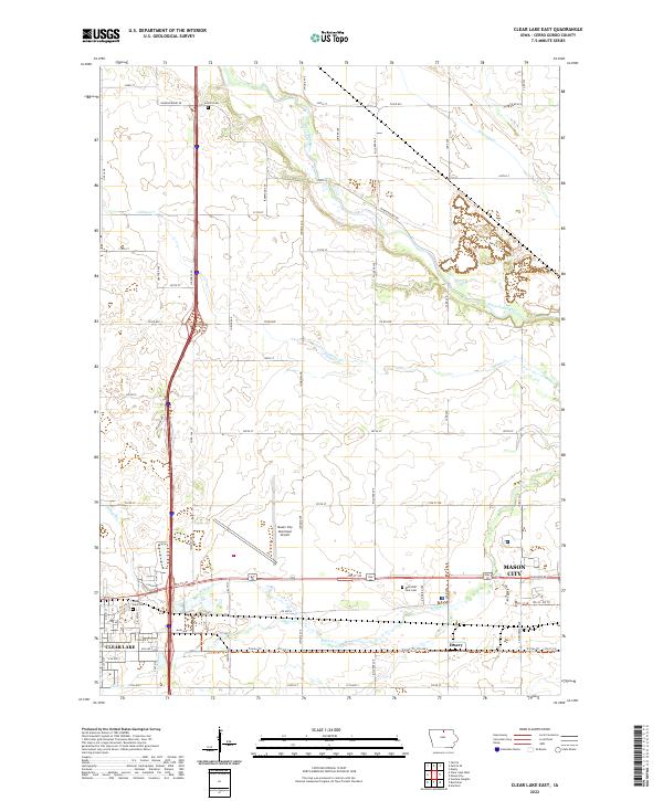 2022 Clear Lake East2022 Print · USGSCerro Gordo County emerges at a point of modernization and transit growth in the 2020s. Genealogists and local historians can trace family plots in Lincoln Cem or follow the historic path of the Trolley Trl near the settlement of Emery.
 - 2022 Map of Grafton, 2022 Print
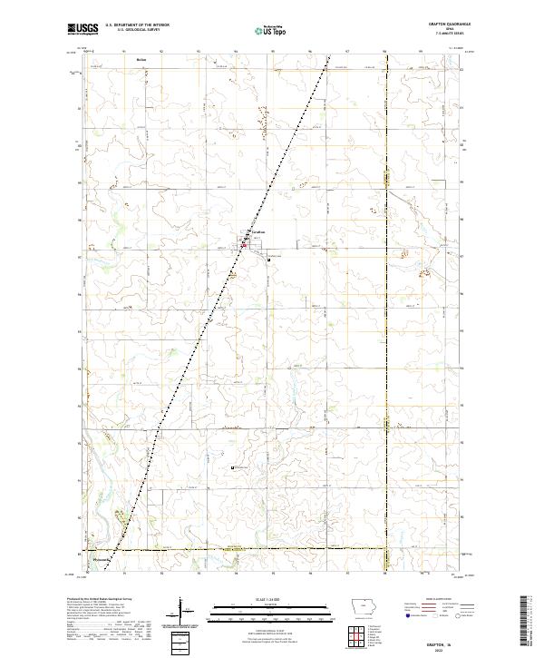 2022 Grafton2022 Print · USGSThe agricultural heart of Worth County is captured here in the early twenty-first century, centered on the settlement of Grafton. Genealogists and local historians can trace rural property context near Grafton Cem and the banks of the Shell Rock River.
 - 2022 Map of Manly, 2022 Print
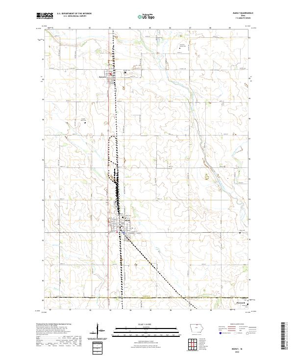 2022 Manly2022 Print · USGSWorth and Cerro Gordo counties are captured here in the early twenty-first century, showing the enduring agricultural and riverine landscape of northern Iowa. Researchers can trace family history at the Overholt Family Plot, Sacred Heart Cem, or along the banks of the Shell Rock River.
 - 2022 Map of Clear Lake West, 2022 Print
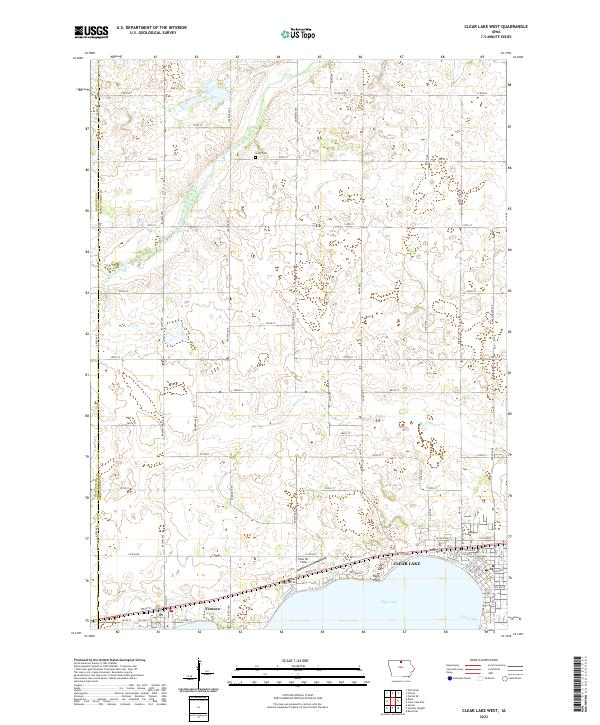 2022 Clear Lake West2022 Print · USGSCerro Gordo County at the start of the 2020s shows a landscape where lakeside leisure at Clear Lake meets steady prairie agriculture. Researchers can trace the layout of Ventura or find family history at Grant Cem and along Buddy Holly Pl.
 - 2022 Map of Nora Springs, 2022 Print
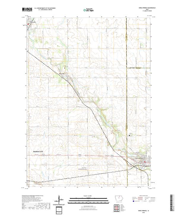 2022 Nora Springs2022 Print · USGSSettled along the winding Shell Rock River in the early 2020s, this region shows the enduring agricultural and river-town patterns of Iowa. Trace local roots and landmarks between Nora Springs, Rock Falls, and Plymouth, including the Spring Grove Cem and Spotts Field.
 - 2022 Map of Mason City, 2022 Print
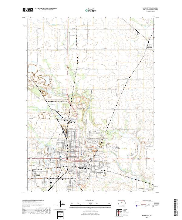 2022 Mason City2022 Print · USGSMason City and the Winnebago River valley are shown here in the twenty-first century, balancing a busy county seat with expansive natural preserves. Researchers can locate the Cerro Gordo County Courthouse and trace local family lines through the Elmwood - Saint Joseph Cemetery.
 - 2022 Map of Sheffield, 2022 Print
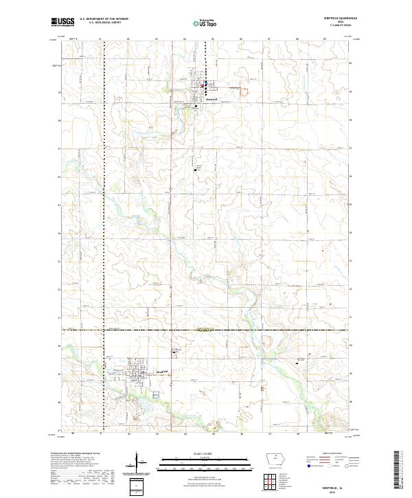 2022 Sheffield2022 Print · USGSSettled across the Cerro Gordo and Franklin county line, this area shows its agricultural and small-town roots in the early 2020s. Genealogists can locate family sites at Rockwell Cem or Saint John Zion Cem while tracing the West Fork Cedar River.
 - 2022 Map of Dougherty, 2022 Print
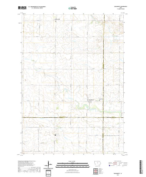 2022 Dougherty2022 Print · USGSThis northern Iowa landscape at the meeting of three counties highlights the enduring rural character of the region. Genealogists and local historians can locate Saint Patricks Catholic Cem and West Fork Cem while tracing the winding paths of Coldwater Creek.
 - 2022 Map of Fertile, 2022 Print
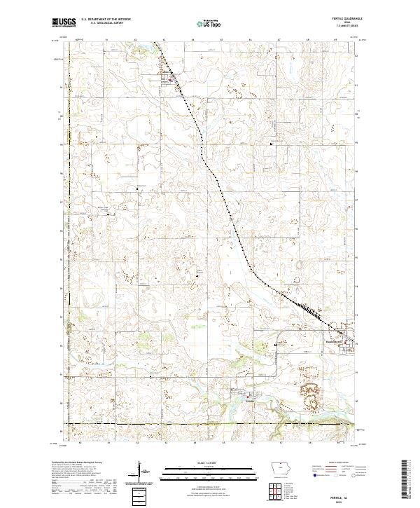 2022 Fertile2022 Print · USGSNorthern Iowa's agricultural heartland is documented here in the early twenty-first century, centered on the communities of Fertile and Hanlontown. Genealogists can locate family landmarks at Beaver Creek Lutheran Cem, Elim Cem, and Brush Point Cem along the Winnebago River.
 - 2022 Map of Mason City SE, 2022 Print
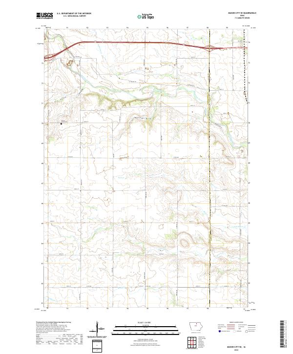 2022 Mason City SE2022 Print · USGSCerro Gordo County remains a landscape of sprawling farmsteads and wandering creeks in the early 2020s. Researchers can locate the Owens Grove Cem or trace the winding course of the Winnebago River and the distinctively named Badlands Draw.
 - 2022 Map of Fertile SE, 2022 Print
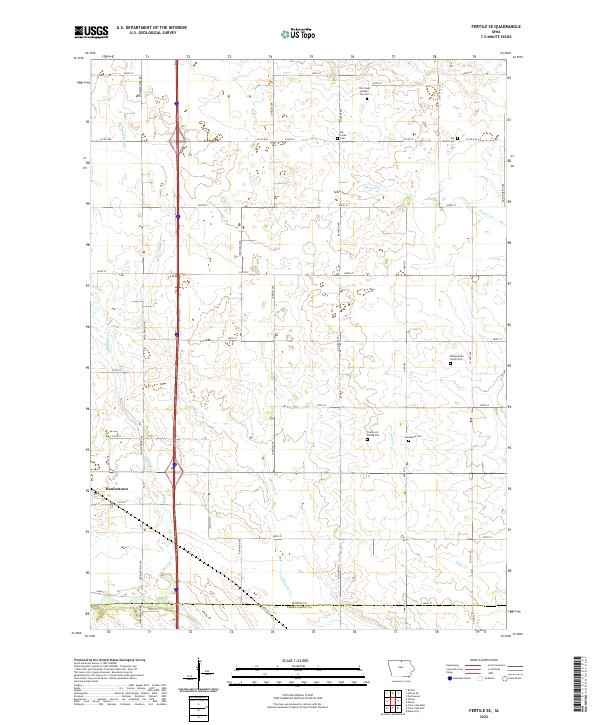 2022 Fertile SE2022 Print · USGSNorthern Iowa's farm country and the Winnebago River valley are captured here in the early 2020s. Genealogists can trace local history through several small burial sites, including the Benjegerdes Family Plot, Elk Grove Cem, and Grandview Cem.
 - 2022 Map of Ventura Heights, 2022 Print
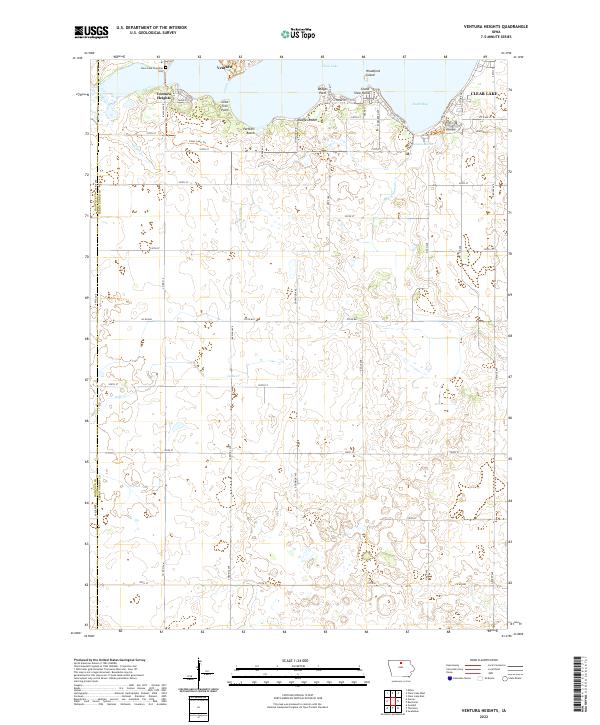 2022 Ventura Heights2022 Print · USGSClear Lake and its surrounding western communities are detailed here during the early twenty-first century. Researchers can trace lakeshore developments at Ventura Heights, find family names at Clear Lake Township Cem, or explore natural features like Woodford Island.
 - 2022 Map of Hanford, 2022 Print
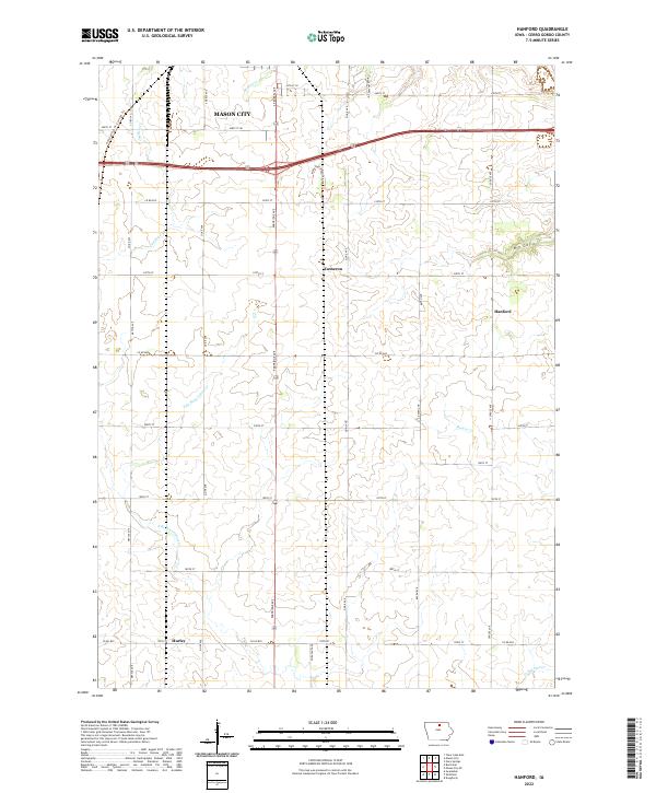 2022 Hanford2022 Print · USGSCerro Gordo County agricultural lands and the southern outskirts of the regional hub are shown here in the early twenty-first century. Researchers can trace the path of the Railroad R.O.W. Corridor Trl and locate the rural communities of Hanford, Hurley, and Cameron.
 - 2022 Map of Burchinal, 2022 Print
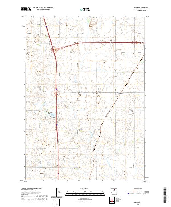 2022 Burchinal2022 Print · USGSCerro Gordo County's agricultural heartland is documented here in the early twenty-first century as the landscape balances modern transit with its rural roots. Genealogists and local historians can locate Mount Vernon Cem and trace the legacy of the rails along the Railroad R.O.W. Corridor Trl near Burchinal.
 - 2022 Map of Thornton, 2022 Print
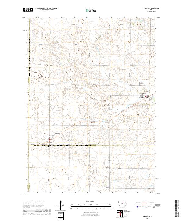 2022 Thornton2022 Print · USGSThe agricultural plains of Cerro Gordo County are captured here in the early twenty-first century. Researchers can trace the legacy of the rails along the Railroad R.O.W. Corridor Trl or locate family roots at Pleasant View Cem and Meservey Cem.
 - 2022 Map of Swaledale, 2022 Print
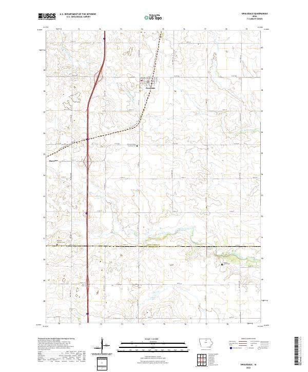 2022 Swaledale2022 Print · USGSThe agricultural plains of Cerro Gordo and Franklin Counties are captured here in the early twenty-first century. Genealogists and local historians can trace family plots at Richland Lutheran Cem and Shobes Grove Cem or follow the path of the Railroad R.O.W. Corridor Trl.
End of results
Showing maps 1-16 of 16
Top cities of Cerro Gordo County
- Mason City historical maps
- Clear Lake historical maps
- Rockwell historical maps
- Ventura historical maps
- Thornton historical maps
- Plymouth historical maps
See more
Frequently asked questions
- What are the different types of historical maps available for Cerro Gordo County?
- What is the oldest map of Cerro Gordo County?
- Where can I purchase historical maps of Cerro Gordo County for my home or office?
- Where can I download high-res historical maps of Cerro Gordo County?
- Are there historical topographic maps available for Cerro Gordo County?
- Is there historical aerial imagery available for Cerro Gordo County?
- Where are historical maps of Cerro Gordo County sourced from?