Old Maps of Clay County, Iowa for Hiking & Exploration
Hike through history with 129 historic maps of Clay County. Explore old trails, ghost towns, and forgotten backroads — perfect for outdoor adventurers and local explorers.
- Rediscover forgotten places: Map out old mining camps, roads, and footpaths that no longer exist on modern maps.
- Layer with modern tools: Combine with LiDAR or satellite views to plan hikes through historical terrain.
- Made for exploration: Popular among hikers, overlanders, and local history lovers.
Use these maps to find adventure and explore the hidden past of Clay County.
Clay County, IA maps
(129)- 1954 Map of Fairmont, 1967 Print
 1954 Fairmont1967 Print · USGSThe prairie landscape of southern Minnesota and northern Iowa comes alive in this mid-century survey of the Coteau des Prairies. Genealogists and historians can trace the rail-connected growth of Fairmont and Blue Earth or locate family roots near St Kilian Ch and Union Slough National Wildlife Refuge.3 unique versions available
 - 1954 Map of Fort Dodge, 1968 Print
 1954 Fort Dodge1968 Print · USGSNorthwest Iowa is shown here during a period of steady industrial and rail activity in the mid-fifties. Researchers can trace the extensive rail lines connecting Fort Dodge to mining and manufacturing sites like Gypsum and Industry Station.3 unique versions available
 - 1957 Map of Fort Dodge
 1957 Fort Dodge1957 Print · USGSWest-central Iowa thrived as a network of rail-linked agricultural hubs and river towns during the mid-fifties. Researchers can trace the development of the Des Moines River valley and locate historic landmarks in Fort Dodge, Storm Lake, and Lehigh.
 - 1958 Map of Fort Dodge
 1958 Fort Dodge1958 Print · USGSWestern Iowa in the mid-1950s reveals a productive landscape of river-valley industry and prairie agricultural hubs. Researchers can trace the development of the Des Moines River corridor through Fort Dodge and locate vanished local landmarks near Coalville or Storm Lake.
 - 1958 Map of Fairmont
 1958 Fairmont1958 Print · USGSThe borderlands of southern Minnesota and northern Iowa come alive in the mid-1950s, showing a landscape defined by glacial lakes and rail-line commerce. Researchers can trace historic landmarks like Lakeside Laboratory, Gridley Station, and the Bancroft Wildlife Refuge across the prairie.
 - 1966 Map of Spencer, 1967 Print
 1966 Spencer1967 Print · USGSSpencer and the surrounding Clay County prairies thrived as a rail and river hub in the mid-1960s. Genealogists and local historians can trace legacy sites like Riverside Cemetery, local schools such as North School, and landmarks including the County Fairground.2 unique versions available
 - 1966 Map of Gillett Grove, 1967 Print
 1966 Gillett Grove1967 Print · USGSClay County's rural landscape is captured here in the mid-1960s as the river-and-rail economy centered on Gillett Grove remained in full swing. Researchers can trace the Chicago Milwaukee St Paul and Pacific railroad line or find the Rose Hill Cem.
 - 1966 Map of Greenville, 1967 Print
 1966 Greenville1967 Print · USGSClay County's rural landscape is captured here in the mid-sixties, dominated by the diagonal path of the Chicago Rock Island and Pacific railroad. Genealogists can locate family sites at Lincoln Cem and Lutheran Cem or trace the early plats of Rossie and Greenville.
 - 1966 Map of Dickens, 1967 Print
 1966 Dickens1967 Print · USGSClay County's rural townships and rail corridors are preserved here as they appeared in the mid-1960s. Genealogists and local historians can trace the foundations of Dickens and Langdon or locate landmarks like Fairview Cem and Kingdom Hall.
 - 1970 Map of Milford, 1972 Print
 1970 Milford1972 Print · USGSThe Iowa Great Lakes region shows its mid-century recreational and agricultural character as the 1970s began. Genealogists and local historians can trace the Milwaukee Road rail line and locate community landmarks like Old Town and St Josephs Cem.2 unique versions available
 - 1970 Map of Hartley SW, 1972 Print
 1970 Hartley SW1972 Print · USGSNorthwestern Iowa farm country is documented here during the early seventies, showing the section-line roads and stream networks of O’Brien and Clay counties. Researchers can trace land ownership patterns across Grant and Omega or follow the winding courses of Waterman Creek and McCreath Creek.
 - 1970 Map of Everly, 1972 Print
 1970 Everly1972 Print · USGSEverly and the surrounding Clay County townships are captured in the early seventies during a period of steady agricultural and utility growth. Genealogists and local historians can locate Lone Tree Cem, the First Reformed Ch, and the winding tracks of the Chicago Milwaukee St Paul and Pacific.
 - 1970 Map of Hartley, 1972 Print
 1970 Hartley1972 Print · USGSNorthwest Iowa's farm country is documented here during the early seventies, centered on the bustling rail junction at Hartley. Genealogists and local historians can trace the town's development through its High School, Pleasant View Cemetery, and the small southern settlement of Moneta.
 - 1970 Map of Royal, 1972 Print
 1970 Royal1972 Print · USGSClay County's agricultural heartland is captured here in the early seventies, centered on the village of Royal. Local researchers can trace family landmarks and rural infrastructure across Lone Tree and Lincoln, including Maple Grove Ch and Tri Mello Cem.
 - 1970 Map of Spirit Lake SE, 1972 Print
 1970 Spirit Lake SE1972 Print · USGSNorthwestern Iowa’s lake country is captured here during the 1970s, showing the intersection of recreation and rural industry. Genealogists and local historians can trace the lakeside developments of Arnolds Park or follow the Chicago and North Western rail line toward Little Muddy Creek.
 - 1970 Map of Lake Park SE, 1972 Print
 1970 Lake Park SE1972 Print · USGSDickinson and Clay counties come together in this 1970s survey of the Iowa prairie as the modern agricultural grid matured. Local historians can locate landmarks like Westport Cem, Excelsior Ch, and the headwaters of the Little Sioux River.
 - 1970 Map of May City, 1972 Print
 1970 May City1972 Print · USGSOsceola County and its neighbors are shown here in the early seventies, a landscape of section-line roads and river valleys. Genealogists can locate Mennonite Cemetery and Harrison Cemetery near the crossroads of May City.
 - 1971 Map of Sioux Rapids, 1973 Print
 1971 Sioux Rapids1973 Print · USGSNorthwest Iowa's river valleys and rail corridors are captured here in the early seventies as the local landscape balanced industry and tradition. Researchers can pinpoint rural burial sites like Fanny Fern Cem, the community of Linn Grove, and the Old RR Grade.
 - 1971 Map of Rush Lake West, 1973 Print
 1971 Rush Lake West1973 Print · USGSNorthwest Iowa's agricultural heartland is documented here in the early 1970s, centered on the rail junction at Leverett. Researchers can trace the intersecting lines of the Milwaukee Road and the Rock Island near Silver Lake and Pickerel Lake.
 - 1971 Map of Peterson, 1973 Print
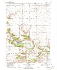 1971 Peterson1973 Print · USGSPeterson and the surrounding river bluffs are captured in detail in the early 1970s, as the town serves the local farming and rail economy. Genealogists and historians can trace the Chicago and North Western line, locate Oakland Cem, and explore the wooded grounds of Wanata State Park.
 - 1971 Map of Webb, 1973 Print
 1971 Webb1973 Print · USGSThe town of Webb and the surrounding prairies of northwest Iowa are captured here during the early 1970s. Local researchers can trace a dense network of railroads including the Milwaukee Road and locate the Burr Oak Cem along the Little Sioux River.
 - 1971 Map of Sutherland East, 1973 Print
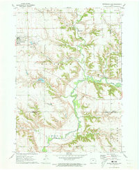 1971 Sutherland East1973 Print · USGSSutherland and the Little Sioux River valley are captured here in the early 1970s, showing a landscape defined by prairie agriculture and river bluffs. Researchers can locate Waterman Cem, the Chicago and North Western line, and Indian Village State Park.
 - 1972 Map of Terril, 1974 Print
 1972 Terril1974 Print · USGSThe township borders of Dickinson and Emmet counties meet here in the early 1970s, centered on the rail-aligned town of Terril. Genealogists and local historians can trace the Chicago and North Western line, locate Fairview Cem, and explore the wetlands of Twelvemile Lake.
 - 1972 Map of Silver Lake, 1974 Print
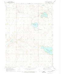 1972 Silver Lake1974 Print · USGSClay and Palo Alto counties are captured here in the early 1970s, showing a landscape of glacial lakes and prairie conservation areas. Genealogists and researchers can locate the Township Cem and trace the route of the Chicago and North Western railroad past Virgin Lake.
 - 1972 Map of Ruthven, 1974 Print
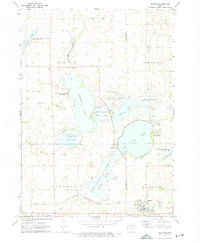 1972 Ruthven1974 Print · USGSThe Palo Alto County wetlands and the prairie town of Ruthven are captured here in the early seventies during a period of significant state land management. Researchers can locate Crown Hill Cem, trace the Chicago Milwaukee St Paul and Pacific rail line, and explore the shorelines of Trumbull Lake.
Showing maps 1-25 of 129
Top cities of Clay County
- Spencer historical maps
- Everly historical maps
- Royal historical maps
- Peterson historical maps
- Fostoria historical maps
- Dickens historical maps
See more
Frequently asked questions
- What are the different types of historical maps available for Clay County?
- What is the oldest map of Clay County?
- Where can I purchase historical maps of Clay County for my home or office?
- Where can I download high-res historical maps of Clay County?
- Are there historical topographic maps available for Clay County?
- Is there historical aerial imagery available for Clay County?
- Where are historical maps of Clay County sourced from?