Old Maps of Lee County, Iowa for Academic Research
Study the evolution of Lee County with 127 high-resolution historic maps. Whether you're teaching, researching, or modeling changes in land use, these maps provide essential visual documentation of urban, environmental, and geographic change.
- Analyze long-term change: Track patterns in development, transportation, and natural features.
- Ideal for environmental or urban studies: Support academic projects with primary historical map data.
- Use in the classroom or lab: Educators and researchers rely on these maps to bring historical context to life.
These maps are a powerful tool for teaching, research, and visualizing how Lee County has changed over the decades.
Lee County, IA maps
(127)- 1903 Map of Kahoka
 1903 Kahoka1903 Print · USGSNortheast Missouri at the turn of the century shows a landscape defined by the convergence of major rivers and competing rail lines. Genealogists can trace family roots in early centers like Kahoka and Monticello, or locate riverfront crossings at St. Francisville and Canton.3 unique versions available
 - 1932 Map of Lomax, 1957 Print
 1932 Lomax1957 Print · USGSWestern Illinois river towns and railroad junctions thrive during the early 1930s as the river remains a central artery for commerce and life. Genealogists can trace family footprints across dozens of rural landmarks, including Dallas City, Gittings Mound, and the uniquely named Froggie Sch.
 - 1934 Map of Burlington
 1934 Burlington1934 Print · USGSThe river bottomlands of Illinois and Iowa come alive in the mid-1930s, showing a landscape defined by the shifting currents and rail lines. Genealogists and historians can trace small rural communities and local education centers like Orchard City, Carthage Junc, and Crystal Lake Sch.2 unique versions available
 - 1936 Map of Keokuk
 1936 Keokuk1936 Print · USGSHancock County and the Mississippi River transition into a new era of hydroelectric power and rail transit in the 1930s. Genealogists can locate dozens of country schools and churches, from Froggy Sch and Sylvanvale Sch to Sanobia Ch.3 unique versions available
 - 1936 Map of Fort Madison
 1936 Fort Madison1936 Print · USGSThe Illinois shore of the Mississippi River is captured here in the mid-1930s, featuring the historic street grid of Nauvoo. Genealogists and local historians can trace a dense network of rural landmarks, including Jackson Cem and numerous country schoolhouses like Maple Grove Sch and Elliott Sch.3 unique versions available
 - 1937 Map of Lomax
 1937 Lomax1937 Print · USGSThe riverfront and rail corridors of Henderson and Hancock Counties come alive in the late 1930s, documenting a time of active country schools and river commerce. Genealogists can locate family landmarks like Gittings Cem, Enterprise Ch, and distinctively named sites like Shake Rag Sch.2 unique versions available
 - 1940 Map of Burlington
 1940 Burlington1940 Print · USGSThe Mississippi River floodplain comes alive in the mid-1930s, showing the intricate network of sloughs and rail lines between Illinois and Iowa. Genealogists and historians can locate rural landmarks like Merry Dell Sch, trace the Chicago Burlington and Quincy tracks, or explore the riverfront at Gulfport.3 unique versions available
 - 1949 Map of Wayland, 1954 Print
 1949 Wayland1954 Print · USGSThe Des Moines River border between Missouri and Iowa comes alive in the late 1940s, showing the early rail and road networks of Clark and Lee Counties. Researchers can find St Francisville, trace the Chicago Burlington and Quincy tracks, or locate Oak Hill Cem.3 unique versions available
 - 1950 Map of Wayland
 1950 Wayland1950 Print · USGSThe river border between Missouri and Iowa comes alive in the late 1940s, showing a landscape of rail-connected farming towns and river crossings. Genealogists can trace family footprints at St Francisville, Wayland, and rural landmarks like Oak Hill Cem or Independent Sch.
 - 1950 Map of Keokuk, 1954 Print
 1950 Keokuk1954 Print · USGSThe Mississippi River borderlands of Iowa and Illinois come alive in the mid-century as the Keokuk Dam reshapes the valley. Genealogists can trace a remarkable concentration of local landmarks, from Moss Cem to numerous rural schoolhouses like Rocky Run Sch and Eureka Sch.
 - 1958 Map of Burlington, 1968 Print
 1958 Burlington1968 Print · USGSThe tri-state river country of Iowa, Illinois, and Missouri is captured here in the mid-fifties, dominated by the Mississippi River and major rail lines. Genealogists and historians can trace the development of river towns like Keokuk or locate the sprawling Iowa Army Ammunition Plant.4 unique versions available
 - 1961 Map of Burlington
 1961 Burlington1961 Print · USGSThe tri-state borderlands along the Mississippi River are captured here during the late fifties and early sixties, showing the vital river-and-rail economy of Iowa, Illinois, and Missouri. Genealogists and historians can trace the development of major hubs like Galesburg and Macomb alongside landmark sites such as the Iowa Ordnance Plant and the historic river town of Nauvoo.
 - 1963 Map of Burlington
 1963 Burlington1963 Print · USGSThe tri-state river country of the Mississippi and Illinois valleys comes alive in this mid-century survey. Genealogists and historians can trace the industrial and academic growth of the region, from the Iowa Ordnance Plant to campuses like Knox College and Western Illinois University.
 - 1964 Map of Nauvoo, 1965 Print
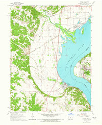 1964 Nauvoo1965 Print · USGSThe Mississippi River valley comes alive in the mid-sixties, showing the rail-linked communities of Nauvoo, Illinois, and Montrose, Iowa. Researchers can trace the Indian Treaty Boundary and locate local landmarks like Dundey Cemetery and Inspiration Point.2 unique versions available
 - 1964 Map of Hamilton, 1965 Print
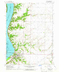 1964 Hamilton1965 Print · USGSHancock County sits at a mid-century crossroads where the river and rail economies meet. Researchers can trace the industrial footprint of the Keokuk Dam or find family landmarks like Oakwood Cem and the Golden Point Ch.2 unique versions available
 - 1964 Map of Lomax, 1965 Print
 1964 Lomax1965 Print · USGSThe Mississippi River floodplain and rail junctions of Henderson County are captured here in the mid-1960s. Genealogists can trace family sites at Gittings Cem and Freeland Cem or follow the heavy rail traffic through Lomax and Iowa Junction.
 - 1964 Map of West Point, 1965 Print
 1964 West Point1965 Print · USGSWest Point and the surrounding Lee County countryside are captured here in the mid-1960s, showing a well-established rail and agricultural community. Genealogists can locate several historic burial sites like St Peters Cem and Graner Cem while tracing the path of the Chicago Burlington and Quincy railroad.2 unique versions available
 - 1964 Map of West Burlington, 1965 Print
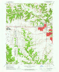 1964 West Burlington1965 Print · USGSDes Moines County reveals its mid-century industrial and suburban character as the Cold War era reshaped the landscape. Trace the massive Iowa Army Ammunition Plant, the tracks of the Chicago Burlington and Quincy, and landmarks like Burk Chapel.2 unique versions available
 - 1964 Map of Dallas City, 1965 Print
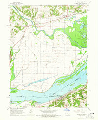 1964 Dallas City1965 Print · USGSThe Mississippi River floodplain in the 1960s reveals a landscape of industrial rail lines and intricate backwaters. Trace the historic tracks of the Atchison Topeka and Santa Fe or locate rural landmarks like Oak Grove Ch and Eureka Sch.4 unique versions available
 - 1964 Map of Niota, 1965 Print
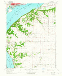 1964 Niota1965 Print · USGSThe Mississippi River corridor in the mid-1960s shows a landscape defined by major rail lines and historical riverfront towns. Genealogists can locate family names at Pioneer Saints Cem, Appanoose Cem, or the rural crossroads of Powellton.2 unique versions available
 - 1964 Map of Fort Madison, 1965 Print
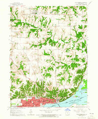 1964 Fort Madison1965 Print · USGSFort Madison and the Mississippi River waterfront are captured in the mid-1960s before modern expansion. Genealogists can trace family locations through numerous landmarks, including Claypoole Cem, the State Penitentiary, and several local parochial schools.2 unique versions available
 - 1964 Map of Keokuk, 1965 Print
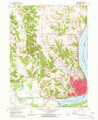 1964 Keokuk1965 Print · USGSKeokuk and its river-junction landscape are captured in the mid-sixties, showing a city built on rail and water commerce. Genealogists can trace family names through several historic sites, including the National Cemetery, Summitville, and The Yellow Banks Cem.3 unique versions available
 - 1968 Map of Argyle, 1970 Print
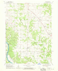 1968 Argyle1970 Print · USGSThe Des Moines River valley and its surrounding timberlands are shown here in the late sixties as the railway era persists. Family researchers can locate rural landmarks like St Marys Church, Charleston Cem, and the old New Boston settlement.2 unique versions available
 - 1968 Map of Donnellson, 1970 Print
 1968 Donnellson1970 Print · USGSSoutheast Iowa's prairie landscape is showcased here in the late sixties, centered on the rail-connected hub of Donnellson. Local historians can trace a high density of rural burial grounds and church sites like Mennonite Cem, Clay-Grove Ch, and Franklin Station.2 unique versions available
 - 1968 Map of Croton, 1970 Print
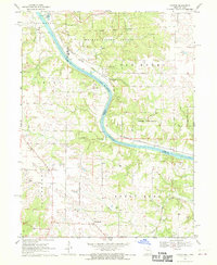 1968 Croton1970 Print · USGSThe borderlands of Missouri and Iowa are captured here in the late sixties as the Des Moines River winds through timber and farmland. Genealogists and historians can trace the Old Indian Treaty Boundary and locate family burial sites like Shaffer Cem and Walker Cem.2 unique versions available
Showing maps 1-25 of 127
Top cities of Lee County
- Fort Madison historical maps
- Keokuk historical maps
- West Point historical maps
- Donnellson historical maps
- Montrose historical maps
- Denmark historical maps
See more
Frequently asked questions
- What are the different types of historical maps available for Lee County?
- What is the oldest map of Lee County?
- Where can I purchase historical maps of Lee County for my home or office?
- Where can I download high-res historical maps of Lee County?
- Are there historical topographic maps available for Lee County?
- Is there historical aerial imagery available for Lee County?
- Where are historical maps of Lee County sourced from?