1900s (20th Century) Maps of Plover, Iowa
Explore 8 historic maps of Plover from the 1900s (20th Century). These maps offer a rare glimpse into what life looked like during the 1900s — showing old roads, neighborhoods, homes, and landmarks that have changed or disappeared over time.
Whether you're researching your family's past, planning a metal detecting trip, or studying how Plover's landscape evolved across the 1900s, these high-resolution maps are a powerful tool for exploring the history of this region.
- Focus on a specific era: All maps on this page are from the 1900s, giving you a focused view of this time period.
- See what’s changed: Compare century-old streets, trails, and buildings to today's modern landscape using overlays and satellite layers.
- Research with precision: Use these maps for genealogy, historical research, land use analysis, or educational projects.
- View, download, or print: Maps are fully viewable online in high resolution, and can be downloaded or printed for your own records.
Start exploring Plover's history through authentic maps from the 1900s. This is your window into the past.
Plover, IA maps
(8)- 1954 Map of Fort Dodge, 1968 Print
 1954 Fort Dodge1968 Print · USGSNorthwest Iowa is shown here during a period of steady industrial and rail activity in the mid-fifties. Researchers can trace the extensive rail lines connecting Fort Dodge to mining and manufacturing sites like Gypsum and Industry Station.3 unique versions available
 - 1957 Map of Fort Dodge
 1957 Fort Dodge1957 Print · USGSWest-central Iowa thrived as a network of rail-linked agricultural hubs and river towns during the mid-fifties. Researchers can trace the development of the Des Moines River valley and locate historic landmarks in Fort Dodge, Storm Lake, and Lehigh.
 - 1958 Map of Fort Dodge
 1958 Fort Dodge1958 Print · USGSWestern Iowa in the mid-1950s reveals a productive landscape of river-valley industry and prairie agricultural hubs. Researchers can trace the development of the Des Moines River corridor through Fort Dodge and locate vanished local landmarks near Coalville or Storm Lake.
 - 1980 Map of Rolfe
 1980 Rolfe1980 Print · USGSIowa's prairie townships and the rail-oriented town of Rolfe are captured here in the 1980s. Genealogists can locate family sites at Powhatan Cem and Clinton-Garfield Cem, while tracing the CHICAGO AND NORTH WESTERN line.
 - 1980 Map of Havelock
 1980 Havelock1980 Print · USGSPocahontas County at the start of the 1980s reveals a precision-mapped landscape of rail junctions and prairie drainage. Genealogists and rail historians can trace the paths of the Chicago and North Western and the town's local Cemetery and Park.
 - 1980 Map of Mallard
 1980 Mallard1980 Print · USGSNorthwest Iowa's farm country is shown here during the late twentieth century, centered on the railroad hub of Mallard. Genealogists and historians can trace the local landscape through landmarks like St Marys Cem and the Chicago and North Western rail line.
 - 1980 Map of Plover
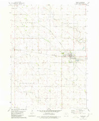
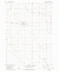
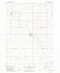
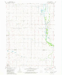 1980 Plover1980 Print · USGSThe rural agricultural landscapes of Pocahontas and Palo Alto Counties are captured here in the late twentieth century. Genealogists and local historians can trace property lines and find quiet landmarks like Lincoln Cem, Ellington Cem, and the C & N W rail line.
 - 1984 Map of Humboldt, 1985 Print
 1984 Humboldt1985 Print · USGSNorth Central Iowa in the mid-eighties shows a deeply integrated landscape of agricultural drainage and rail-connected settlements. Trace the rural layout of the era via the Chicago and North Western line, Rush Lake, and Lizard Lake County Park.2 unique versions available
End of results
Showing maps 1-8 of 8
Top cities near Plover
- Emmetsburg historical maps
- Pocahontas historical maps
- Laurens historical maps
- West Bend historical maps
- Rolfe historical maps
- Whittemore historical maps
See more
Frequently asked questions
- What are the different types of historical maps available for Plover?
- What is the oldest map of Plover?
- Where can I purchase historical maps of Plover for my home or office?
- Where can I download high-res historical maps of Plover?
- Are there historical topographic maps available for Plover?
- Is there historical aerial imagery available for Plover?
- Where are historical maps of Plover sourced from?