1970s Maps of Pottawattamie County, Iowa
Explore 13 historic maps of Pottawattamie County from the 1970s. These maps offer a rare glimpse into what life looked like during the 1970s — showing old roads, neighborhoods, homes, and landmarks that have changed or disappeared over time.
Whether you're researching your family's past, planning a metal detecting trip, or studying how Pottawattamie County's landscape evolved across the 1970s, these high-resolution maps are a powerful tool for exploring the history of this region.
- Focus on a specific era: All maps on this page are from the 1970s, giving you a focused view of this time period.
- See what’s changed: Compare century-old streets, trails, and buildings to today's modern landscape using overlays and satellite layers.
- Research with precision: Use these maps for genealogy, historical research, land use analysis, or educational projects.
- View, download, or print: Maps are fully viewable online in high resolution, and can be downloaded or printed for your own records.
Start exploring Pottawattamie County's history through authentic maps from the 1970s. This is your window into the past.
Pottawattamie County, IA maps
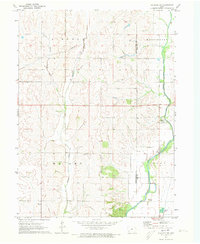
(13)- 1970 Map of Missouri Valley, 1972 Print
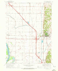 1970 Missouri Valley1972 Print · USGSMissouri Valley and the surrounding Harrison County bottomlands are captured here during a period of significant infrastructure development in the 1970s. Researchers can trace the local landscape from the winding Willow Creek to the hilltop Mt Carmel Cem.
 - 1970 Map of Modale, 1972 Print
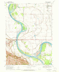 1970 Modale1972 Print · USGSThe Missouri River floodplain on the Iowa-Nebraska border comes alive in this early 1970s survey. Researchers can trace river changes at De Soto Lake and locate local landmarks like the Fort Calhoun Powerplant and Blair Cem.2 unique versions available
 - 1970 Map of Beebeetown, 1972 Print
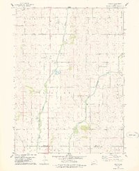
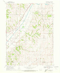 1970 Beebeetown1972 Print · USGSHarrison County at the start of the 1970s shows a landscape of river-valley rail lines and upland farm settlements. Trace the paths of the Illinois Central railroad and locate rural landmarks like Beebeetown and Oak Grove Cem.
 - 1971 Map of Walnut, 1973 Print
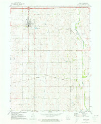 1971 Walnut1973 Print · USGSWalnut and its surrounding townships are shown here during a period of transition in the early 1970s. Researchers can trace the local rail economy along the Chicago Rock Island and Pacific Railroad and locate burial sites like Township Cem.
 - 1971 Map of Atlantic SW, 1973 Print
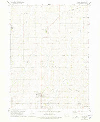
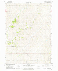
 1971 Atlantic SW1973 Print · USGSThe Pottawattamie and Cass County line in the early 1970s is defined by the winding East Nishnabotna River. Researchers can locate family sites at Whipple Cem and Smith Cem, or trace the grounds of Camp Wakonda.
 - 1978 Map of Hard Scratch
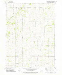 1978 Hard Scratch1978 Print · USGSHarrison County farmland meets the Pottawattamie border in the late seventies, showing a landscape defined by creek drainages and rural townships. Trace family history at Bethel Cem or Harris Grove Ch and locate the curious settlement of Hard Scratch.
 - 1978 Map of Carson
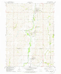 1978 Carson1978 Print · USGSThe West Nishnabotna River valley near the Pottawattamie and Mills county line is captured here in the late seventies. Researchers can trace the legacy of regional transport through the Burlington Northern line and the Old Railroad Grade, or find family roots at Carson Cem and Farm Creek Cem.
 - 1978 Map of Griswold
 1978 Griswold1978 Print · USGSGriswold and Elliott sit along the East Nishnabotna River valley in the late seventies, showing the rail-connected agricultural landscape of southwestern Iowa. Researchers can locate numerous pioneer and local burial grounds including Flint Cem, Waveland Cem, and Hillside Cem near Coe.
 - 1978 Map of Corley
 1978 Corley1978 Print · USGSShelby County farmland and river valleys are captured here in the late seventies as the river systems defined the local economy. Genealogists and historians can locate Corley, trace the Old Railroad Grade, and find Altamont Church and its cemetery.
 - 1978 Map of Persia
 1978 Persia1978 Print · USGSHarrison County farmland in the late 1970s reveals a landscape of quiet rail towns and numerous family burial grounds. Genealogists can locate Persia and Yorkshire, while tracing ancestors at Lytle Cem, Chambers Cem, or Spears Cem.
 - 1978 Map of Prairie Rose Lake
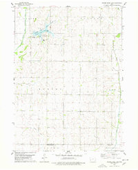 1978 Prairie Rose Lake1978 Print · USGSShelby County's rural landscape is captured here in the late seventies, centered on the newly established recreation area at Prairie Rose Lake. Genealogists and local historians can locate community landmarks like Monroe Ch, the settlement of Christensen, and the Townhall.
 - 1978 Map of Shelby
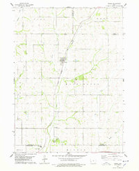
 1978 Shelby1978 Print · USGSWestern Iowa's agricultural heartland is captured here in the late seventies, centered on the community of Shelby. Genealogists and rail historians can trace the Old Railroad Grade and locate local landmarks like Olson Cem and the small settlement of Tennant.
 - 1978 Map of Carson NE
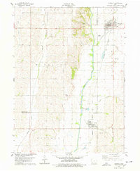
 1978 Carson NE1978 Print · USGSThe agricultural heartland of Southwest Iowa comes into focus during the late seventies, showing the rural townships of Grove and Waveland. Genealogists and local historians can trace family roots through sites like Mormon Cem, Wheeler Grove Ch, and Pleasant Grove Cem.
End of results
Showing maps 1-13 of 13
Top cities of Pottawattamie County
- Council Bluffs historical maps
- Carter Lake historical maps
- Avoca historical maps
- Oakland historical maps
- Treynor historical maps
- Underwood historical maps
See more
Frequently asked questions
- What are the different types of historical maps available for Pottawattamie County?
- What is the oldest map of Pottawattamie County?
- Where can I purchase historical maps of Pottawattamie County for my home or office?
- Where can I download high-res historical maps of Pottawattamie County?
- Are there historical topographic maps available for Pottawattamie County?
- Is there historical aerial imagery available for Pottawattamie County?
- Where are historical maps of Pottawattamie County sourced from?