1990s Maps of Pottawattamie County, Iowa
Explore 12 historic maps of Pottawattamie County from the 1990s. These maps offer a rare glimpse into what life looked like during the 1990s — showing old roads, neighborhoods, homes, and landmarks that have changed or disappeared over time.
Whether you're researching your family's past, planning a metal detecting trip, or studying how Pottawattamie County's landscape evolved across the 1990s, these high-resolution maps are a powerful tool for exploring the history of this region.
- Focus on a specific era: All maps on this page are from the 1990s, giving you a focused view of this time period.
- See what’s changed: Compare century-old streets, trails, and buildings to today's modern landscape using overlays and satellite layers.
- Research with precision: Use these maps for genealogy, historical research, land use analysis, or educational projects.
- View, download, or print: Maps are fully viewable online in high resolution, and can be downloaded or printed for your own records.
Start exploring Pottawattamie County's history through authentic maps from the 1990s. This is your window into the past.
Pottawattamie County, IA maps
(12)- 1994 Map of Mc Clelland
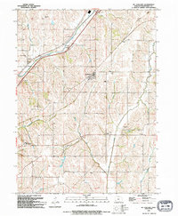 1994 Mc Clelland1994 Print · USGSPottawattamie County's rolling farmland is mapped here in the early nineties, showing a landscape shaped by creek drainage and rural hubs. Genealogy researchers can locate the Downsville Cemetery, St Columbus Church, and the Old Railroad Grade.
 - 1994 Map of Loveland
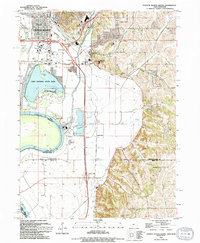
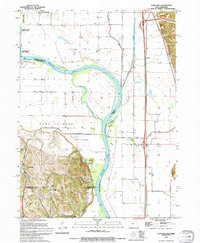 1994 Loveland1994 Print · USGSThe Missouri River floodplain north of Omaha reached a point of high stabilization in the early nineties, managed by a complex network of levees. Genealogists and local historians can trace small communities like Loveland and Nashville, or locate features like the Landing Strip and Boyer Chute.
 - 1994 Map of Avoca NW
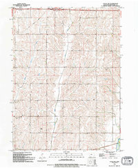 1994 Avoca NW1994 Print · USGSPottawattamie County's rolling farmland is captured in the early 1990s as modern transit routes intersect traditional rural life. Genealogists and historians can locate the Silver Valley Cem and Silver Creek Ch alongside the banks of Middle Silver Creek.
 - 1994 Map of Underwood
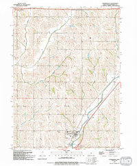 1994 Underwood1994 Print · USGSPottawattamie County in the mid-nineties shows a well-established agricultural landscape centered on the community of Underwood. Genealogists and local researchers can pinpoint Castor Cem, Fisher Cem, and the local High Sch among the winding paths of Mosquito Creek.
 - 1994 Map of Council Bluffs South
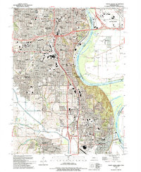
 1994 Council Bluffs South1994 Print · USGSSouthern Council Bluffs and the Missouri River bottoms are captured here in the mid-nineties during a period of industrial and recreational development. Researchers can trace rural lineages at Plumer Cem or follow the Wabash Trace Nature Trail past the Iowa School for the Deaf.
 - 1994 Map of Honey Creek
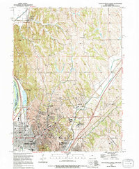
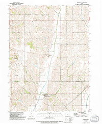
 1994 Honey Creek1994 Print · USGSIn the hills of Pottawattamie County during the mid-nineties, the landscape preserves a mix of traditional rural centers and modern recreational development. Researchers can trace family sites like St Bridgett Cem or visit the Townhall and local St Johns Ch.
 - 1994 Map of Avoca
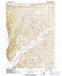
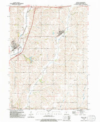
 1994 Avoca1994 Print · USGSPottawattamie County during the mid-nineties shows the river-valley communities of Avoca and Hancock at a point of modern maturity. Genealogists and local historians can trace local landmarks like Graceland Cem, the Avoha High Sch, and the Old Grade Railroad.
 - 1994 Map of Council Bluffs North
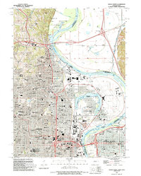
 1994 Council Bluffs North1994 Print · USGSCouncil Bluffs and the Missouri River bluffs appear in the 1990s during a period of steady growth and civic development. Genealogists and historians can trace local landmarks like St Marys Cem, the Lewis & Clark Hist Mon, and the Glendale Sch.
 - 1994 Map of Mineola
 1994 Mineola1994 Print · USGSThe Loess Hills of southwest Iowa are captured here in the mid-nineties as traditional rail lines began their transformation into recreation. Trace local family history at Zion Cem or explore the early trail system at Wabash Nature Trail and Mineola.
 - 1994 Map of Neola
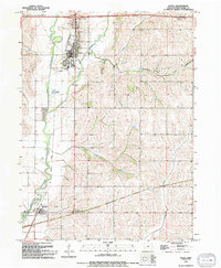
 1994 Neola1994 Print · USGSPottawattamie County during the mid-nineties shows a landscape defined by traditional farming communities and the growing reach of the interstate. You can trace the path of the Old Railroad Grade and find local landmarks like Arrowhead County Park and the settlement of Bentley.
 - 1994 Map of Omaha South, 1995 Print
 1994 Omaha South1995 Print · USGSOmaha and Bellevue thrive along the Missouri River in the mid-nineties, showing a landscape defined by military aviation and dense neighborhood history. Researchers can trace local roots through numerous sites like St Johns Cem, Rosenblatt Stadium, and the extensive grounds of Offutt Air Force Base.
 - 1994 Map of Omaha North, 1995 Print
 1994 Omaha North1995 Print · USGSThe northern reaches of Omaha and the Missouri River floodplains are captured here in the mid-1990s. Researchers can locate landmark institutions like Creighton University and St Cecilia Cathedral, or trace family roots in the large Forest Lawn Cemetery.
End of results
Showing maps 1-12 of 12
Top cities of Pottawattamie County
- Council Bluffs historical maps
- Carter Lake historical maps
- Avoca historical maps
- Oakland historical maps
- Treynor historical maps
- Underwood historical maps
See more
Frequently asked questions
- What are the different types of historical maps available for Pottawattamie County?
- What is the oldest map of Pottawattamie County?
- Where can I purchase historical maps of Pottawattamie County for my home or office?
- Where can I download high-res historical maps of Pottawattamie County?
- Are there historical topographic maps available for Pottawattamie County?
- Is there historical aerial imagery available for Pottawattamie County?
- Where are historical maps of Pottawattamie County sourced from?