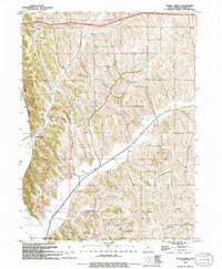
1994 Map of Honey Creek
USGS Topo · Published 1994About this map
Honey Creek and the surrounding Loess Hills of Pottawattamie County are defined by a landscape of sharp ridges and deeply carved stream valleys. The settlement pattern is anchored by rural institutions, including St Johns Ch and Grange Ch, alongside a network of family-named cemeteries such as Branson Cem and St Bridgett Cem. The drainage of the Missouri River floodplain is managed by an extensive Levee system protecting the lowlands near the Crescent corporate boundary. Modern recreational use is visible in the presence of an Overlook and a Ski Lift located among the steep bluffs. Waterways like Pigeon Creek and Simon Run cut through the terrain, illustrating the hydrological challenges of this unique geological region in the late twentieth century.
Find a feature on this map
20 named features on this map. Tap any name to fly to it.
Don’t see what you’re looking for? This feature index may not catch every label — zoom into the map to look around manually.
Map Details
Editions of this 1994 Honey Creek Map
This is the sole edition of this map. No revisions or reprints were ever made.
Other maps of this area

1893 · Omaha
USGS Topo · 1:62,500

1954 · Omaha
USGS Topo · 1:250,000

1956 · Underwood
USGS Topo · 1:24,000

1956 · Council Bluffs North
USGS Topo · 1:24,000

1956 · Omaha North
USGS Topo · 1:24,000

1956 · Mc Clelland
USGS Topo · 1:24,000

1957 · Omaha
USGS Topo · 1:250,000

1957 · Loveland
USGS Topo · 1:24,000

1957 · Honey Creek
USGS Topo · 1:24,000

1958 · Omaha
USGS Topo · 1:250,000