Old Maps of Woodbury County, Iowa for Metal Detecting
Plan your next treasure hunt with 180 historic maps of Woodbury County. Find old homesites, ghost towns, trails, and gathering spots that may be lost to time — perfect for identifying promising metal detecting locations.
- Locate forgotten sites: Uncover places like long-lost settlements, abandoned rail lines, or gathering spots.
- Plan better hunts: Use map overlays combined with LiDAR or satellite views to narrow in on historically rich areas.
- Made for detectorists: Thousands of hobbyists use these maps to discover relics, coins, and hidden history.
Use these historic maps to boost your research and find new opportunities beneath the surface of Woodbury County.
Woodbury County, IA maps
(180)- 1954 Map of Fort Dodge, 1968 Print
 1954 Fort Dodge1968 Print · USGSNorthwest Iowa is shown here during a period of steady industrial and rail activity in the mid-fifties. Researchers can trace the extensive rail lines connecting Fort Dodge to mining and manufacturing sites like Gypsum and Industry Station.3 unique versions available
 - 1955 Map of Sioux City, 1959 Print
 1955 Sioux City1959 Print · USGSThe Missouri River valley in the mid-fifties is captured here during a time of major engineering and social transition. Genealogists and historians can trace the foundations of Gavins Point Dam, tribal boundaries on the Santee Sioux Indian Reservation, and local landmarks like the Norfolk State Hospital.4 unique versions available
 - 1957 Map of Fort Dodge
 1957 Fort Dodge1957 Print · USGSWest-central Iowa thrived as a network of rail-linked agricultural hubs and river towns during the mid-fifties. Researchers can trace the development of the Des Moines River valley and locate historic landmarks in Fort Dodge, Storm Lake, and Lehigh.
 - 1958 Map of Sioux City
 1958 Sioux City1958 Print · USGSThe Missouri River valley in the late fifties was a bustling intersection of tribal lands, rail corridors, and river towns. Genealogists can trace family roots through specific rural sites like Daisy Valley School, St Johns Church and School, and Yankton State Hospital.
 - 1958 Map of Fort Dodge
 1958 Fort Dodge1958 Print · USGSWestern Iowa in the mid-1950s reveals a productive landscape of river-valley industry and prairie agricultural hubs. Researchers can trace the development of the Des Moines River corridor through Fort Dodge and locate vanished local landmarks near Coalville or Storm Lake.
 - 1959 Map of Sioux City
 1959 Sioux City1959 Print · USGSThe tri-state region surrounding the Missouri River is captured here in the late fifties, showing the convergence of Nebraska, South Dakota, and Iowa. Researchers can trace rural lineages through numerous country schoolhouses like Cemetery School and the many numbered Washington School districts.
 - 1962 Map of Union Center, 1964 Print
 1962 Union Center1964 Print · USGSThe agricultural heartland of Plymouth and Woodbury Counties is documented here in the early sixties, showing a landscape defined by rail lines and section roads. Researchers can locate family landmarks like St Josephs Cem, the small settlement of Neptune, and the path of the Illinois Central Railroad through Merrill.
 - 1963 Map of Sioux City South, 1964 Print
 1963 Sioux City South1964 Print · USGSThe tri-state river junction between Nebraska, Iowa, and South Dakota hums with mid-century activity along the Missouri and Big Sioux Rivers. Genealogists can trace old family roots at Salem Ch, St Michaels Cem, or the rural Hileman Sch.4 unique versions available
 - 1963 Map of Sioux City North, 1964 Print
 1963 Sioux City North1964 Print · USGSThe northern reaches of Sioux City and Riverside are captured in the early sixties as urban development meets the rugged Loess Hills. Researchers can find precise locations for Briar Cliff College, Logan Park Cemetery, and the old Soos Speedway.3 unique versions available
 - 1964 Map of Sergeant Bluff, 1965 Print
 1964 Sergeant Bluff1965 Print · USGSSioux City and Sergeant Bluff are captured during a decade of significant suburban and institutional growth in the mid-1960s. Researchers can trace the development of Morningside College, find family plots in Graceland Park Cemetery, or locate old landmarks like Redeemer Chapel.3 unique versions available
 - 1964 Map of James, 1965 Print
 1964 James1965 Print · USGSThe Floyd River valley north of Sioux City shows a landscape of rail-driven transit and suburban growth in the early sixties. Genealogists and local historians can trace the rural roots of Hungerford through Hungerford Cem and the Grant Sch.3 unique versions available
 - 1964 Map of Lawton, 1966 Print
 1964 Lawton1966 Print · USGSMid-century Woodbury County is captured here as the prairie landscape of Lawton and Bronson began to modernize. Researchers can trace ancestral locations near Eberly Cem or follow the path of the Old Railroad Grade across the hills.
 - 1964 Map of Climbing Hill, 1966 Print
 1964 Climbing Hill1966 Print · USGSWoodbury County in the mid-1960s is defined here by the winding channels of the Little Sioux River and the West Fork Little Sioux River. Researchers can locate rural landmarks like the German City Ch, Willow Cem, and the small settlement of Climbing Hill.
 - 1964 Map of Luton, 1966 Print
 1964 Luton1966 Print · USGSThe Woodbury County countryside in the mid-sixties is captured here as an intricate network of drainage ditches and diagonal rail lines. Genealogists and local historians can trace the early footprints of Luton and Owego along the Chicago Milwaukee St Paul and Pacific line.
 - 1964 Map of Moville, 1966 Print
 1964 Moville1966 Print · USGSMoville and the surrounding Woodbury County townships are documented here during the mid-1960s, showcasing a classic Iowa agricultural and rail landscape. Genealogists and local researchers can locate Arlington Cem, the Fairground, and the route of the Chicago and North Western railroad.
 - 1964 Map of Homer, 1966 Print
 1964 Homer1966 Print · USGSNear the Missouri River in the mid-1960s, this area of Dakota County reveals a landscape shaped by the Winnebago reservation and the rail lines. Genealogists and local historians can trace the community of Homer alongside St Cornelius Cem, Omaha Valley Cem, and the old Combs Sch.2 unique versions available
 - 1964 Map of Salix, 1966 Print
 1964 Salix1966 Print · USGSThe Missouri River bottomlands of Woodbury County are captured here in the mid-sixties as the Interstate era reached the region. Researchers can trace family history at St Josephs Cem or explore the river-driven geography of Browns Lake and the Winnebago Indian Reservation Boundary.2 unique versions available
 - 1969 Map of Danbury, 1971 Print
 1969 Danbury1971 Print · USGSDanbury and the surrounding river valleys are captured here in the late sixties as the rail-and-river economy shaped Woodbury County. Researchers can locate several burial grounds including St Marys Cem and Hartleben Cem, or trace the Chicago and North Western line.2 unique versions available
 - 1969 Map of Holstein SW, 1971 Print
 1969 Holstein SW1971 Print · USGSWoodbury and Ida Counties are captured here in the late sixties, showing a landscape shaped by the Maple River and the rural townships. Genealogists can locate St Pauls Ch and St Marys Cem, or trace the Chicago and North Western rail line.2 unique versions available
 - 1969 Map of Pierson, 1971 Print
 1969 Pierson1971 Print · USGSThe rural landscape of Woodbury and Plymouth counties is captured here in the late sixties, centered on the village of Pierson. Researchers can trace the path of the Illinois Central Railroad Grade or locate early community centers like Grand Meadow Sch and Meadow Star Ch.
 - 1969 Map of Mapleton, 1971 Print
 1969 Mapleton1971 Print · USGSMapleton was a bustling Monona County rail junction in the late sixties, where two major rail lines converged along the Maple River. Genealogists and local historians can locate family burial plots at Mt Hope Cem and Heisler Cem or trace the winding course of Pumpkin Run.2 unique versions available
 - 1969 Map of Correctionville NW, 1971 Print
 1969 Correctionville NW1971 Print · USGSWoodbury County in the late sixties reveals an organized landscape of townships and rural section roads. Genealogists and local historians can trace family locations near Fairfield Cem, Rock Branch Ch, and the banks of Wolf Creek.
 - 1969 Map of Correctionville, 1971 Print
 1969 Correctionville1971 Print · USGSThe Little Sioux River valley in the late sixties reveals a landscape of established rail towns and riverside parks. Local historians can trace the Illinois Central line through Anthon or locate family sites near Correctionville Cem and Hillside Ch.
 - 1969 Map of Albaton, 1971 Print
 1969 Albaton1971 Print · USGSThe Missouri River valley along the Iowa-Nebraska border comes to life in this late sixties survey of Monona County. Researchers can trace the intricate Winnebago Indian Reservation Boundary and locate local landmarks like Albaton, Fairview Cem, and Sand Hill Lake.
 - 1969 Map of Kingsley, 1971 Print
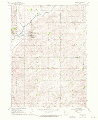 1969 Kingsley1971 Print · USGSKingsley and its surrounding townships are captured in the late sixties as the local landscape transitioned away from rail dominance. Genealogists and historians can locate Kingsley Cem, trace the Old Railroad Grade, or study the banks of the Little Sioux River.
Showing maps 1-25 of 180
Top cities of Woodbury County
- Sioux City historical maps
- Sergeant Bluff historical maps
- Moville historical maps
- Sloan historical maps
- Lawton historical maps
- Correctionville historical maps
See more
Frequently asked questions
- What are the different types of historical maps available for Woodbury County?
- What is the oldest map of Woodbury County?
- Where can I purchase historical maps of Woodbury County for my home or office?
- Where can I download high-res historical maps of Woodbury County?
- Are there historical topographic maps available for Woodbury County?
- Is there historical aerial imagery available for Woodbury County?
- Where are historical maps of Woodbury County sourced from?