2020s Maps of Ottawa, Kansas
Explore 4 historic maps of Ottawa from the 2020s. These maps offer a rare glimpse into what life looked like during the 2020s — showing old roads, neighborhoods, homes, and landmarks that have changed or disappeared over time.
Whether you're researching your family's past, planning a metal detecting trip, or studying how Ottawa's landscape evolved across the 2020s, these high-resolution maps are a powerful tool for exploring the history of this region.
- Focus on a specific era: All maps on this page are from the 2020s, giving you a focused view of this time period.
- See what’s changed: Compare century-old streets, trails, and buildings to today's modern landscape using overlays and satellite layers.
- Research with precision: Use these maps for genealogy, historical research, land use analysis, or educational projects.
- View, download, or print: Maps are fully viewable online in high resolution, and can be downloaded or printed for your own records.
Start exploring Ottawa's history through authentic maps from the 2020s. This is your window into the past.
Ottawa, KS maps
(4)- 2022 Map of Ottawa South, 2022 Print
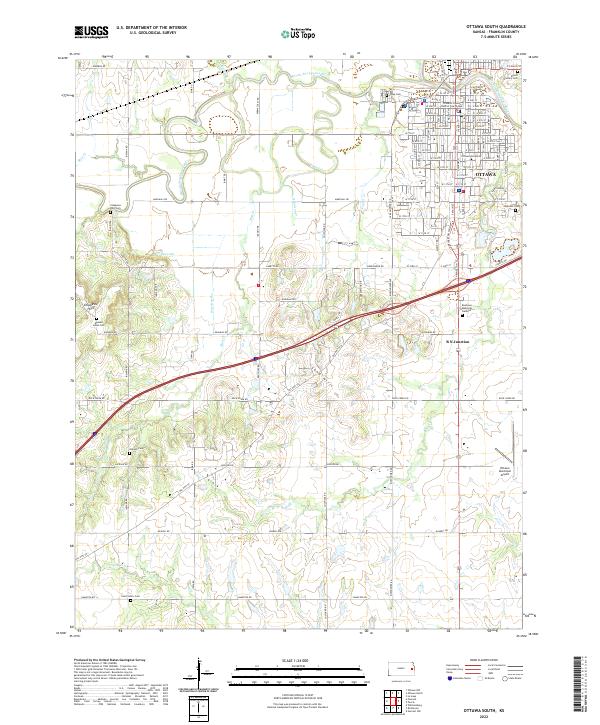 2022 Ottawa South2022 Print · USGSOttawa and southern Franklin County are captured here in the early twenty-first century as the riverfront town continues its role as a regional center. Genealogists can locate several historic burial sites, including Munsee Indian Cem, Antioch Cem, and Hope Cem.
 - 2022 Map of Peoria, 2022 Print
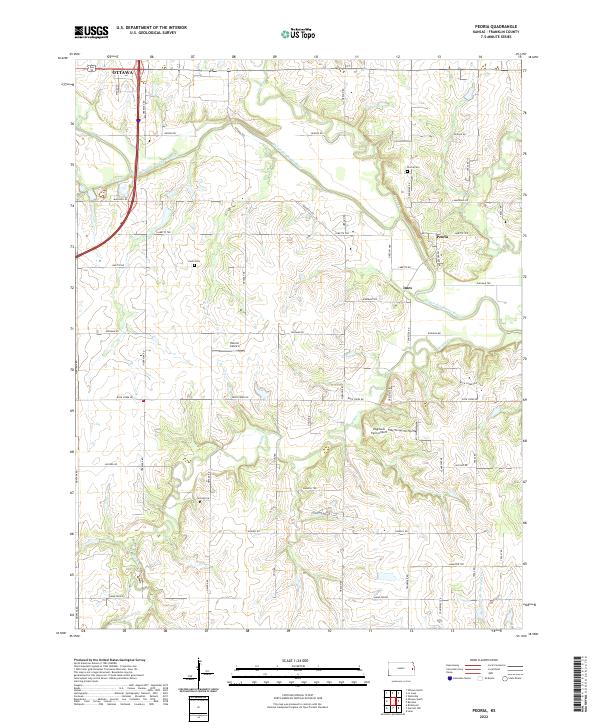 2022 Peoria2022 Print · USGSFranklin County in the early twenty-first century reveals a landscape defined by the Marais des Cygnes River and established rural townships. Genealogists can locate Peoria Cem and Fouts Cem, or trace the small settlements of Peoria and Imes.
 - 2022 Map of Le Loup, 2022 Print
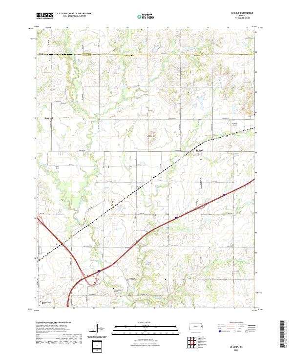 2022 Le Loup2022 Print · USGSFranklin and Douglas counties are mapped here in the early twenty-first century, showcasing a landscape defined by the winding tributaries of Tauy Creek. Researchers can locate the Ottawa Indian Mission Burying Ground or trace the rural crossroads of Le Loup and Norwood.
 - 2022 Map of Ottawa North, 2022 Print
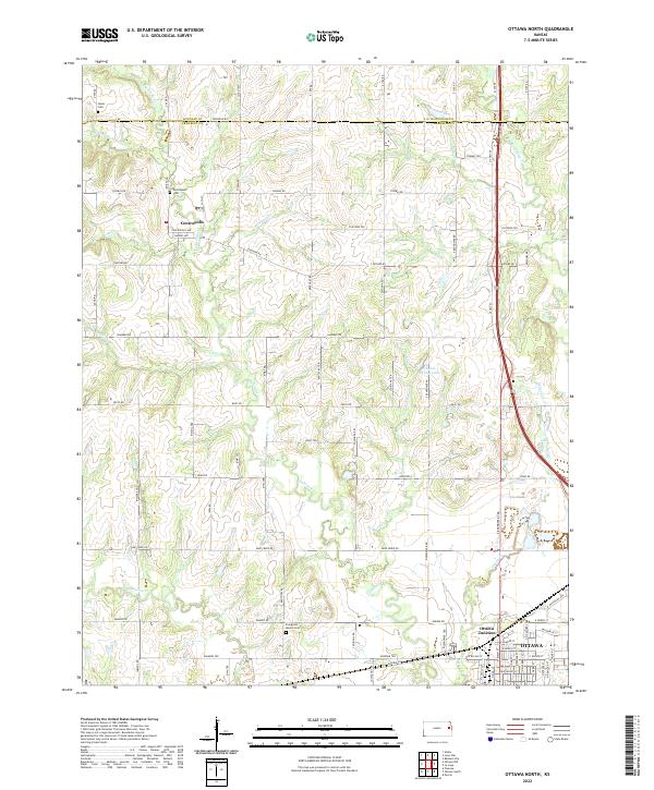 2022 Ottawa North2022 Print · USGSFranklin County and the northern outskirts of Ottawa are captured in this detailed survey of the Kansas prairie. Genealogists and local historians can trace family locations near Centropolis, Ottawa Junction, and rural landmarks like Evergreen Mound Cemetery.
End of results
Showing maps 1-4 of 4
Top cities near Ottawa
- Baldwin City historical maps
- Edgerton historical maps
- Wellsville historical maps
- Centropolis historical maps
- Stanton historical maps
- Pomona historical maps
See more
Frequently asked questions
- What are the different types of historical maps available for Ottawa?
- What is the oldest map of Ottawa?
- Where can I purchase historical maps of Ottawa for my home or office?
- Where can I download high-res historical maps of Ottawa?
- Are there historical topographic maps available for Ottawa?
- Is there historical aerial imagery available for Ottawa?
- Where are historical maps of Ottawa sourced from?