1960s Maps of Tribune Township, Kansas
Explore 8 historic maps of Tribune Township from the 1960s. These maps offer a rare glimpse into what life looked like during the 1960s — showing old roads, neighborhoods, homes, and landmarks that have changed or disappeared over time.
Whether you're researching your family's past, planning a metal detecting trip, or studying how Tribune Township's landscape evolved across the 1960s, these high-resolution maps are a powerful tool for exploring the history of this region.
- Focus on a specific era: All maps on this page are from the 1960s, giving you a focused view of this time period.
- See what’s changed: Compare century-old streets, trails, and buildings to today's modern landscape using overlays and satellite layers.
- Research with precision: Use these maps for genealogy, historical research, land use analysis, or educational projects.
- View, download, or print: Maps are fully viewable online in high resolution, and can be downloaded or printed for your own records.
Start exploring Tribune Township's history through authentic maps from the 1960s. This is your window into the past.
Tribune Township, KS maps
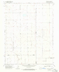
(8)- 1968 Map of Sharon Springs 3 NE, 1969 Print
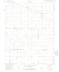 1968 Sharon Springs 3 NE1969 Print · USGSWestern Kansas ranching and farm lands are captured here in the late sixties, where the high plains meet the Colorado border. Researchers can trace land use through a network of water sources including South Ladder Creek and numerous Well sites across Colony and Weskan.2 unique versions available
 - 1968 Map of Sharon Springs 4 NW, 1969 Print
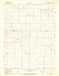
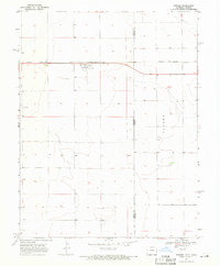
 1968 Sharon Springs 4 NW1969 Print · USGSWestern Kansas high plains and the winding branches of the local creek system are captured here in the late sixties. Researchers can trace the Bethany Cem and the complex confluence of Middle Ladder Creek and Sharon Springs Creek.2 unique versions available
 - 1968 Map of Sharon Springs 3 NW, 1969 Print
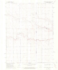
 1968 Sharon Springs 3 NW1969 Print · USGSThe High Plains of western Kansas in the late sixties reveal a landscape of vast townships and scattered prairie homesteads. Genealogists can locate Stockholm Cem and trace the meandering paths of South Fork Middle Ladder Creek through the townships of Weskan and Colony.2 unique versions available
 - 1968 Map of Sharon Springs 4 NE, 1969 Print
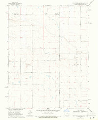
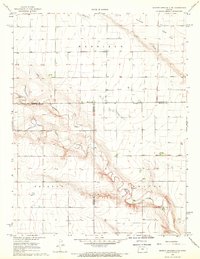 1968 Sharon Springs 4 NE1969 Print · USGSThe high plains of Western Kansas appear here in the late sixties, where the deep incisions of Ladder Creek break the flat horizon. Researchers can trace the rural infrastructure of the day, from the West Bethany Ch to local industrial sites like a Sandpit and Gravel Pit.2 unique versions available
 - 1968 Map of Towner SE, 1971 Print
 1968 Towner SE1971 Print · USGSThe high plains along the Colorado-Kansas border are captured here in the late sixties, showing the vast township divisions of the prairie. Local researchers can trace the course of Wild Horse Creek and locate early infrastructure like the cross-country Pipeline and named tracts like Richland.
 - 1968 Map of Towner, 1971 Print
 1968 Towner1971 Print · USGSThe Colorado-Kansas state line is captured here in the late sixties as a landscape of isolated rail towns and prairie settlements. Genealogists and historians can locate the Towner Cem or trace the path of the Missouri Pacific through Towner and Colokan.
 - 1969 Map of Cheyenne Wells 4 NE, 1971 Print
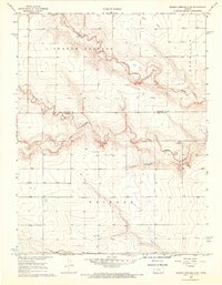
 1969 Cheyenne Wells 4 NE1971 Print · USGSThe Colorado and Kansas borderlands meet in the late sixties along the winding path of South Ladder Creek. Genealogists and researchers can trace township boundaries and find family-named landmarks like Wells or the remote Colony and Weskan districts.3 unique versions available
 - 1969 Map of Cheyenne Wells 4 SE, 1971 Print
 1969 Cheyenne Wells 4 SE1971 Print · USGSHigh plains life at the Colorado and Kansas border is captured here during the late sixties. Genealogists and local historians can trace the rural landscape near Colony, locating the local Cem and the winding path of White Woman Creek.3 unique versions available
End of results
Showing maps 1-8 of 8
Top cities near Tribune Township
Top neighborhoods of Tribune Township
- Astor historical maps
- Kanco historical maps
- Walkinghood historical maps
- Whitelaw historical maps
- Tribune historical maps
- Horace historical maps
Frequently asked questions
- What are the different types of historical maps available for Tribune Township?
- What is the oldest map of Tribune Township?
- Where can I purchase historical maps of Tribune Township for my home or office?
- Where can I download high-res historical maps of Tribune Township?
- Are there historical topographic maps available for Tribune Township?
- Is there historical aerial imagery available for Tribune Township?
- Where are historical maps of Tribune Township sourced from?