
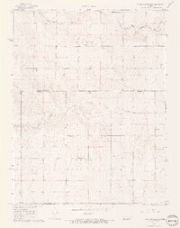
1968 Map of Sharon Springs 3 NW
USGS Topo · Published 1969About this map
Stockholm Cem sits at the heart of this High Plains landscape, a solitary landmark in a region defined by agricultural expanse and intermittent watercourses. The drainage of South Fork Middle Ladder Creek and South Ladder Creek dictates the topography, carved through the townships of Weskan and Colony. This late-1960s survey documents a sparse but vital infrastructure of early industry and resource management, illustrated by a prominent Gravel Pit and numerous wells scattered across the township sections. The boundary line between Wallace and Greeley County bisects the southern half of the map, marking a transition in local jurisdiction across this prairie terrain.
Find a feature on this map
8 named features on this map. Tap any name to fly to it.
Don’t see what you’re looking for? This feature index may not catch every label — zoom into the map to look around manually.
Map Details
Editions of this 1968 Sharon Springs 3 NW Map
2 editions found
Other maps of this area

1892 · Cheyenne Wells
USGS Topo · 1:125,000

1894 · Cheyenne Wells
USGS Topo · 1:125,000

1954 · Lamar
USGS Topo · 1:250,000

1955 · Scott City
USGS Topo · 1:250,000

1958 · Lamar
USGS Topo · 1:250,000

1958 · Scott City
USGS Topo · 1:250,000

1959 · Weskan
USGS Topo · 1:62,500

1968 · Sharon Springs 3 NE
USGS Topo · 1:24,000

1969 · Arapahoe SE
USGS Topo · 1:24,000

1969 · Cheyenne Wells 4 NE
USGS Topo · 1:24,000