2020s Maps of McPherson County, Kansas
Explore 24 historic maps of McPherson County from the 2020s. These maps offer a rare glimpse into what life looked like during the 2020s — showing old roads, neighborhoods, homes, and landmarks that have changed or disappeared over time.
Whether you're researching your family's past, planning a metal detecting trip, or studying how McPherson County's landscape evolved across the 2020s, these high-resolution maps are a powerful tool for exploring the history of this region.
- Focus on a specific era: All maps on this page are from the 2020s, giving you a focused view of this time period.
- See what’s changed: Compare century-old streets, trails, and buildings to today's modern landscape using overlays and satellite layers.
- Research with precision: Use these maps for genealogy, historical research, land use analysis, or educational projects.
- View, download, or print: Maps are fully viewable online in high resolution, and can be downloaded or printed for your own records.
Start exploring McPherson County's history through authentic maps from the 2020s. This is your window into the past.
McPherson County, KS maps
(24)- 2022 Map of McPherson North, 2022 Print
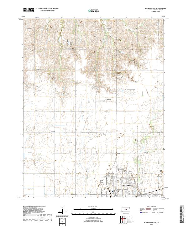 2022 McPherson North2022 Print · USGSThe northern outskirts of McPherson appear here in the early twenty-first century, showing the transition from urban neighborhoods to the Kansas prairie. Trace local landmarks like Johnstown, Crestwood Memorial Park, and the quiet waters of Dry Turkey Creek.
 - 2022 Map of Canton, 2022 Print
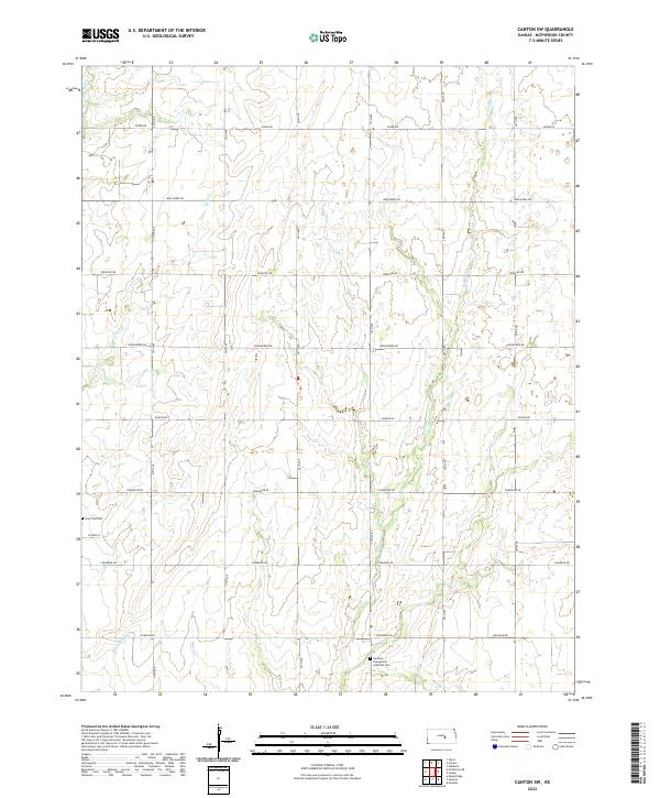
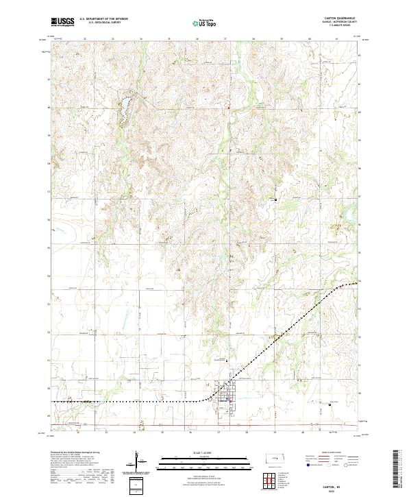 2022 Canton2022 Print · USGSCanton and the surrounding McPherson County countryside are shown here as they appeared in the early twenty-first century. Genealogists can locate family sites near Canton Township Cem and Oakes Cem or follow the path of Running Turkey Cr.
 - 2022 Map of Moundridge, 2022 Print
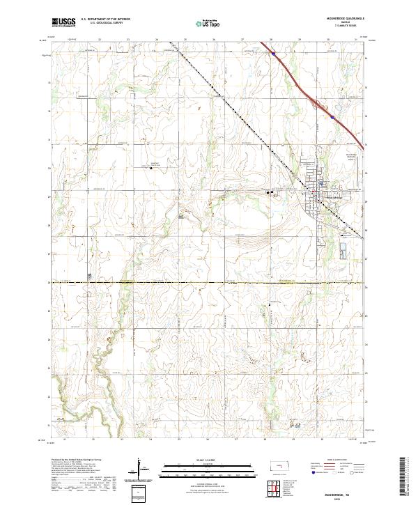 2022 Moundridge2022 Print · USGSThe McPherson and Harvey county line in the early 2020s shows a landscape of steady agricultural tradition and community growth. Researchers can trace local heritage at First Mennonite Cem or locate the Moundridge Municipal Airport near Black Kettle Cr.
 - 2022 Map of Galva, 2022 Print
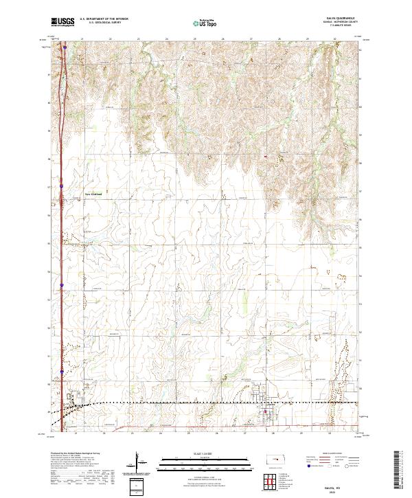 2022 Galva2022 Print · USGSMcPherson County at the start of the 2020s shows a landscape of established agriculture and steady rural life. Genealogists and researchers can trace the roads and waterways connecting the town of Galva to the settlement at New Gottland and along Kentucky Cr.
 - 2022 Map of Windom, 2022 Print
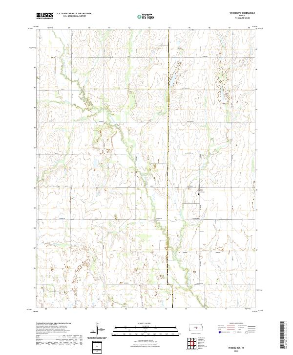
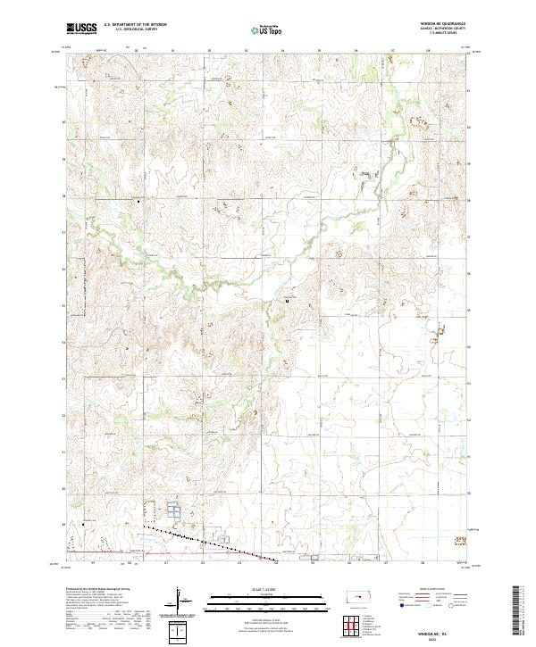
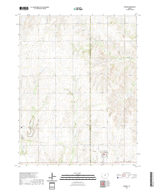 2022 Windom2022 Print · USGSThe borderlands of Rice and McPherson counties are captured here in the early twenty-first century, showcasing a landscape shaped by prairie agriculture. Genealogists and researchers can locate Bean Cem and trace the winding course of the Little Arkansas River and Salt Cr.
 - 2022 Map of Lindsborg, 2022 Print
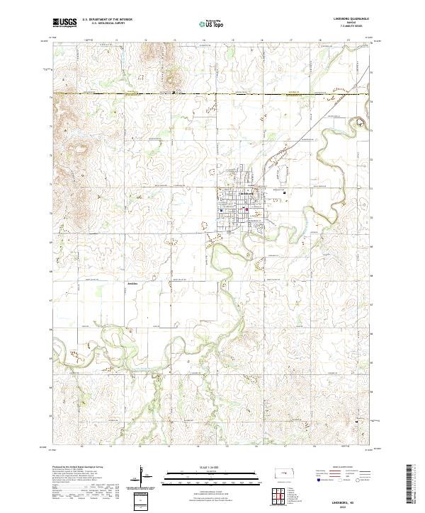 2022 Lindsborg2022 Print · USGSLindsborg and the central Kansas plains are captured here in the early 2020s, centered on the Bethany College campus and the winding Smoky Hill River. Researchers can locate several burial grounds including Smoky Hill Cem and Elmwood Cem, or trace the small settlement of Jenkins.
 - 2022 Map of Hutchinson NW, 2022 Print
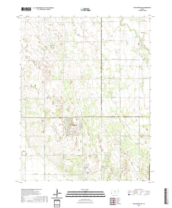 2022 Hutchinson NW2022 Print · USGSKansas prairie lands meet the winding Little Arkansas River in this modern survey of the tri-county border region. Genealogists and local historians can trace the residential development of The Highlands via uniquely named routes like Paganica Pass and Dull Knife Rd.
 - 2022 Map of Waldeck, 2022 Print
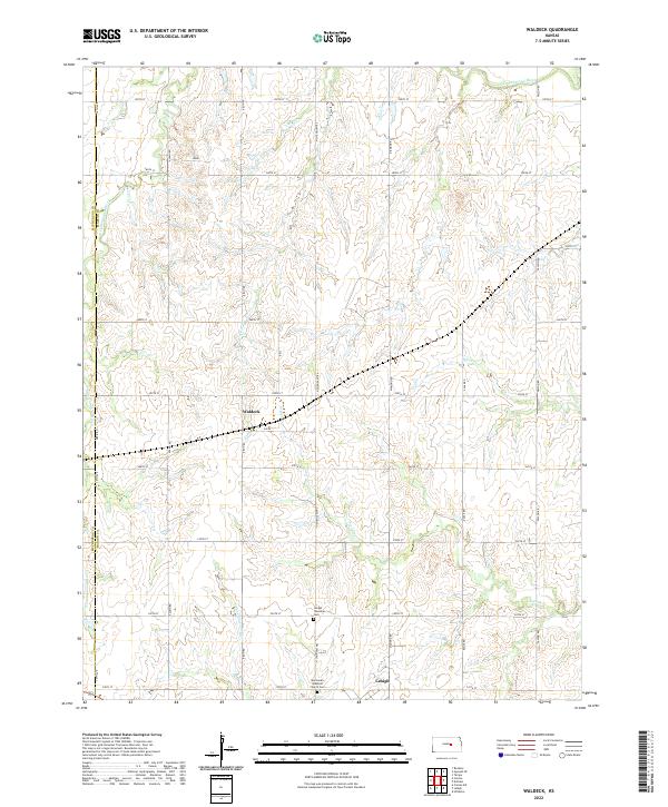 2022 Waldeck2022 Print · USGSMarion County farming communities are documented here in the early twenty-first century, showing the enduring grid of the Kansas prairie. Genealogists and historians can locate family burial sites at the Mennonite Brethren Church Cem and trace watercourses like French Cr and the N Cottonwood River.
 - 2022 Map of Marquette, 2022 Print
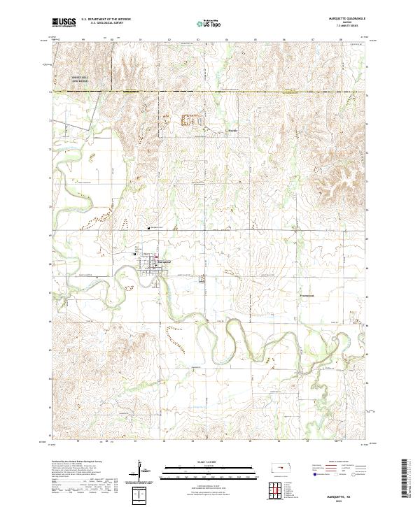 2022 Marquette2022 Print · USGSMarquette and the surrounding McPherson County agricultural lands are captured here in the early twenty-first century. Genealogists and local historians can trace family locations near Marquette, the Elim Lutheran Cem, and the quiet community of Freemount.
 - 2022 Map of Windom SW, 2022 Print
 2022 Windom SW2022 Print · USGSRice and McPherson Counties are captured here in a contemporary view of their rural landscape and agricultural roots. Genealogists can locate family landmarks like the Andover Lutheran Church Cemetery and trace the winding course of the Little Arkansas River.
 - 2022 Map of Lindsborg SE, 2022 Print
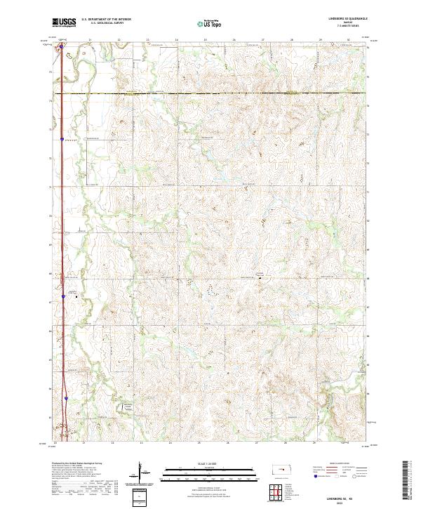 2022 Lindsborg SE2022 Print · USGSMcPherson County farmland and river bottoms are documented here as they appeared in the early twenty-first century. Genealogists can trace family landmarks like Kentucky Creek Cem, Christian Ridge Cem, and Kentucky Creek Landing.
 - 2022 Map of Canton SW, 2022 Print
 2022 Canton SW2022 Print · USGSThe McPherson County countryside appears in its modern form in this recent survey of the Kansas plains. Researchers can trace the path of Running Turkey Cr or study the enduring section-line road network that defines this agricultural heartland.
 - 2022 Map of Lehigh, 2022 Print
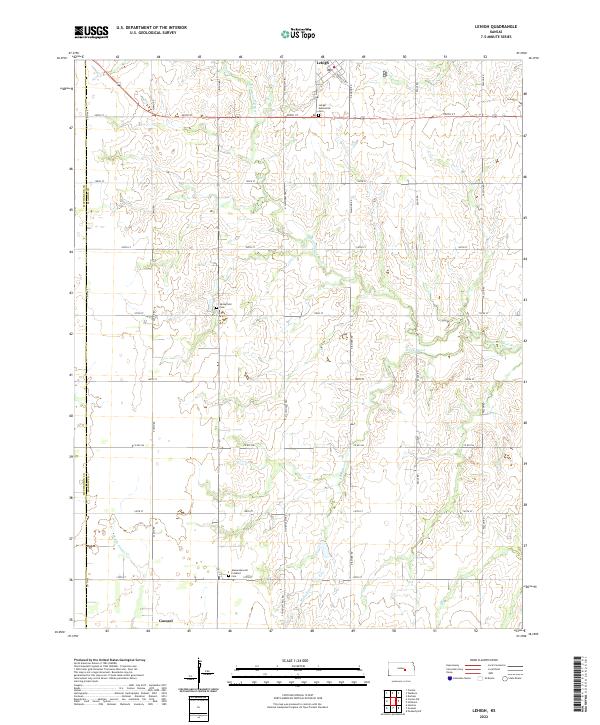 2022 Lehigh2022 Print · USGSMarion and McPherson counties are shown here at the turn of the twenty-first century, preserving a landscape shaped by early trails and faith communities. Genealogists can locate family sites near the Alexanderwohl Friedhof Cem or trace the historic path of the N Chisholm Trl.
 - 2022 Map of Gypsum SE, 2022 Print
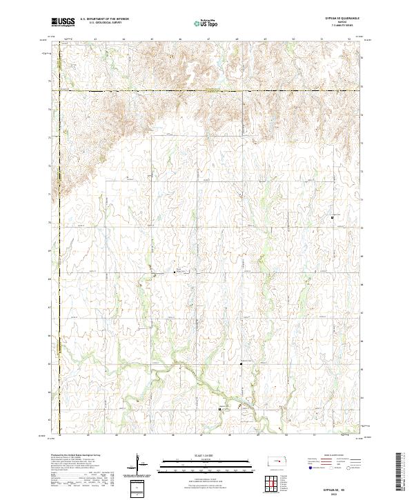 2022 Gypsum SE2022 Print · USGSMarion and Dickinson counties are shown here in the 2020s, preserving a traditional Kansas landscape of section-line roads and family-named landmarks. Researchers can locate rural burial sites like Peace Valley Cem and Baptist Cem or trace the historic path of the N Chisholm Trl.
 - 2022 Map of Windom NE, 2022 Print
 2022 Windom NE2022 Print · USGSAgricultural McPherson County comes into focus in the early 2020s, revealing a landscape of section-line roads and prairie creek systems. Genealogists can locate several rural burial sites like Excelsior Cem and Fairview Cem along the banks of Sharps Cr.
 - 2022 Map of Halstead NW, 2022 Print
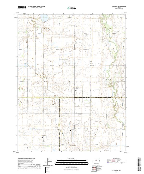 2022 Halstead NW2022 Print · USGSThe rural borderlands where McPherson, Reno, and Harvey counties meet are captured here in the early twenty-first century. Researchers can trace family history through local landmarks like Hoffnungsau Mennonite Church Cem, Hebron Cem, and the geological feature Big Sinkhole.
 - 2022 Map of Roxbury, 2022 Print
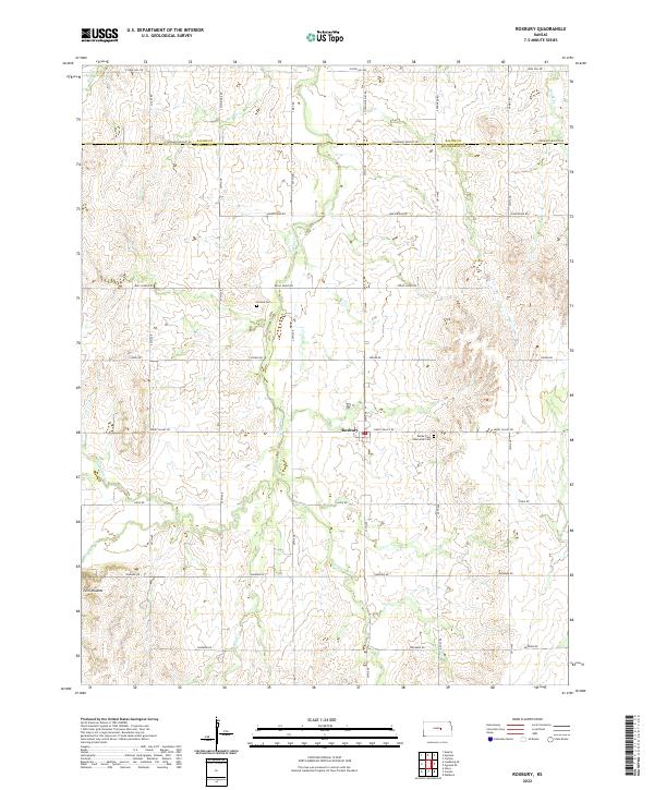 2022 Roxbury2022 Print · USGSThe rural plains of McPherson County are captured here in the early 2020s, centered on the historic crossroads of Roxbury. Genealogists and local researchers can locate burial sites at Valley View Memorial Cem and Eureka Cem or trace the winding course of Gypsum Cr.
 - 2022 Map of Hesston, 2022 Print
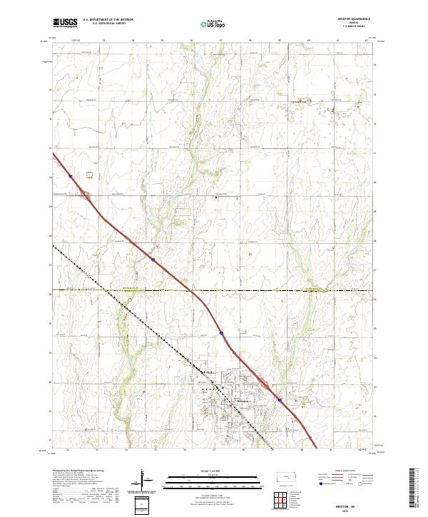 2022 Hesston2022 Print · USGSThe community of Hesston and its collegiate grounds are shown here in the early twenty-first century. Genealogists and local historians can trace the town's street grid near Hesston College or locate rural landmarks like Freedom Cem.
 - 2022 Map of Conway, 2022 Print
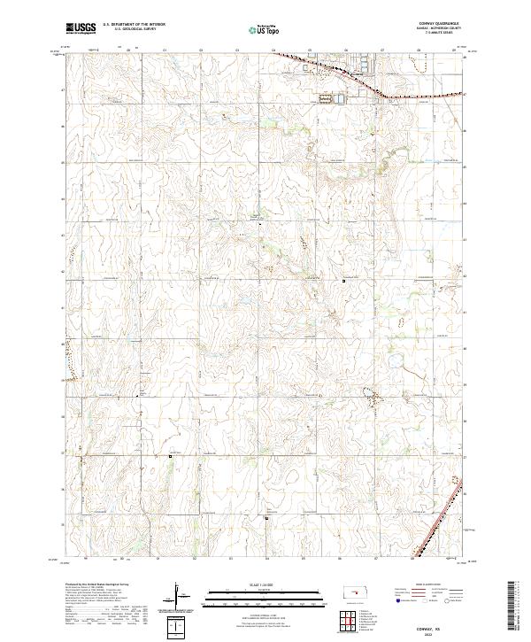 2022 Conway2022 Print · USGSMcPherson County farming communities thrive across the Kansas prairie in the early twenty-first century. Researchers can locate numerous local burial sites like Amish Cem, Groveland Cem, and Zion Mennonite Cem alongside the settlement of Conway.
 - 2022 Map of McPherson SE, 2022 Print
 2022 McPherson SE2022 Print · USGSThe rural landscape of McPherson County is captured here in the early 2020s, showing a well-established grid of section roads and prairie waterways. Researchers can trace family history at the Empire Cemetery or follow historic transit routes like Old US Hwy 81 and Chisholm Road.
 - 2022 Map of Goessel, 2022 Print
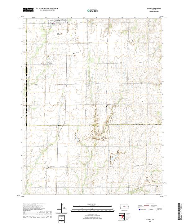 2022 Goessel2022 Print · USGSThe area surrounding Goessel in the early twenty-first century reveals a deeply rooted agricultural landscape straddling the Marion and Harvey county lines. Genealogists can trace family heritage at sites like Groenfeld Cemetery or Highland Cemetery and locate local landmarks such as Hiebert Airfield.
 - 2022 Map of Buhler, 2022 Print
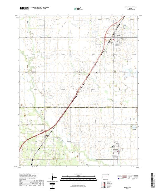 2022 Buhler2022 Print · USGSThis central Kansas region on the Reno and McPherson County line was a well-established agricultural hub by the early 2020s. Genealogists can trace family roots through numerous local burial sites like Thiessen Family Cem and Evergreen Cem near the Little Arkansas River.
 - 2022 Map of McPherson South, 2022 Print
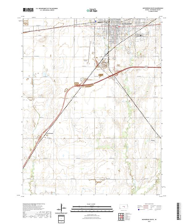 2022 McPherson South2022 Print · USGSThe plains of central Kansas are centered here on a bustling college town and its nearby farming outposts in the early 2020s. Genealogists and local historians can trace the development of McPherson through landmarks like the McPherson Cem and the campus of McPherson College.
 - 2022 Map of Langley, 2022 Print
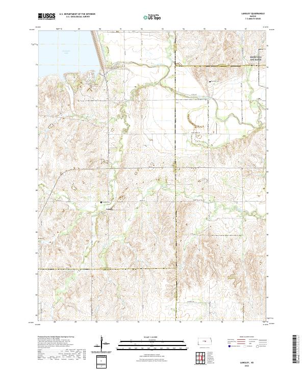 2022 Langley2022 Print · USGSLangley and the surrounding plains of central Kansas appear in high detail in the early 2020s as the Smoky Hill River winds through the prairie. Researchers can pinpoint Langley Cem, trace the course of Wolf Cr, and locate the southern banks of Kanopolis Lake.
End of results
Showing maps 1-24 of 24
Top cities of McPherson County
- McPherson historical maps
- Lindsborg historical maps
- Moundridge historical maps
- Inman historical maps
- Canton historical maps
- Galva historical maps
See more
Frequently asked questions
- What are the different types of historical maps available for McPherson County?
- What is the oldest map of McPherson County?
- Where can I purchase historical maps of McPherson County for my home or office?
- Where can I download high-res historical maps of McPherson County?
- Are there historical topographic maps available for McPherson County?
- Is there historical aerial imagery available for McPherson County?
- Where are historical maps of McPherson County sourced from?