Old Maps of McPherson County, Kansas for Genealogy
Trace your family roots with 158 historic maps of McPherson County. These high-res maps reveal old neighborhoods, homesites, landmarks, and streets — helping you uncover where your ancestors lived and how the area evolved over time.
- Explore historic neighborhoods: Identify where your relatives may have lived in the 1800s or 1900s.
- Compare maps over time: Trace the changes in streets, buildings, and landmarks for multi-generational research.
- Perfect for genealogy & ancestry research: Used by family historians and researchers to map out lineage and migration.
These maps are an incredible resource for exploring your personal connection to McPherson County's past.
McPherson County, KS maps
(158)- 1889 Map of Newton
 1889 Newton1889 Print · USGSRailroad expansion defines this Kansas landscape in the late 1880s, centered on the growing hubs of Newton and Marion. Genealogists and historians can trace the early grids of towns like Peabody, Hillsboro, and Lehigh as they appeared at their founding.
 - 1889 Map of Abilene
 1889 Abilene1889 Print · USGSAbilene and Dickinson County appear here in the late 1880s during the height of the Kansas railroad expansion. Genealogists and historians can trace the early development of Enterprise, Gypsum City, and Navarre along the complex network of the Union Pacific Railroad and competing lines.
 - 1891 Map of Hutchinson
 1891 Hutchinson1891 Print · USGSCentral Kansas at the close of the frontier era was a landscape of burgeoning rail towns and organized townships. Genealogists and local historians can trace the early footprints of Hutchinson and Mc Pherson alongside vanished locales like King City and Aiken.
 - 1892 Map of Salina
 1892 Salina1892 Print · USGSCentral Kansas at the close of the nineteenth century centers on the booming rail junctions and river valleys of the Smoky Hill region. Genealogists can trace family footprints in riverside settlements like Lindsborg and Assaria or the rail stops of Bavaria and Terra Cotta.6 unique versions available
 - 1893 Map of Hutchinson
 1893 Hutchinson1893 Print · USGSCentral Kansas at the close of the nineteenth century reveals a landscape undergoing a total transformation through railroad expansion and township settlement. Genealogists can trace early homestead patterns and family-named districts like Lone Tree and Garden while locating vanished stops along the Missouri Pacific Railway.5 unique versions available
 - 1894 Map of Newton
 1894 Newton1894 Print · USGSCentral Kansas was undergoing a rapid transformation into a rail-driven agricultural hub during the 1890s. Genealogists and historians can trace the early growth of Newton, Marion, and Peabody alongside branching rail lines and the winding COTTONWOOD RIVER.5 unique versions available
 - 1894 Map of Abilene
 1894 Abilene1894 Print · USGSCentral Kansas at the peak of the railroad era shows a landscape transformed by competing iron rails and river commerce. Genealogists and historians can trace family roots through early settlements like Abilene, Enterprise, and Hope, or locate old stops along the Missouri Pacific Railroad.6 unique versions available
 - 1942 Map of Salina
 1942 Salina1942 Print · USGSCentral Kansas during the early 1940s reveals a landscape transitioning between its deep agricultural roots and a massive new wartime footing. Researchers can trace the development of the Military Reservation and locate small rail-side settlements like Terra Cotta and Smolan.
 - 1955 Map of Hutchinson, 1967 Print
 1955 Hutchinson1967 Print · USGSCentral Kansas in the mid-sixties reveals a landscape of growing reservoirs and evolving transportation corridors. Trace the development of towns like Hutchinson and Abilene alongside the Union Pacific Railroad and the expanding Interstate 70.3 unique versions available
 - 1959 Map of Hutchinson
 1959 Hutchinson1959 Print · USGSCentral Kansas thrives at the intersection of rail and river in the mid-1950s, as post-war aviation infrastructure reshapes the prairie. Genealogists and historians can trace the paths of the AT&SF RR through Newton and Hutchinson, or locate military sites like Smoky Hill Air Force Base.2 unique versions available
 - 1964 Map of Marquette, 1965 Print
 1964 Marquette1965 Print · USGSMarquette and the surrounding McPherson County plains appear here in the mid-1960s, defined by the winding Smoky Hill River. Researchers can trace the Missouri Pacific rail line and locate community landmarks like Freemount Ch and Mackie.2 unique versions available
 - 1964 Map of Gypsum SE, 1965 Print
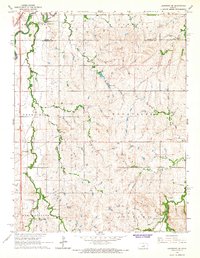
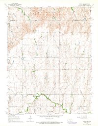 1964 Gypsum SE1965 Print · USGSThis central Kansas landscape at the dawn of the sixties shows a deep-rooted rural community where the North Cottonwood River winds through fertile plains. Genealogists can trace family footprints across numerous sites like Elm Springs, the Grand Central Sch, and Friedenstal Cem.3 unique versions available
 - 1964 Map of Langley, 1965 Print
 1964 Langley1965 Print · USGSThe rural borderlands of Ellsworth and McPherson counties are captured here in the mid-1960s. Genealogists can trace family footprints around the village of Langley, the Langley Sch, and the riverside Sandpits along the Smoky Hill River.2 unique versions available
 - 1964 Map of Windom SW, 1966 Print
 1964 Windom SW1966 Print · USGSThe rural intersection of Rice and McPherson counties is captured here in the mid-1960s as a landscape of structured townships and prairie waterways. Researchers can locate community anchors like Rockville Sch, Andover Cem, and a Quarry near the Little Arkansas River.2 unique versions available
 - 1964 Map of Roxbury, 1966 Print
 1964 Roxbury1966 Print · USGSRoxbury and the surrounding townships in McPherson and Saline counties are shown here during a mid-century peak in local petroleum production. Genealogists and researchers can trace family lands near the Roxbury Oil Field or locate burial sites at Eureka Cem and Valley View Memorial Cem.3 unique versions available
 - 1964 Map of Conway, 1966 Print
 1964 Conway1966 Print · USGSMcPherson County farmland and rail lines are captured here in the mid-1960s, showing a landscape defined by small rural townships and creek drainages. Genealogists can locate family landmarks like the Amish Cemetery, Plainview School, and Zion Church.3 unique versions available
 - 1965 Map of Goessel, 1966 Print
 1965 Goessel1966 Print · USGSMarion and Harvey counties appear in the mid-1960s as a structured agricultural landscape centered on the town of Goessel. Genealogists and local historians can trace rural roots through landmarks like Highland Ch, Grange Hall, and Greenfield Cem.
 - 1965 Map of Mc Pherson South, 1966 Print
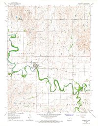
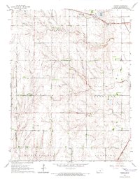
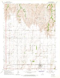
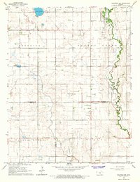
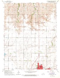
 1965 Mc Pherson South1966 Print · USGSMcPherson thrived as a center for education and industry in the mid-1960s, surrounded by vast Kansas agricultural lands. Genealogists and historians can trace the development of McPherson College or locate family sites near Groveland and the McPherson Cemetery.3 unique versions available
 - 1965 Map of Galva, 1966 Print
 1965 Galva1966 Print · USGSMcPherson County farming and rail life are at their peak in the mid-1960s as these two major railroads meet in Galva. Researchers can trace old rural school sites like New Union Sch and local landmarks such as the New Gottland Ch.3 unique versions available
 - 1965 Map of Halstead NW, 1966 Print
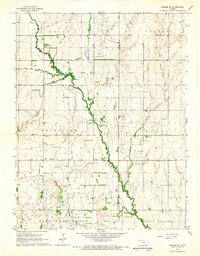
 1965 Halstead NW1966 Print · USGSCentral Kansas farm country across McPherson and Harvey counties is captured here in the mid-sixties, showing a landscape defined by prairie streams and section roads. Genealogists can trace family footprints through numerous local sites like Hoffnungsau Ch, Hebron Cem, and the Turkey Creek Sch.
 - 1965 Map of Lindsborg, 1966 Print
 1965 Lindsborg1966 Print · USGSLindsborg and the surrounding Kansas prairie are documented here in the mid-sixties as the local economy shifted between agriculture and oil. Researchers can trace historic family plots at Smoky Hill Cem or locate defunct rural schoolhouses like Soderstrom Sch and Riverside Sch.3 unique versions available
 - 1965 Map of Mc Pherson SE, 1966 Print
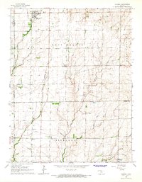
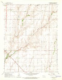 1965 Mc Pherson SE1966 Print · USGSMcPherson County agricultural and oil lands are captured here in the mid-sixties, south of the county seat. Researchers can trace the legacy of rural communities through the Sunflower Sch, the Ritz Canton Oil Field, and the rail stop at Elyria.4 unique versions available
 - 1965 Map of Lindsborg SE, 1966 Print
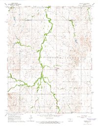
 1965 Lindsborg SE1966 Print · USGSMcPherson and Saline Counties are captured here in the mid-sixties, showing a landscape of traditional townships and rail corridors. Genealogists and historians can locate Smoky Hill Cem, the residential area of Alliance Acres, and the tracks of the Union Pacific Railroad.3 unique versions available
 - 1965 Map of Mc Pherson North, 1966 Print
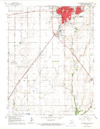
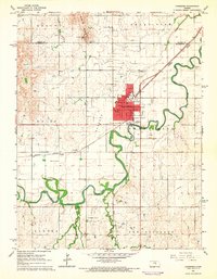
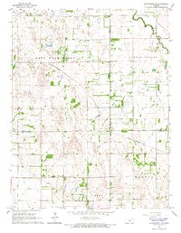
 1965 Mc Pherson North1966 Print · USGSMid-century Kansas comes to life as the city of McPherson expands amid a network of rural schoolhouses and active rail lines. Researchers can trace the layout of the Lincoln Sch, locate the old Drive-in Theater, and follow the Union Pacific railroad through Johnstown.3 unique versions available
 - 1965 Map of Hutchinson NW, 1966 Print
 1965 Hutchinson NW1966 Print · USGSThe rural borderlands of Rice, Reno, and McPherson counties are captured here in the mid-1960s as a landscape of prairie agriculture and energy production. Researchers can locate the Welch Bornholdt Oil Field, the Thomas Grove Sch, and the winding Little Arkansas River.2 unique versions available
Showing maps 1-25 of 158
Top cities of McPherson County
- McPherson historical maps
- Lindsborg historical maps
- Moundridge historical maps
- Inman historical maps
- Canton historical maps
- Galva historical maps
See more
Frequently asked questions
- What are the different types of historical maps available for McPherson County?
- What is the oldest map of McPherson County?
- Where can I purchase historical maps of McPherson County for my home or office?
- Where can I download high-res historical maps of McPherson County?
- Are there historical topographic maps available for McPherson County?
- Is there historical aerial imagery available for McPherson County?
- Where are historical maps of McPherson County sourced from?