2020s Maps of Osborne County, Kansas
Explore 24 historic maps of Osborne County from the 2020s. These maps offer a rare glimpse into what life looked like during the 2020s — showing old roads, neighborhoods, homes, and landmarks that have changed or disappeared over time.
Whether you're researching your family's past, planning a metal detecting trip, or studying how Osborne County's landscape evolved across the 2020s, these high-resolution maps are a powerful tool for exploring the history of this region.
- Focus on a specific era: All maps on this page are from the 2020s, giving you a focused view of this time period.
- See what’s changed: Compare century-old streets, trails, and buildings to today's modern landscape using overlays and satellite layers.
- Research with precision: Use these maps for genealogy, historical research, land use analysis, or educational projects.
- View, download, or print: Maps are fully viewable online in high resolution, and can be downloaded or printed for your own records.
Start exploring Osborne County's history through authentic maps from the 2020s. This is your window into the past.
Osborne County, KS maps
(24)- 2022 Map of Portis, 2022 Print
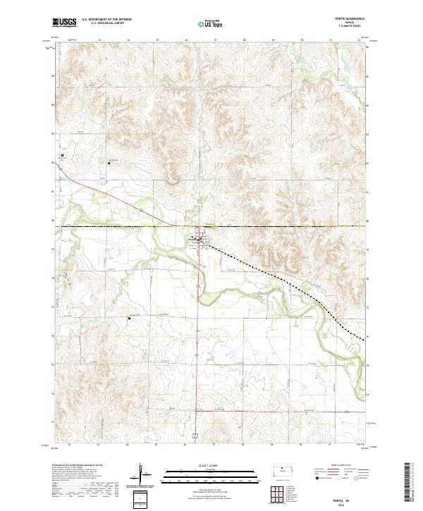 2022 Portis2022 Print · USGSThe North Fork Solomon River valley and the town of Portis appear here in their modern rural context. Genealogists can trace early homestead ties through the presence of Fairview Cem, Garrett Cem, and Hammond Cem.
 - 2022 Map of Laton, 2022 Print
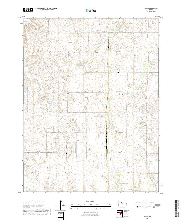 2022 Laton2022 Print · USGSRooks and Osborne counties in North Central Kansas maintain their traditional agricultural character in this modern survey. Genealogists can locate several remote burial sites including Aurora Cem, Chalk Mound Cem, and Immanuel Lutheran Cem.
 - 2022 Map of Bloomington, 2022 Print
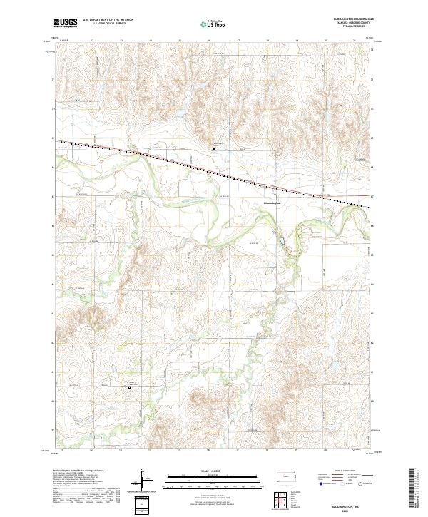 2022 Bloomington2022 Print · USGSOsborne County, Kansas, is documented in the early twenty-first century as a land shaped by its river valleys and section-line roads. Researchers can locate the Bloomington Cem and Mount Hope Cem or trace the winding course of the S Fork Solomon River through the heart of the township.
 - 2022 Map of Osborne SW, 2022 Print
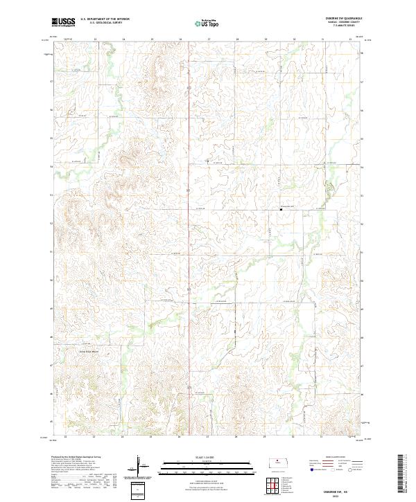 2022 Osborne SW2022 Print · USGSOsborne County remains a quintessential Kansas farming landscape in this recent survey. Researchers can locate the Zimmerman Cem and trace the paths of Twin Cr and Sunny Slope Mound across the township grid.
 - 2022 Map of Harlan, 2022 Print
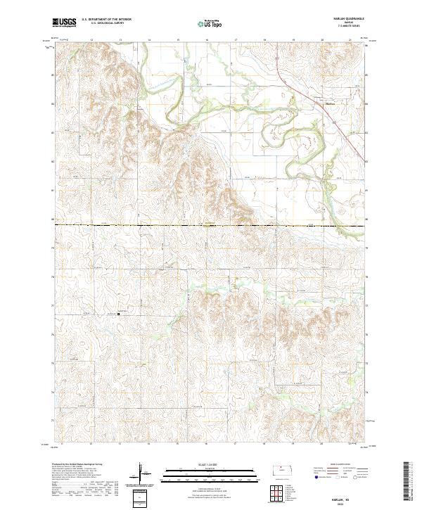 2022 Harlan2022 Print · USGSAgricultural life in Smith and Osborne counties continues along the North Fork Solomon River in this modern record of the plains. Researchers can locate the settlement of Harlan and trace rural family history at the Butler Cem.
 - 2022 Map of Mill Creek, 2022 Print
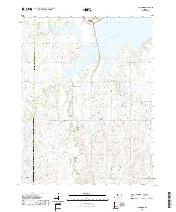 2022 Mill Creek2022 Print · USGSThe confluence of the North and South Forks of the Solomon River defines this Kansas landscape in the early twenty-first century. Researchers can trace the modern shoreline of Waconda Lake and follow the routes of Tipton Rd and Lake Dr through the valley.
 - 2022 Map of Downs South, 2022 Print
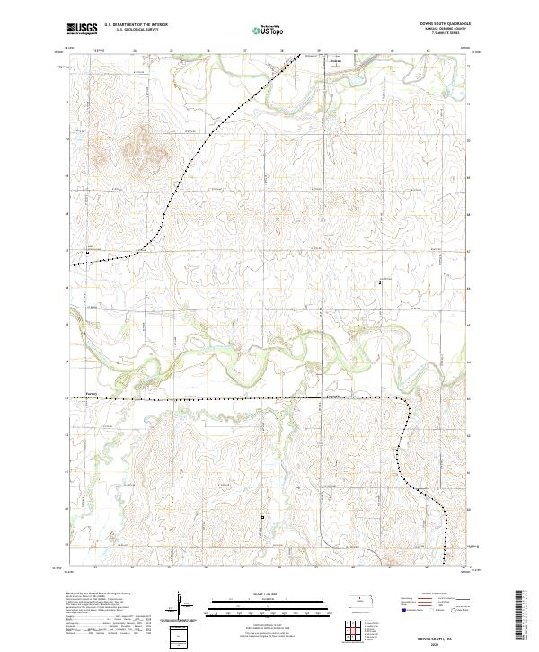 2022 Downs South2022 Print · USGSOsborne County, Kansas, is captured here in the early 2020s, showcasing the rural landscape south of Downs. Researchers can locate historic sites such as Corinth Cemetery and the settlement of Forney along the winding South Fork Solomon River.
 - 2022 Map of Alton SW, 2022 Print
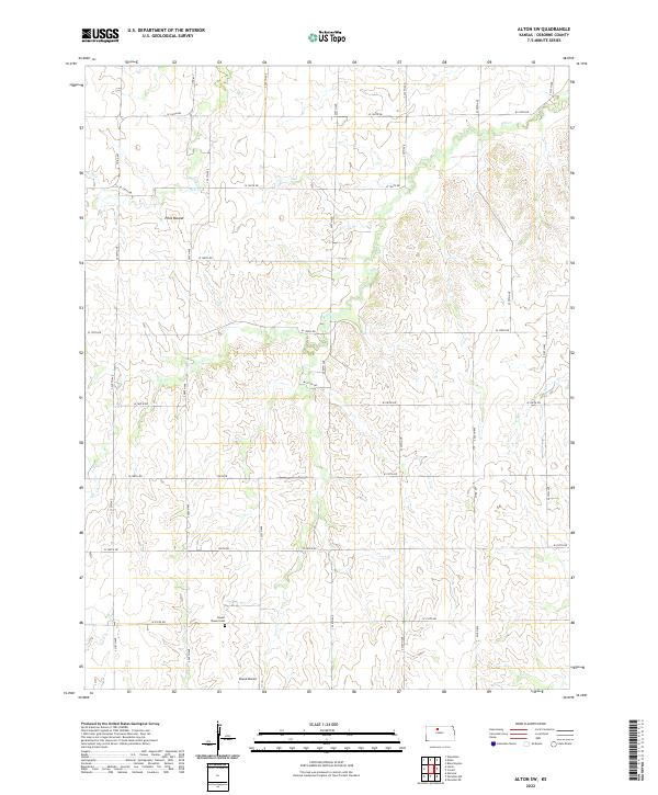 2022 Alton SW2022 Print · USGSIn the high plains of north-central Kansas, this 2022 survey captures the rural character of Osborne County's township divisions. Researchers can trace the layout of family-named topography like Pilot Mound and locate Round Mound Cem near the southern boundary.
 - 2022 Map of Downs North, 2022 Print
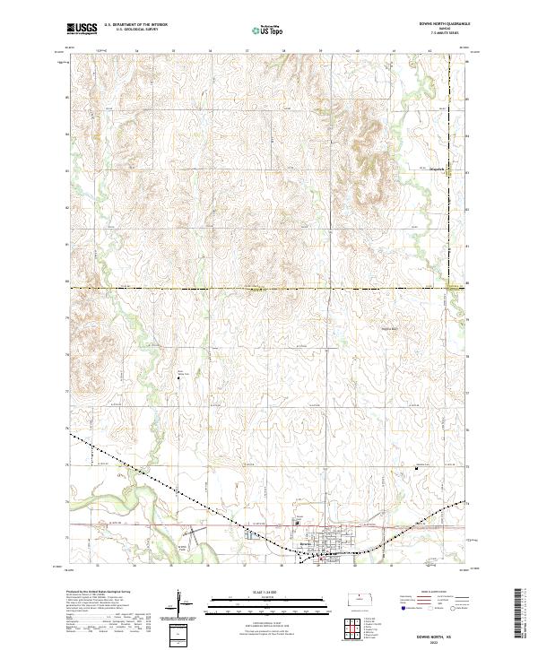 2022 Downs North2022 Print · USGSNorth Central Kansas is documented here in the early twenty-first century as it spans the borders of Smith, Osborne, and Jewell counties. Researchers can locate family sites near Rose Valley Cem, explore the streets of Downs, or trace the winding Twelvemile Cr.
 - 2022 Map of Paradise NE, 2022 Print
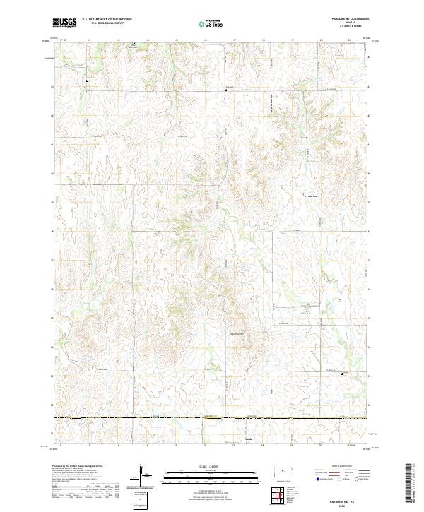 2022 Paradise NE2022 Print · USGSOsborne and Russell Counties come together at the town of Waldo in this modern-era study of the Kansas prairie. Researchers can trace rural lineages through local landmarks like Cedar Bluff Cem, Victor Cem, and the prominent Tabletop Hill.
 - 2022 Map of Covert, 2022 Print
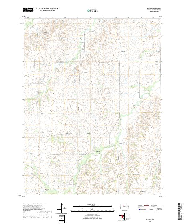 2022 Covert2022 Print · USGSOsborne County at the start of the 2020s remains a landscape of deeply-rooted rural settlements and section-line roads. Genealogists can locate the Covert Cem and Bristow Cem, or trace the winding paths of Kill Cr and Covert Cr.
 - 2022 Map of Cawker City, 2022 Print
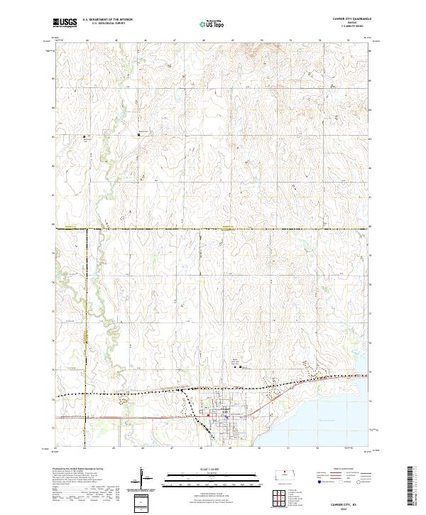 2022 Cawker City2022 Print · USGSCawker City sits at the edge of the expansive Waconda Lake in north-central Kansas. Genealogists and local historians can trace family roots through several local burial sites, including Rooker Cem, Prairie Grove Cem, and Reformed Cem.
 - 2022 Map of Osborne, 2022 Print
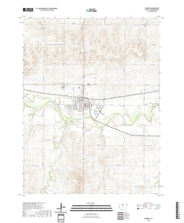 2022 Osborne2022 Print · USGSOsborne and the surrounding plains are detailed here in the 2020s, centered on the Solomon River valley. Genealogists can trace family sites at Bethany Center Cem or locate the historic Osborne County Courthouse.
 - 2022 Map of Paradise NW, 2022 Print
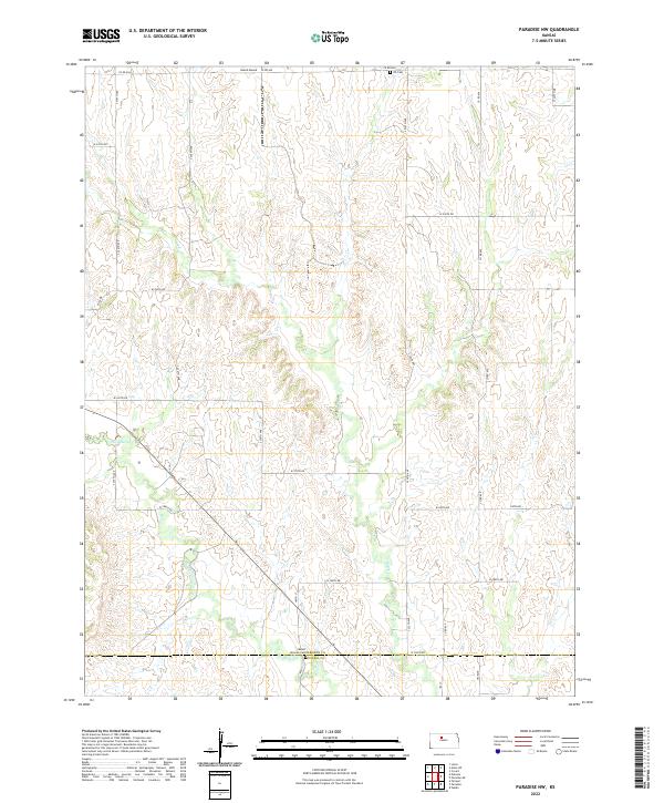 2022 Paradise NW2022 Print · USGSOsborne and Russell counties are captured in the twenty-first century, showing the enduring rural layout of the Kansas plains. Researchers can locate family burial sites at Mount Herman Cemetery or trace the drainage of Paradise Creek and Eagle Creek.
 - 2022 Map of Osborne SE, 2022 Print
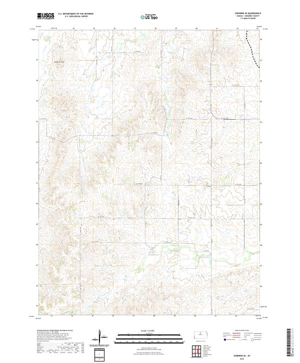 2022 Osborne SE2022 Print · USGSOsborne County remains a landscape of high prairie divides and deep creek valleys in the early twenty-first century. Researchers can trace the drainage patterns of Twin Cr and Carr Cr or locate specific sections near landmarks like Medicine Peak.
 - 2022 Map of Gaylord SW, 2022 Print
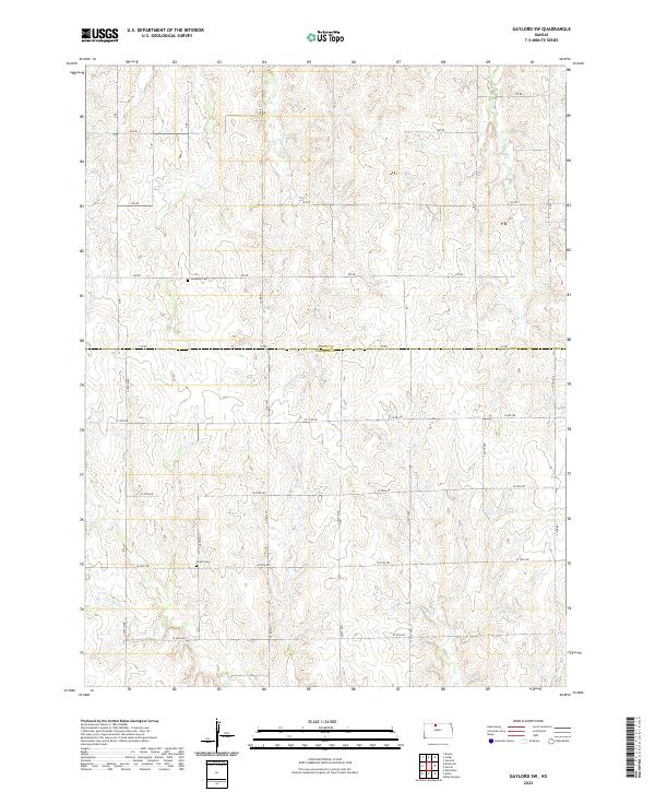 2022 Gaylord SW2022 Print · USGSThe Smith and Osborne County border comes into focus in this recent survey of North Central Kansas farm country. Genealogists and local historians can trace family roots through the sites of Leasburg Cem and Grant Cem along the banks of Glen Rock Cr.
 - 2022 Map of Meades Ranch, 2022 Print
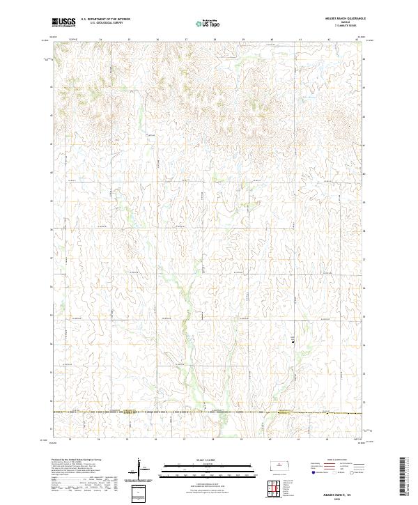 2022 Meades Ranch2022 Print · USGSOsborne and Russell counties remain defined by their rural section-line grids and creek-carved terrain in this recent survey. Researchers can locate the Delhi Cem and trace the drainage of E Fork Wolf Cr near landmarks like Lake Hobbie.
 - 2022 Map of Woodston, 2022 Print
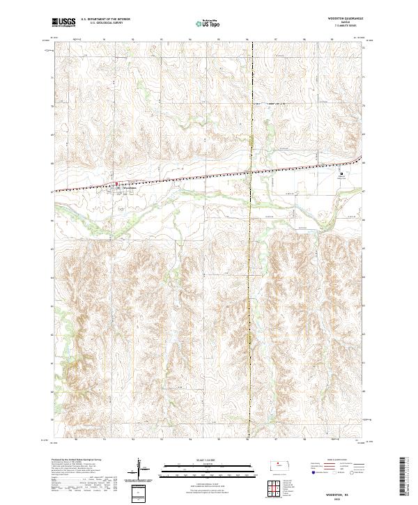 2022 Woodston2022 Print · USGSThe rural settlement of Woodston and the surrounding farmland of North Central Kansas are captured here in the early twenty-first century. Genealogists and local historians can trace family roots through Pleasant Valley Cem and the riverbanks of the S Fork Solomon River.
 - 2022 Map of Vincent, 2022 Print
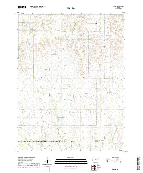 2022 Vincent2022 Print · USGSOsborne County farm country is mapped here during its modern agricultural era. Researchers can trace rural lineages through the Potterville Cem and Cheyenne Cem or locate the natural landmark of Cheyenne Gap.
 - 2022 Map of Kirwin SE, 2022 Print
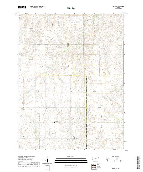 2022 Kirwin SE2022 Print · USGSFour Kansas counties converge in this rural agricultural landscape during the early twenty-first century. Genealogists and local historians can locate several family and community landmarks, such as Bohemian Cem, Ash Rock Cem, and the waters of Medicine Cr.
 - 2022 Map of Natoma, 2022 Print
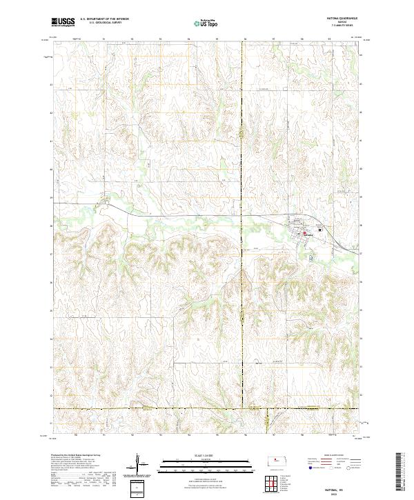 2022 Natoma2022 Print · USGSThe rural landscape around the town of Natoma appears in this contemporary survey where Osborne, Rooks, Ellis, and Russell counties meet. Genealogists can locate family sites near Natoma Cem or trace the geography of Paradise Cr and Mt Os.
 - 2022 Map of Tipton, 2022 Print
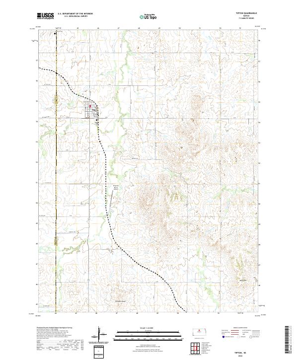 2022 Tipton2022 Print · USGSMitchell and Osborne counties appear here in the early 2020s, centered on the community of Tipton. Genealogists and local historians can trace the town's roots at Saint Boniface Cem and follow the paths of Carr Cr and Salt Cr.
 - 2022 Map of Alton, 2022 Print
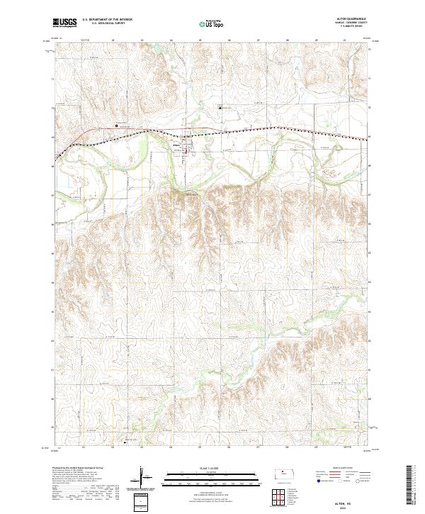 2022 Alton2022 Print · USGSThe Osborne County plains and the South Fork Solomon River valley are documented here in the early twenty-first century. Genealogists can locate family burial sites at Pioneer Cem, Sumner Cem, and Mount Ayr Cem near the town of Alton.
 - 2022 Map of Hunter, 2022 Print
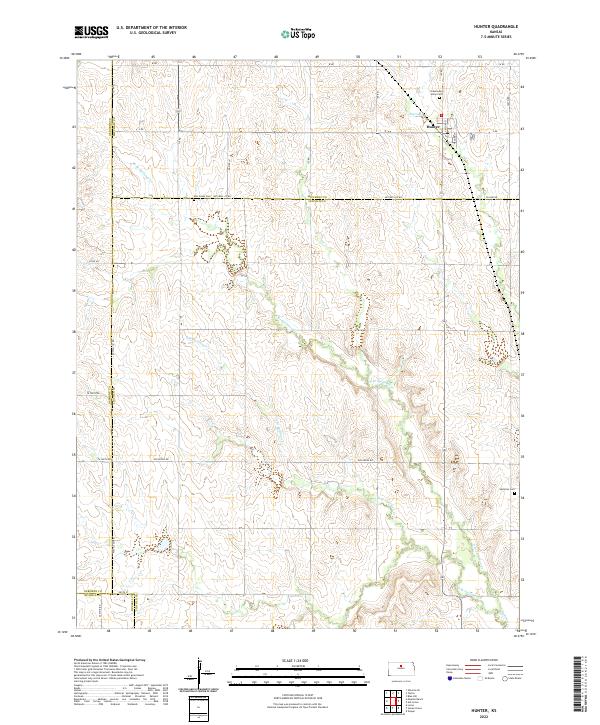 2022 Hunter2022 Print · USGSThe community of Hunter and the surrounding Mitchell County plains are documented here in the early twenty-first century. Researchers can trace local lineage at Greenwood Union Cem, Elm Creek Cem, and Spillman Cem near the winding N Br Spillman Cr.
End of results
Showing maps 1-24 of 24
Top cities of Osborne County
- Osborne historical maps
- Downs historical maps
- Natoma historical maps
- Portis historical maps
- Alton historical maps
- Corinth historical maps
See more
Frequently asked questions
- What are the different types of historical maps available for Osborne County?
- What is the oldest map of Osborne County?
- Where can I purchase historical maps of Osborne County for my home or office?
- Where can I download high-res historical maps of Osborne County?
- Are there historical topographic maps available for Osborne County?
- Is there historical aerial imagery available for Osborne County?
- Where are historical maps of Osborne County sourced from?