Old Maps of Osborne County, Kansas for Academic Research
Study the evolution of Osborne County with 156 high-resolution historic maps. Whether you're teaching, researching, or modeling changes in land use, these maps provide essential visual documentation of urban, environmental, and geographic change.
- Analyze long-term change: Track patterns in development, transportation, and natural features.
- Ideal for environmental or urban studies: Support academic projects with primary historical map data.
- Use in the classroom or lab: Educators and researchers rely on these maps to bring historical context to life.
These maps are a powerful tool for teaching, research, and visualizing how Osborne County has changed over the decades.
Osborne County, KS maps
(156)- 1893 Map of Smith Center
 1893 Smith Center1893 Print · USGSNorth-central Kansas emerges in the early 1890s as a landscape of grid-patterned townships and growing rail towns. Researchers can trace the early footprints of Smith Center and Lebanon or locate vanished points like Jacksonburg and Womer.3 unique versions available
 - 1893 Map of Phillipsburg
 1893 Phillipsburg1893 Print · USGSPhillips County was a burgeoning rail and river corridor in the 1890s, with three major railroads carving paths through the prairie townships. Genealogists and researchers can trace the early layouts of Phillipsburg, Kirwin, and Agra as they appeared before the turn of the century.4 unique versions available
 - 1894 Map of Mankato
 1894 Mankato1894 Print · USGSJewell and Mitchell Counties come into focus during the late nineteenth-century expansion of the Kansas rail network. Genealogists and historians can trace the early development of Mankato, Burr Oak, and Cawker along the vital lines of the Missouri Pacific Railway.4 unique versions available
 - 1894 Map of Beloit
 1894 Beloit1894 Print · USGSMitchell and Lincoln counties come alive in the 1890s as the railroad and river systems began to shape these Kansas prairie towns. Genealogists and researchers can trace early homesteads and rail-stop settlements like Denmark, Tipton, and the Rocky Hill Mill.3 unique versions available
 - 1896 Map of Osborne
 1896 Osborne1896 Print · USGSNorth Central Kansas in the late nineteenth century was a landscape of budding railroad towns and river-fed townships. Researchers can trace the early layout of Osborne and Luray, or locate vanished rural hubs like Corinth, Bristow, and the Meade Ranch.4 unique versions available
 - 1896 Map of Plainville
 1896 Plainville1896 Print · USGSThe Rooks County high plains are seen here in the 1890s as the rail networks expanded across the Solomon and Saline river valleys. Genealogists can trace family roots in early settlements like Plainville, Stockton, and the vanished site of Turkville.3 unique versions available
 - 1953 Map of Downs South
 1953 Downs South1953 Print · USGSOsborne County farming and transit are captured here in the early fifties, where the river and rail lines converge. Genealogists can locate family landmarks such as Iowa Cem and Cottonwood Sch along the South Fork Solomon River.3 unique versions available
 - 1953 Map of Waconda Springs, 1954 Print
 1953 Waconda Springs1954 Print · USGSMitchell County in the early fifties shows the Solomon River valley just before the landscape was transformed by reservoir construction. Genealogists and researchers can locate Waconda Springs, the St Peter and Paul Cem, and the rural Town Hall at the heart of Carr Creek.4 unique versions available
 - 1953 Map of Bloomington, 1954 Print
 1953 Bloomington1954 Print · USGSOsborne County in the early 1950s is defined by its rural schoolhouses and the winding South Fork Solomon River. Genealogists can trace family landmarks near Bloomington, including Mayview Sch and the United Brethren Ch.3 unique versions available
 - 1953 Map of Osborne, 1954 Print
 1953 Osborne1954 Print · USGSOsborne was a vital rail and river crossing in north-central Kansas during the early fifties. Local historians can trace family roots through sites like Bethany Center Cem and Mt Hope Sch or follow the lines of the Missouri Pacific railroad.3 unique versions available
 - 1953 Map of Woodston, 1954 Print
 1953 Woodston1954 Print · USGSThe town of Woodston and its surrounding townships are shown here in the early fifties, caught between the river and the rail line. Researchers can trace the mid-century footprint of local education and community at High Sch, Pleasant Valley Sch, and the Pleasant Valley Cem.2 unique versions available
 - 1953 Map of Alton, 1954 Print
 1953 Alton1954 Print · USGSOsborne County farm country is mapped here in the early fifties, centered on the riverfront town of Alton. Genealogists can trace early rural life through detailed landmarks like Mount Ayr Sch, Sumner Cem, and the Missouri Pacific rail line.3 unique versions available
 - 1955 Map of Beloit, 1971 Print
 1955 Beloit1971 Print · USGSNorth Central Kansas in the mid-fifties shows a landscape of river-valley agriculture and expanding water infrastructure. Genealogists can trace the rail lines of the Union Pacific through towns like Nicodemus, Cawker City, and the State Sanatorium.3 unique versions available
 - 1959 Map of Beloit
 1959 Beloit1959 Print · USGSNorth Central Kansas at mid-century reveals a landscape shaped by river valleys and the expansion of massive water reservoirs. Genealogists and historians can trace the rail-town connections of Beloit and Norton or locate the site of the new Webster Dam.3 unique versions available
 - 1960 Map of Downs North, 1962 Print
 1960 Downs North1962 Print · USGSThe Smith and Osborne County borderlands come to life in the early 1960s at the junction of the Solomon River forks. Researchers can locate vanished rural landmarks like Pleasant Ridge Sch, the settlement of Dispatch, and Rose Valley Ch.2 unique versions available
 - 1961 Map of Kirwin SE, 1962 Print
 1961 Kirwin SE1962 Print · USGSThe rural crossroads of Rooks, Phillips, Smith, and Osborne counties are captured here in the early sixties. Genealogists can locate family sites and rural landmarks like Bohemian Cem, Spring Branch Cem, and Ash Rock Sch 2.
 - 1961 Map of Portis, 1962 Print
 1961 Portis1962 Print · USGSThe Osborne County plains in the early sixties reveal a landscape of river-valley farming and rail transport. Genealogists can trace family landmarks like Fairview Cem and Garrett Cem near the North Fork Solomon River.
 - 1961 Map of Harlan, 1962 Print
 1961 Harlan1962 Print · USGSNorth central Kansas farmland is documented here in the early 1960s, showing the intricate water management along the North Fork Solomon River. Genealogists and local historians can locate the Harlan townsite, Butler Cem, and rural congregations like Mayflower Ch.
 - 1961 Map of Gaylord SW, 1962 Print
 1961 Gaylord SW1962 Print · USGSNorth-central Kansas in the early 1960s was a landscape of township divisions and rural stream valleys. Genealogists and local historians can trace family locations near Leasburg Cem, Grant Cem, and the waters of Glen Creek.
 - 1962 Map of Cawker City, 1963 Print
 1962 Cawker City1963 Print · USGSCawker City thrived as a rail and river hub during the early sixties, anchoring a landscape of small family farms and rural townships. Researchers can trace ancestral roots through several local burial grounds like Prairie Grove Cem and locate the historic Chandler Sch.3 unique versions available
 - 1967 Map of Hunter, 1969 Print
 1967 Hunter1969 Print · USGSThe rural plains of Mitchell and Lincoln counties are captured here in the late sixties, centered on the railroad town of Hunter. Genealogists and historians can trace local family landmarks such as Greenwood Union Cem, Spillman Cem, and the winding Bacon Creek.
 - 1978 Map of Natoma, 1979 Print
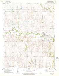 1978 Natoma1979 Print · USGSThe Kansas plains of the late seventies come alive on this sheet centered on the rail-side community of Natoma. Researchers can trace the legacy of local industry and genealogy through the Oil Field and landmarks like Conger Cem.
 - 1978 Map of Osborne SW, 1979 Print
 1978 Osborne SW1979 Print · USGSOsborne County farm country is mapped here in the late seventies, showing the township lines and creek beds of the Kansas prairie. Genealogists can locate Zimmerman Cem and trace the paths of Covert Creek and Twin Creek through the land.
 - 1978 Map of Paradise NW, 1979 Print
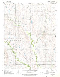 1978 Paradise NW1979 Print · USGSOsborne and Russell County lands appear in the late 1970s as a quiet expanse of prairie and energy production. Researchers can trace the path of the Union Pacific railroad or locate local landmarks like I X L Cem and the summit of Round Mound.
 - 1978 Map of Tipton, 1979 Print
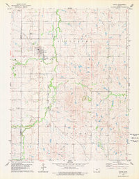 1978 Tipton1979 Print · USGSThe northern Kansas prairie around Tipton is captured here in the late seventies as the rail-and-ranching economy remained firmly in place. Genealogists can locate family plots at St Boniface Cem and Union Cem or trace the Atchison Topeka and Santa Fe line.
Showing maps 1-25 of 156
Top cities of Osborne County
- Osborne historical maps
- Downs historical maps
- Natoma historical maps
- Portis historical maps
- Alton historical maps
- Corinth historical maps
See more
Frequently asked questions
- What are the different types of historical maps available for Osborne County?
- What is the oldest map of Osborne County?
- Where can I purchase historical maps of Osborne County for my home or office?
- Where can I download high-res historical maps of Osborne County?
- Are there historical topographic maps available for Osborne County?
- Is there historical aerial imagery available for Osborne County?
- Where are historical maps of Osborne County sourced from?