1890s Maps of Reno County, Kansas
Explore 6 historic maps of Reno County from the 1890s. These maps offer a rare glimpse into what life looked like during the 1890s — showing old roads, neighborhoods, homes, and landmarks that have changed or disappeared over time.
Whether you're researching your family's past, planning a metal detecting trip, or studying how Reno County's landscape evolved across the 1890s, these high-resolution maps are a powerful tool for exploring the history of this region.
- Focus on a specific era: All maps on this page are from the 1890s, giving you a focused view of this time period.
- See what’s changed: Compare century-old streets, trails, and buildings to today's modern landscape using overlays and satellite layers.
- Research with precision: Use these maps for genealogy, historical research, land use analysis, or educational projects.
- View, download, or print: Maps are fully viewable online in high resolution, and can be downloaded or printed for your own records.
Start exploring Reno County's history through authentic maps from the 1890s. This is your window into the past.
Reno County, KS maps
(6)- 1891 Map of Hutchinson
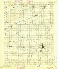
 1891 Hutchinson1891 Print · USGSCentral Kansas at the close of the frontier era was a landscape of burgeoning rail towns and organized townships. Genealogists and local historians can trace the early footprints of Hutchinson and Mc Pherson alongside vanished locales like King City and Aiken.
 - 1891 Map of Cheney
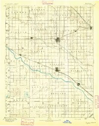
 1891 Cheney1891 Print · USGSKansas prairie life in the 1890s centered on the arrival of the rails and the flow of the rivers. Genealogists and historians can trace early post offices like Stella P.O. and Mona P.O. or follow the path of the Wichita and Western Railroad through Cheney.2 unique versions available
 - 1892 Map of Kingman
 1892 Kingman1892 Print · USGSKingman and the surrounding prairie were rapidly evolving in the late nineteenth century as multiple rail lines competed for the region's grain. Genealogists and historians can trace the early development of towns like Lerado, Arlington, and Penalosa alongside the South Fork Ninnescah River.
 - 1893 Map of Hutchinson
 1893 Hutchinson1893 Print · USGSCentral Kansas at the close of the nineteenth century reveals a landscape undergoing a total transformation through railroad expansion and township settlement. Genealogists can trace early homestead patterns and family-named districts like Lone Tree and Garden while locating vanished stops along the Missouri Pacific Railway.5 unique versions available
 - 1894 Map of Kingman
 1894 Kingman1894 Print · USGSKingman County and southern Reno County are captured during the peak of late-Victorian prairie expansion, when railroads first defined the local economy. Genealogists can trace family homesteads near vanished stops and early rail hubs like Lerado, Cunningham, and Oklahoma.4 unique versions available
 - 1894 Map of Lyons
 1894 Lyons1894 Print · USGSRice County during the late nineteenth-century rail boom shows a landscape organized by townships and expanding prairie towns. Researchers can trace the early development of Lyons and Sterling or locate vanished landmarks like Huntsville P.O. and the Black Marsh.5 unique versions available
End of results
Showing maps 1-6 of 6
Top cities of Reno County
- Hutchinson historical maps
- South Hutchinson historical maps
- Medora historical maps
- Buhler historical maps
- Haven historical maps
- Nickerson historical maps
See more
Frequently asked questions
- What are the different types of historical maps available for Reno County?
- What is the oldest map of Reno County?
- Where can I purchase historical maps of Reno County for my home or office?
- Where can I download high-res historical maps of Reno County?
- Are there historical topographic maps available for Reno County?
- Is there historical aerial imagery available for Reno County?
- Where are historical maps of Reno County sourced from?