1980s Maps of Reno County, Kansas
Explore 4 historic maps of Reno County from the 1980s. These maps offer a rare glimpse into what life looked like during the 1980s — showing old roads, neighborhoods, homes, and landmarks that have changed or disappeared over time.
Whether you're researching your family's past, planning a metal detecting trip, or studying how Reno County's landscape evolved across the 1980s, these high-resolution maps are a powerful tool for exploring the history of this region.
- Focus on a specific era: All maps on this page are from the 1980s, giving you a focused view of this time period.
- See what’s changed: Compare century-old streets, trails, and buildings to today's modern landscape using overlays and satellite layers.
- Research with precision: Use these maps for genealogy, historical research, land use analysis, or educational projects.
- View, download, or print: Maps are fully viewable online in high resolution, and can be downloaded or printed for your own records.
Start exploring Reno County's history through authentic maps from the 1980s. This is your window into the past.
Reno County, KS maps
(4)- 1985 Map of Great Bend
 1985 Great Bend1985 Print · USGSBarton and Rice counties come into focus during the mid-eighties as centers of rail transport and energy production. Genealogists and historians can trace the paths of the Atchison Topeka and Santa Fe through settlements like Ellinwood, Sterling, and Pawnee Rock.2 unique versions available
 - 1985 Map of Pratt
 1985 Pratt1985 Print · USGSMid-1980s South Central Kansas is captured here as a landscape of rail-connected farming towns and energy fields. Researchers can trace the Old Indian Treaty Boundary or locate local landmarks like Walnut Hill Cemetery and the State Fish Hatchery.2 unique versions available
 - 1985 Map of Wichita
 1985 Wichita1985 Print · USGSThe mid-1980s landscape of the Wichita metro area is captured here during a peak era for the local aviation industry. Researchers can trace the sprawling rail network of the Santa Fe and Frisco or locate family landmarks at White Chapel Cem and Cheney Reservoir.
 - 1985 Map of Hutchinson
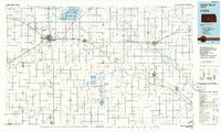
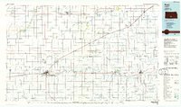
 1985 Hutchinson1985 Print · USGSCentral Kansas in the mid-1980s is revealed here as a landscape of productive plains, rail corridors, and growing college towns. Genealogists and historians can trace family plots at McPherson Cemetery and follow the routes of the Missouri Pacific through settlements like Moundridge and Hesston.2 unique versions available
End of results
Showing maps 1-4 of 4
Top cities of Reno County
- Hutchinson historical maps
- South Hutchinson historical maps
- Medora historical maps
- Buhler historical maps
- Haven historical maps
- Nickerson historical maps
See more
Frequently asked questions
- What are the different types of historical maps available for Reno County?
- What is the oldest map of Reno County?
- Where can I purchase historical maps of Reno County for my home or office?
- Where can I download high-res historical maps of Reno County?
- Are there historical topographic maps available for Reno County?
- Is there historical aerial imagery available for Reno County?
- Where are historical maps of Reno County sourced from?