Old Maps of Reno County, Kansas for Genealogy
Trace your family roots with 232 historic maps of Reno County. These high-res maps reveal old neighborhoods, homesites, landmarks, and streets — helping you uncover where your ancestors lived and how the area evolved over time.
- Explore historic neighborhoods: Identify where your relatives may have lived in the 1800s or 1900s.
- Compare maps over time: Trace the changes in streets, buildings, and landmarks for multi-generational research.
- Perfect for genealogy & ancestry research: Used by family historians and researchers to map out lineage and migration.
These maps are an incredible resource for exploring your personal connection to Reno County's past.
Reno County, KS maps
(232)- 1889 Map of Cheney
 1889 Cheney1889 Print · USGSSouthern Kansas in the late nineteenth century was a landscape of emerging rail towns and river crossings. Genealogists and historians can trace early post offices like Waterloo P.O. and Ost P.O. alongside established hubs like Cheney and Mt. Hope.2 unique versions available
 - 1891 Map of Hutchinson
 1891 Hutchinson1891 Print · USGSCentral Kansas at the close of the frontier era was a landscape of burgeoning rail towns and organized townships. Genealogists and local historians can trace the early footprints of Hutchinson and Mc Pherson alongside vanished locales like King City and Aiken.
 - 1891 Map of Cheney
 1891 Cheney1891 Print · USGSKansas prairie life in the 1890s centered on the arrival of the rails and the flow of the rivers. Genealogists and historians can trace early post offices like Stella P.O. and Mona P.O. or follow the path of the Wichita and Western Railroad through Cheney.2 unique versions available
 - 1892 Map of Kingman
 1892 Kingman1892 Print · USGSKingman and the surrounding prairie were rapidly evolving in the late nineteenth century as multiple rail lines competed for the region's grain. Genealogists and historians can trace the early development of towns like Lerado, Arlington, and Penalosa alongside the South Fork Ninnescah River.
 - 1893 Map of Hutchinson
 1893 Hutchinson1893 Print · USGSCentral Kansas at the close of the nineteenth century reveals a landscape undergoing a total transformation through railroad expansion and township settlement. Genealogists can trace early homestead patterns and family-named districts like Lone Tree and Garden while locating vanished stops along the Missouri Pacific Railway.5 unique versions available
 - 1894 Map of Kingman
 1894 Kingman1894 Print · USGSKingman County and southern Reno County are captured during the peak of late-Victorian prairie expansion, when railroads first defined the local economy. Genealogists can trace family homesteads near vanished stops and early rail hubs like Lerado, Cunningham, and Oklahoma.4 unique versions available
 - 1894 Map of Lyons
 1894 Lyons1894 Print · USGSRice County during the late nineteenth-century rail boom shows a landscape organized by townships and expanding prairie towns. Researchers can trace the early development of Lyons and Sterling or locate vanished landmarks like Huntsville P.O. and the Black Marsh.5 unique versions available
 - 1901 Map of Cheney, 1910 Print
 1901 Cheney1910 Print · USGSSouth Central Kansas was a landscape of budding rail towns and rural post offices at the turn of the century. Genealogists can trace family roots through now-vanished locales like Stella P.O. and Mona P.O. or early hubs like Cheney and Mt. Hope.2 unique versions available
 - 1955 Map of Wichita, 1959 Print
 1955 Wichita1959 Print · USGSSouth-central Kansas comes alive in the mid-1950s as Wichita grows into its role as a regional industrial and military powerhouse. Trace the rail-and-river network connecting El Dorado and Arkansas City through the Atchison Topeka and Santa Fe lines.3 unique versions available
 - 1955 Map of Great Bend, 1966 Print
 1955 Great Bend1966 Print · USGSCentral Kansas during the mid-sixties transition reveals a landscape defined by new reservoirs and enduring rail corridors. Researchers can trace the development of towns like Hays and Great Bend or locate natural landmarks such as Round Mound and the wetlands of the Quivira National Wildlife Refuge.3 unique versions available
 - 1955 Map of Hutchinson, 1967 Print
 1955 Hutchinson1967 Print · USGSCentral Kansas in the mid-sixties reveals a landscape of growing reservoirs and evolving transportation corridors. Trace the development of towns like Hutchinson and Abilene alongside the Union Pacific Railroad and the expanding Interstate 70.3 unique versions available
 - 1955 Map of Pratt, 1968 Print
 1955 Pratt1968 Print · USGSSouth-central Kansas during the mid-fifties presents a landscape of sprawling oil fields and critical rail junctions. Researchers can trace the paths of the Atchison Topeka and Santa Fe railroad or locate local landmarks like the Blue Ridge Community House and Camp Carlisle.3 unique versions available
 - 1957 Map of Great Bend
 1957 Great Bend1957 Print · USGSCentral Kansas at the peak of the postwar era shows a landscape of growing rail hubs and massive new water projects. Trace the routes of the Union Pacific through Hays or locate the newly formed shorelines of Cedar Bluff Reservoir and Kanopolis Reservoir.
 - 1958 Map of Wichita
 1958 Wichita1958 Print · USGSSouth Central Kansas in the late fifties was a landscape of aviation industry, oil exploration, and expanding turnpikes. Researchers can trace mid-century growth through McConnell Air Force Base, major facilities for Cessna Aircraft Company, and the active El Dorado Oil Field.
 - 1958 Map of Great Bend
 1958 Great Bend1958 Print · USGSCentral Kansas in the late fifties reveals a landscape of high-plains agriculture and vital river crossings. Researchers can trace the development of regional hubs like Hays and Russell, or locate historic sites such as Fort Larned and the Cheyenne Bottoms wildlife area.2 unique versions available
 - 1958 Map of Patterson, 1959 Print
 1958 Patterson1959 Print · USGSIn the late fifties, this Harvey County landscape centered on the rail junction at Patterson and the flood-controlled banks of the Arkansas River. Genealogists can locate several local burial grounds including Township Cem, Hunt Cem, and Star Cem.2 unique versions available
 - 1959 Map of Hutchinson
 1959 Hutchinson1959 Print · USGSCentral Kansas thrives at the intersection of rail and river in the mid-1950s, as post-war aviation infrastructure reshapes the prairie. Genealogists and historians can trace the paths of the AT&SF RR through Newton and Hutchinson, or locate military sites like Smoky Hill Air Force Base.2 unique versions available
 - 1959 Map of Pratt
 1959 Pratt1959 Print · USGSSouth-central Kansas thrived as a rail and agricultural hub in the late fifties, where the Arkansas River meets a vast grid of section roads. Researchers can trace the path of the Missouri Pacific railroad through settlements like Turon and Stafford, or locate family landmarks like the Prairie Oak School.2 unique versions available
 - 1959 Map of Burrton, 1960 Print
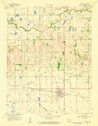 1959 Burrton1960 Print · USGSMid-century Burrton serves as a central hub for Kansas rail and energy development during the late fifties. Genealogists and local historians can locate early rural schools such as Lily Dale Sch and Willis Sch, or trace the path of the Atchison Topeka and Santa Fe railroad.
 - 1959 Map of Mount Hope, 1960 Print
 1959 Mount Hope1960 Print · USGSThe Kansas prairie south of the Arkansas River is captured here in the late fifties, showing the rural grid just as modern industrial features began to appear. Researchers can trace the Old Indian Boundary, locate early Oil Wells, and explore the rail-side layouts of Mount Hope and Andale.2 unique versions available
 - 1960 Map of Yaggy, 1961 Print
 1960 Yaggy1961 Print · USGSReno County's agricultural heartland is documented here at the start of the 1960s, showing a landscape shaped by the Arkansas River and several major railroads. Genealogists and historians can locate old rural schools like Centennial Sch and trace the paths of the Missouri Pacific and other historic rail lines.3 unique versions available
 - 1960 Map of Hutchinson, 1961 Print
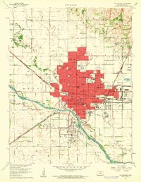 1960 Hutchinson1961 Print · USGSHutchinson and the Arkansas River valley appear in the early sixties as a bustling rail and industrial center. Researchers can trace dozens of local landmarks, including the State Fairground, the city Reformatory, and Fairlawn Cemetery.2 unique versions available
 - 1961 Map of Haven, 1962 Print
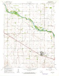 1961 Haven1962 Print · USGSReno County's agricultural and industrial landscape is captured here in the early sixties, centered on the vital Arkansas River corridor. Researchers can trace family history at the Mennonite Cem or follow the Missouri Pacific rails past Yoder and Haven.
 - 1961 Map of Hutchinson SE, 1962 Print
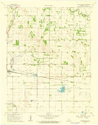 1961 Hutchinson SE1962 Print · USGSSoutheast of Hutchinson in the early sixties, the Kansas prairie was a crossroads of major rail lines and emerging aviation. Trace the vanished local footprints of Obeeville, Kent, and Punkin Center alongside the shores of Brandy Lake.2 unique versions available
 - 1961 Map of Elmer, 1963 Print
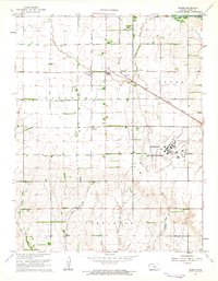 1961 Elmer1963 Print · USGSReno County during the early sixties is characterized by the significant presence of the Hutchinson Air Force Station and a busy rail network. Researchers can trace the intersection of two major railroads and locate rural landmarks like Cruppers Corner, Fairview Cem, and Darlow.
Showing maps 1-25 of 232
Top cities of Reno County
- Hutchinson historical maps
- South Hutchinson historical maps
- Medora historical maps
- Buhler historical maps
- Haven historical maps
- Nickerson historical maps
See more
Frequently asked questions
- What are the different types of historical maps available for Reno County?
- What is the oldest map of Reno County?
- Where can I purchase historical maps of Reno County for my home or office?
- Where can I download high-res historical maps of Reno County?
- Are there historical topographic maps available for Reno County?
- Is there historical aerial imagery available for Reno County?
- Where are historical maps of Reno County sourced from?