1980s Maps of Riley County, Kansas
Explore 9 historic maps of Riley County from the 1980s. These maps offer a rare glimpse into what life looked like during the 1980s — showing old roads, neighborhoods, homes, and landmarks that have changed or disappeared over time.
Whether you're researching your family's past, planning a metal detecting trip, or studying how Riley County's landscape evolved across the 1980s, these high-resolution maps are a powerful tool for exploring the history of this region.
- Focus on a specific era: All maps on this page are from the 1980s, giving you a focused view of this time period.
- See what’s changed: Compare century-old streets, trails, and buildings to today's modern landscape using overlays and satellite layers.
- Research with precision: Use these maps for genealogy, historical research, land use analysis, or educational projects.
- View, download, or print: Maps are fully viewable online in high resolution, and can be downloaded or printed for your own records.
Start exploring Riley County's history through authentic maps from the 1980s. This is your window into the past.
Riley County, KS maps
(9)- 1982 Map of Keats
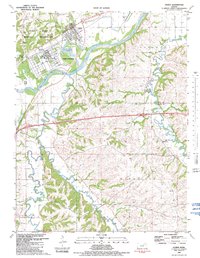
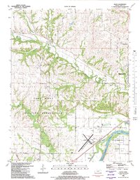 1982 Keats1982 Print · USGSThe rural uplands of Riley County and the edges of the military reservation are captured here in the early eighties. Genealogists and local researchers can trace the Union Pacific corridor and find established landmarks like Vinton School, Rebekah Cem, and the old Ashland Bottoms river lands.
 - 1982 Map of Manhattan
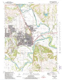 1982 Manhattan1982 Print · USGSManhattan and the surrounding Riley County river valleys appear in high detail during the early eighties. Genealogists and historians can locate Kansas State University, the Union Pacific tracks, and family markers at Sunrise Cem.
 - 1982 Map of Fort Riley NE
 1982 Fort Riley NE1982 Print · USGSNortheastern Kansas in the early eighties reveals the extensive training grounds and local settlements flanking the base. Researchers can locate family landmarks like Shanks Cem and Vinton Cem or trace the path of the Old Military Road.
 - 1982 Map of Milford
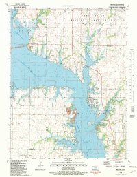 1982 Milford1982 Print · USGSMilford and the Republican River valley are shown here in the early eighties as a hub for both military operations and lakeside recreation. Researchers can trace the boundaries of the Fort Riley Military Reservation and locate local landmarks like the Milford Cem and Fragrant Hill.
 - 1982 Map of Junction City
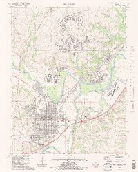 1982 Junction City1982 Print · USGSJunction City and the surrounding river forks appear in the early 1980s as a vital military and transport hub. Genealogists and historians can trace neighborhood growth alongside Fort Riley and locate landmarks like St Marys Cem and the Union Pacific line.2 unique versions available
 - 1982 Map of Ogden
 1982 Ogden1982 Print · USGSThe military and river history of Riley and Geary Counties comes alive in the early eighties. Researchers can trace the infrastructure of Camp Funston and find local family landmarks like Berry Sch, Fairview Cem, and Whiskey Lake.
 - 1982 Map of Swede Creek
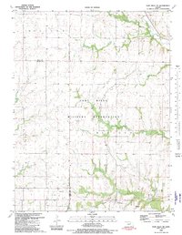
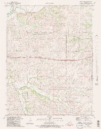 1982 Swede Creek1982 Print · USGSThe Flint Hills region of Kansas is shown in the early eighties as the tallgrass prairie ecosystem is preserved and studied. Researchers can trace rural life through the Ashland Cem, the McDowell Creek Sch, and the Briggs Cem.2 unique versions available
 - 1985 Map of Manhattan, 1986 Print
 1985 Manhattan1986 Print · USGSThe Flint Hills and Kansas River valley are captured in the mid-eighties, showing the growth of Manhattan alongside major military and ecological preserves. Trace local history through the Union Pacific rail lines, the Treaty Boundary, and the infrastructure of Fort Riley.
 - 1986 Map of Blue Rapids
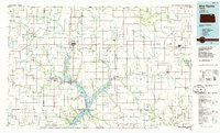 1986 Blue Rapids1986 Print · USGSNortheast Kansas in the mid-eighties was a landscape of river-valley towns and steady rail lines. Researchers can trace family ties and early settlements from Hollenberg and Marysville down to the shores of Tuttle Creek Lake and the Big Blue River.2 unique versions available
End of results
Showing maps 1-9 of 9
Top cities of Riley County
- Manhattan historical maps
- Ogden historical maps
- Riley historical maps
- Bala historical maps
- Leonardville historical maps
- Zeandale historical maps
See more
Frequently asked questions
- What are the different types of historical maps available for Riley County?
- What is the oldest map of Riley County?
- Where can I purchase historical maps of Riley County for my home or office?
- Where can I download high-res historical maps of Riley County?
- Are there historical topographic maps available for Riley County?
- Is there historical aerial imagery available for Riley County?
- Where are historical maps of Riley County sourced from?