1970s Maps of Seward County, Kansas
Explore 11 historic maps of Seward County from the 1970s. These maps offer a rare glimpse into what life looked like during the 1970s — showing old roads, neighborhoods, homes, and landmarks that have changed or disappeared over time.
Whether you're researching your family's past, planning a metal detecting trip, or studying how Seward County's landscape evolved across the 1970s, these high-resolution maps are a powerful tool for exploring the history of this region.
- Focus on a specific era: All maps on this page are from the 1970s, giving you a focused view of this time period.
- See what’s changed: Compare century-old streets, trails, and buildings to today's modern landscape using overlays and satellite layers.
- Research with precision: Use these maps for genealogy, historical research, land use analysis, or educational projects.
- View, download, or print: Maps are fully viewable online in high resolution, and can be downloaded or printed for your own records.
Start exploring Seward County's history through authentic maps from the 1970s. This is your window into the past.
Seward County, KS maps
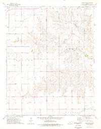
(11)- 1971 Map of Liberal
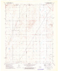
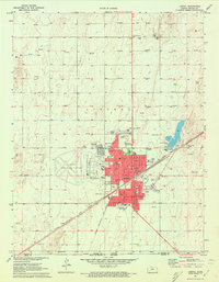 1971 Liberal1971 Print · USGSLiberal flourished as a Kansas energy and transit hub in the early seventies, where the railroad met a vast field of natural gas wells. Genealogists and historians can locate specific neighborhood landmarks like St Anthonys Sch, the Liberal Memorial Cem, and the Chicago Rock Island and Pacific rail lines.3 unique versions available
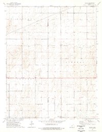
 - 1971 Map of Kismet, 1973 Print
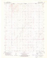
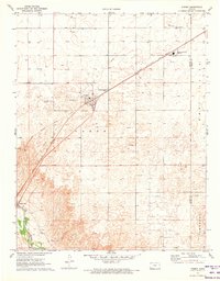 1971 Kismet1973 Print · USGSThe High Plains of Seward County are shown here in the early 1970s, as the energy economy transformed the local landscape. Genealogists and researchers can trace the rail corridor of the Chicago Rock Island and Pacific, locate the South Western Heights High Sch, and see the early footprint of Kismet.
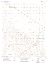
 - 1971 Map of Kismet SW, 1973 Print
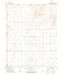
 1971 Kismet SW1973 Print · USGSSeward County, Kansas, is captured in the early 1970s as an active energy landscape centered on the Cimarron River. Researchers can trace old family burial sites at Bixler Cem and locate the numerous Oil Wells that defined the local economy.
 - 1971 Map of Hayne, 1973 Print
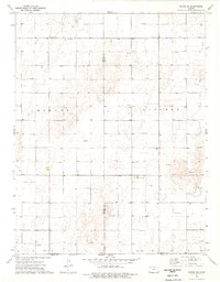
 1971 Hayne1973 Print · USGSThe Kansas-Oklahoma border comes alive in the early seventies, showing the industrial heart of the southern High Plains. Researchers can trace the Chicago Rock Island and Pacific rail line through Hayne and locate numerous wells in the Liberal Gas Field.
 - 1973 Map of Little Ponderosa, 1976 Print
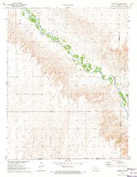
 1973 Little Ponderosa1976 Print · USGSThe High Plains borderlands of Oklahoma and Kansas are captured in the early seventies, showing a landscape shaped by natural gas and rail. Researchers can locate the Independence Cem and trace the path of the Chicago Rock Island and Pacific railroad near Little Ponderosa.
 - 1973 Map of Beaver NW, 1976 Print
 1973 Beaver NW1976 Print · USGSThe Oklahoma Panhandle frontier meets the Kansas border in the early seventies, capturing a landscape of ranching and early energy development. Genealogists and local historians can locate Midway Cem, Bethel Ch, and the extensive L T Ranch.
 - 1973 Map of Turpin NE, 1976 Print
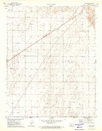
 1973 Turpin NE1976 Print · USGSThe Oklahoma-Kansas state line meets the High Plains in the early seventies, a time when the energy industry was reshaping the local landscape. Genealogists and historians can locate rural landmarks like Union Cem, Turpin Cem, and the settlement of Little Ponderosa.
 - 1974 Map of Woods SE, 1976 Print
 1974 Woods SE1976 Print · USGSThe Kansas-Oklahoma border comes alive in the mid-1970s, showcasing a landscape defined by ranching and energy extraction. Genealogists and historians can locate Dewey and the Community Hall among a vast network of Gas Well and Oil Well sites.
 - 1974 Map of Moscow SE, 1976 Print
 1974 Moscow SE1976 Print · USGSSeward and Stevens counties appear here during the mid-1970s, showcasing a landscape shaped by the Cimarron River and energy production. Researchers can trace land use through detailed field lines or locate local landmarks like Golden Plains Cem and the northern Compressor Station.
 - 1974 Map of Woods, 1976 Print
 1974 Woods1976 Print · USGSSeward and Stevens Counties in the mid-1970s show a landscape shaped by rural community and energy production. Researchers can trace the layout of the settlement at Woods, find the Lone Star Ch, and locate the Pleasant Valley Community Hall.
 - 1975 Map of Ryus, 1976 Print
 1975 Ryus1976 Print · USGSHaskell County's high plains landscape is captured in the mid-seventies, showing a region where the energy industry meets the Cimarron River. Researchers can trace the industrial footprint of the era through the Ryus settlement, the Oil and Gas Field, and the Atchison Topeka and Santa Fe railroad.
End of results
Showing maps 1-11 of 11
Top cities of Seward County
Frequently asked questions
- What are the different types of historical maps available for Seward County?
- What is the oldest map of Seward County?
- Where can I purchase historical maps of Seward County for my home or office?
- Where can I download high-res historical maps of Seward County?
- Are there historical topographic maps available for Seward County?
- Is there historical aerial imagery available for Seward County?
- Where are historical maps of Seward County sourced from?