2020s Maps of Shawnee County, Kansas
Explore 18 historic maps of Shawnee County from the 2020s. These maps offer a rare glimpse into what life looked like during the 2020s — showing old roads, neighborhoods, homes, and landmarks that have changed or disappeared over time.
Whether you're researching your family's past, planning a metal detecting trip, or studying how Shawnee County's landscape evolved across the 2020s, these high-resolution maps are a powerful tool for exploring the history of this region.
- Focus on a specific era: All maps on this page are from the 2020s, giving you a focused view of this time period.
- See what’s changed: Compare century-old streets, trails, and buildings to today's modern landscape using overlays and satellite layers.
- Research with precision: Use these maps for genealogy, historical research, land use analysis, or educational projects.
- View, download, or print: Maps are fully viewable online in high resolution, and can be downloaded or printed for your own records.
Start exploring Shawnee County's history through authentic maps from the 2020s. This is your window into the past.
Shawnee County, KS maps
(18)- 2022 Map of Auburn, 2022 Print
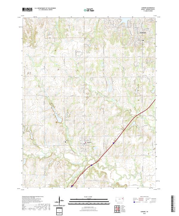 2022 Auburn2022 Print · USGSAuburn and the southwestern edge of the state capital area are mapped here as the suburbs meet the Kansas river valleys. Researchers can locate family sites near Auburn Cem and Elevation Cem or trace the winding course of the Wakarusa River.
 - 2022 Map of Richland, 2022 Print
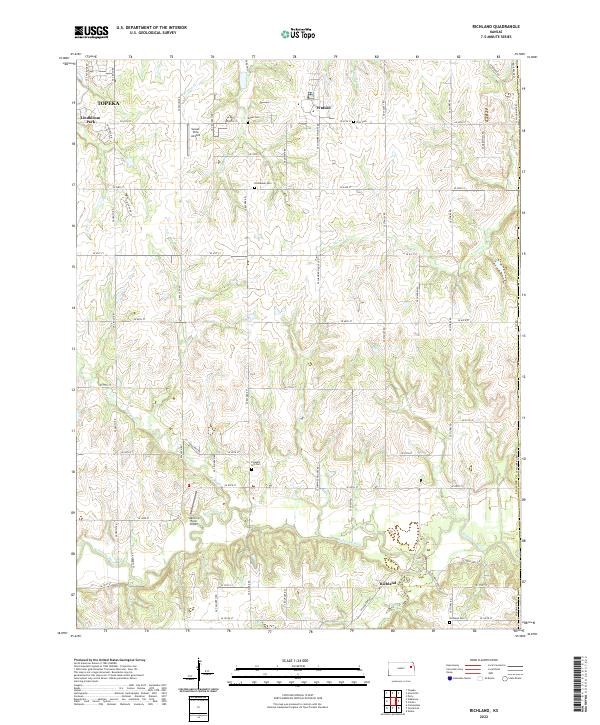 2022 Richland2022 Print · USGSSoutheast of Topeka in the early 2020s, the rural character of Shawnee County remains defined by the winding Wakarusa River. Local historians can trace family roots through several landmarks including Richland Cem, Watson, and the small Richland settlement.
 - 2022 Map of Dover, 2022 Print
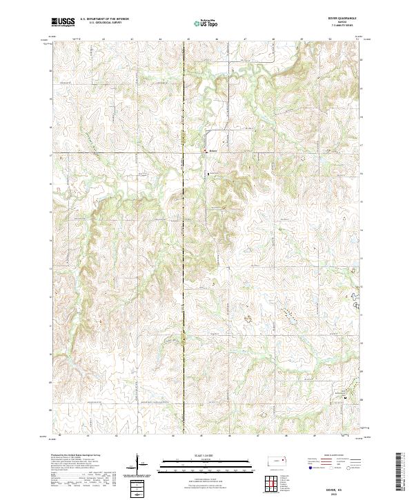 2022 Dover2022 Print · USGSThe area surrounding Dover in the early twenty-first century remains defined by its deep prairie drainages and quiet rural crossroads. Genealogists and local historians can trace family locations near the Dover Cem or follow the path of the Wakarusa River across the county line.
 - 2022 Map of Harveyville, 2022 Print
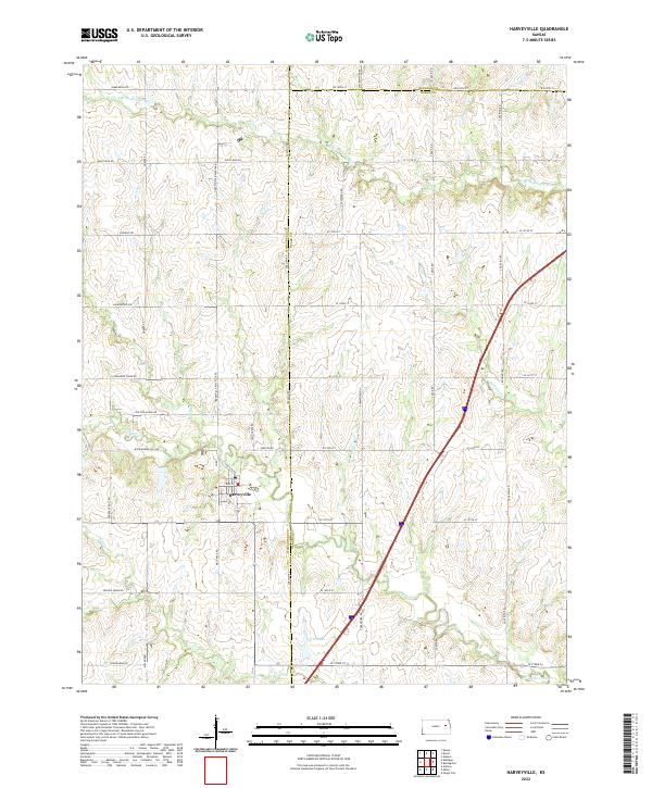 2022 Harveyville2022 Print · USGSThis part of eastern Kansas showcases the rural intersection of Wabaunsee, Osage, and Shawnee counties in the early twenty-first century. Genealogists and local historians can trace the landscape around Harveyville and find family-named landmarks like Smith Lake and Old Log House Rd.
 - 2022 Map of Burlingame, 2022 Print
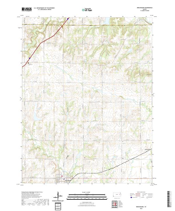 2022 Burlingame2022 Print · USGSThe borderlands of Osage and Shawnee counties are revealed here in the early twenty-first century, featuring the rural centers of Burlingame and Scranton. Genealogists and historians can trace the landscape around Prairie Center Cem and the drainages of Switzler Cr and the Wakarusa River.
 - 2022 Map of Overbrook, 2022 Print
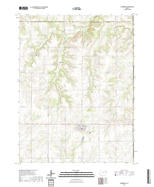 2022 Overbrook2022 Print · USGSOsage and Shawnee counties meet in this 2022 survey of the Kansas prairie, centered on the growing community of Overbrook. Researchers can trace family sites near Ridgeway Cemetery or follow the drainage of Elk Creek and Valley Brook across the grid.
 - 2022 Map of Wakarusa, 2022 Print
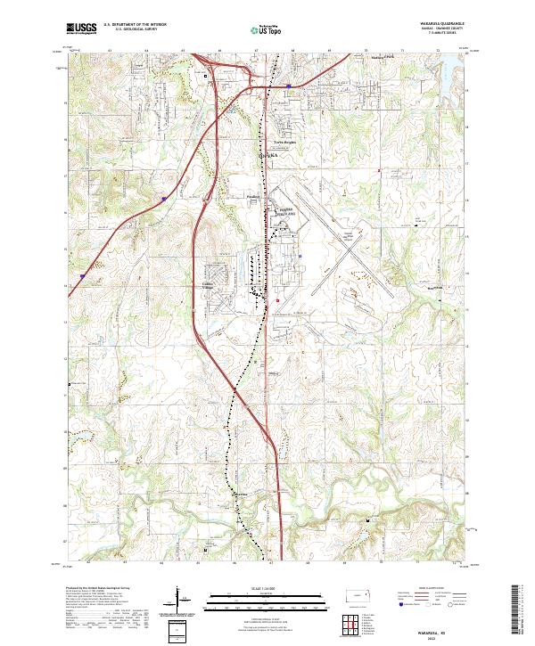 2022 Wakarusa2022 Print · USGSSouthern Shawnee County at the start of the 2020s shows the transition from the capital's suburban growth to the river lowlands. Researchers can locate several historic burial sites like Foster Cem and Lynn Creek Cem near the Wakarusa River.
 - 2022 Map of Elmont, 2022 Print
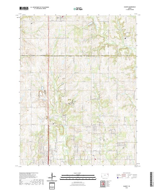 2022 Elmont2022 Print · USGSNortheast Kansas at the junction of Jackson and Shawnee Counties reveals a landscape of quiet rural communities and prairie stream valleys. Genealogists and historians can locate legacy burial sites including Half Day Cem and Steward Cem or trace the winding course of Halfday Cr.
 - 2022 Map of Maple Hill, 2022 Print
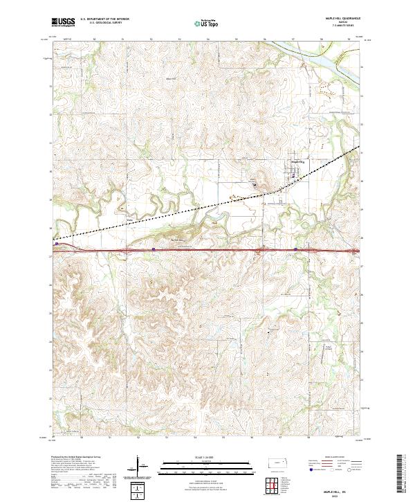 2022 Maple Hill2022 Print · USGSWabaunsee County enters the twenty-first century as a landscape of cattle ranches and creek valleys near the Kansas River. Genealogists and local historians can locate Maple Hill Cemetery, trace the path of Mill Creek, and find landmarks like Buffalo Mound.
 - 2022 Map of Meriden, 2022 Print
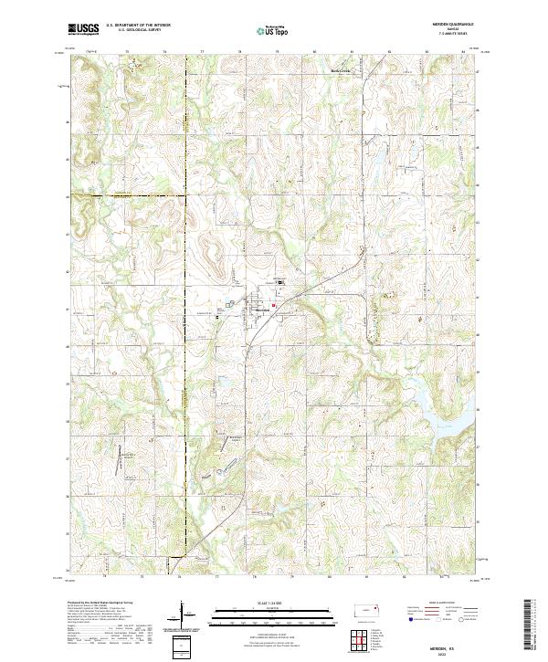 2022 Meriden2022 Print · USGSMeriden and its rural surroundings are captured here in the early twenty-first century, showcasing the township's intersection of farm roads and drainage basins. Researchers can trace local heritage at Saint Aloysius Cem or locate the Blackhawk Airport and Buena Terra Airport landing strips.
 - 2022 Map of Grove, 2022 Print
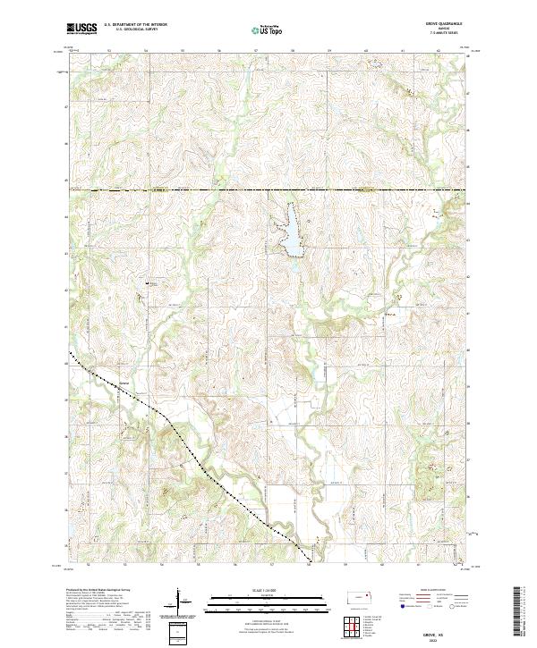 2022 Grove2022 Print · USGSThe rural border of Jackson and Shawnee counties comes into focus during the early 2020s, showing a landscape defined by prairie agriculture and prairie streams. Genealogists and local historians can locate the Grove settlement and Walnut Hill Cemetery near the banks of Soldier Creek.
 - 2022 Map of Saint Marys, 2022 Print
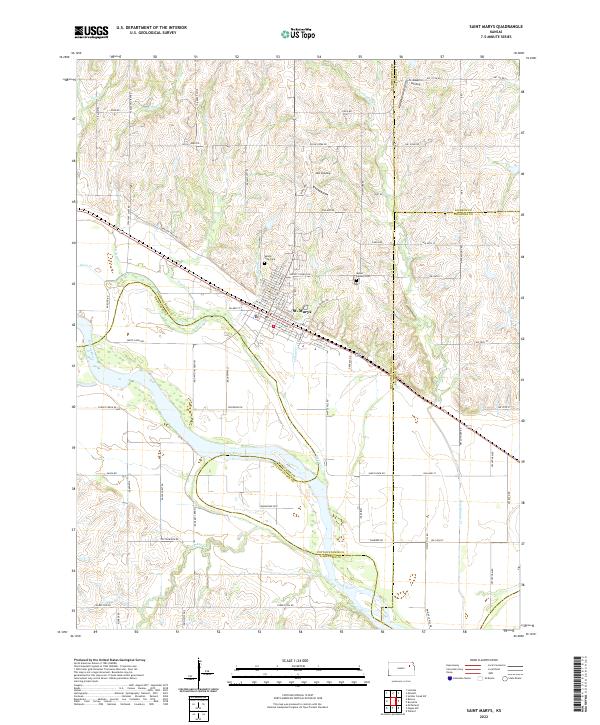 2022 Saint Marys2022 Print · USGSNear the convergence of Pottawatomie, Shawnee, and Jackson counties, this area reflects a landscape shaped by the Kansas River and historic pioneer routes. Genealogists and local researchers can locate Valley View Cem, trace the path of Oregon Trail Rd, and explore river access points like JMJ Landing.
 - 2022 Map of Rossville, 2022 Print
 2022 Rossville2022 Print · USGSThe Kansas prairie north of the Kaw River comes into focus in this recent survey of the Shawnee and Jackson county borderlands. Genealogists can locate family sites near Rossville and Delia, or trace ancestral plots at the Czech - Moravian Cem and Olive Branch Cem.
 - 2022 Map of Carbondale, 2022 Print
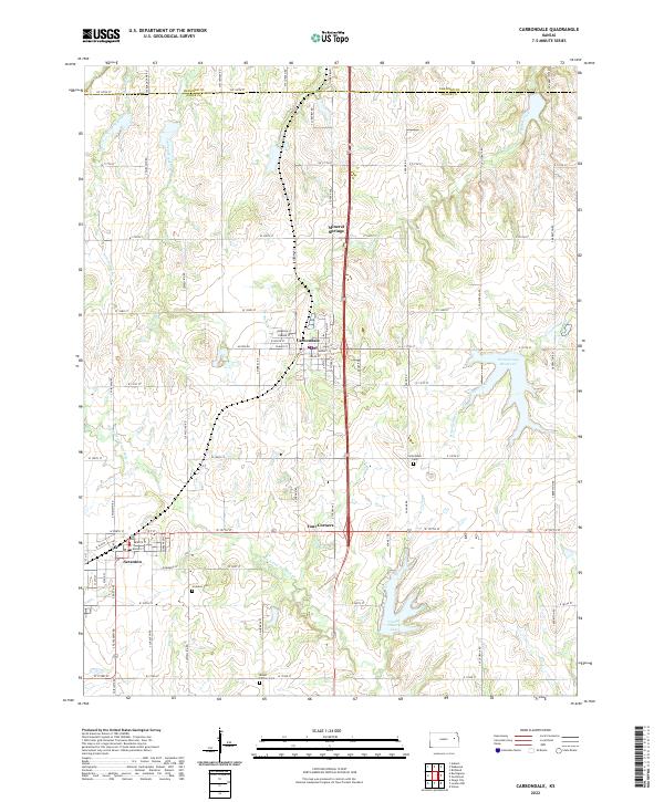 2022 Carbondale2022 Print · USGSOsage and Shawnee counties meet in this 2022 survey of central Kansas, centered on the growing corridor between Topeka and Carbondale. Genealogists and local historians can trace the town layouts of Scranton and Carbondale, along with landmarks like Carbondale Cem and Osage County Lake.
 - 2022 Map of Grantville, 2022 Print
 2022 Grantville2022 Print · USGSNear the bend of the Kansas River, this survey captures the rural character of Jefferson and Shawnee counties in the early twenty-first century. Genealogists can trace family burial sites at Old Grantville Cemetery and Bethel Cemetery while exploring the crossroads of Tecumseh and Grantville.
 - 2022 Map of Willard, 2022 Print
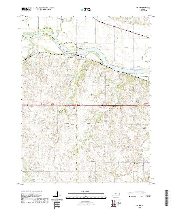 2022 Willard2022 Print · USGSThe Kansas River valley comes into focus in this recent survey, showing the rural communities of Willard and Valencia. Researchers can locate family landmarks like Uniontown Cem and trace the paths of Mission Creek and Post Cr.
 - 2022 Map of Topeka, 2022 Print
 2022 Topeka2022 Print · USGSTopeka at the start of the 2020s shows a capital city deeply tied to its civic landmarks and the path of the Kansas River. Researchers can trace historic neighborhoods and critical sites like the Brown v. Board of Education National Historic Site, Washburn University, and the Topeka Cemetery.
 - 2022 Map of Silver Lake, 2022 Print
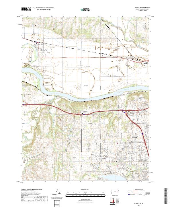 2022 Silver Lake2022 Print · USGSShawnee County in the 2020s shows the continued growth of the Topeka area alongside its deep agricultural roots. Researchers can trace family history at Silver Lake Cem and Mission Center Cem or follow the path of the Kansas River past Kiro and Hickory Knob.
End of results
Showing maps 1-18 of 18
Top cities of Shawnee County
- Topeka historical maps
- Dover historical maps
- Menoken historical maps
- Silver Lake historical maps
- Auburn historical maps
- Tecumseh historical maps
See more
Frequently asked questions
- What are the different types of historical maps available for Shawnee County?
- What is the oldest map of Shawnee County?
- Where can I purchase historical maps of Shawnee County for my home or office?
- Where can I download high-res historical maps of Shawnee County?
- Are there historical topographic maps available for Shawnee County?
- Is there historical aerial imagery available for Shawnee County?
- Where are historical maps of Shawnee County sourced from?