Old Maps of Shawnee County, Kansas for Academic Research
Study the evolution of Shawnee County with 134 high-resolution historic maps. Whether you're teaching, researching, or modeling changes in land use, these maps provide essential visual documentation of urban, environmental, and geographic change.
- Analyze long-term change: Track patterns in development, transportation, and natural features.
- Ideal for environmental or urban studies: Support academic projects with primary historical map data.
- Use in the classroom or lab: Educators and researchers rely on these maps to bring historical context to life.
These maps are a powerful tool for teaching, research, and visualizing how Shawnee County has changed over the decades.
Shawnee County, KS maps
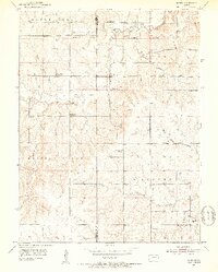
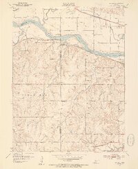
(134)- 1889 Map of Burlingame
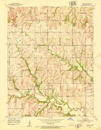
 1889 Burlingame1889 Print · USGSOsage and Shawnee Counties are seen here during the peak of late-Victorian rail expansion and coal-country growth. Genealogists and local historians can trace early township boundaries and the development of rail hubs like Osage City, Burlingame, and the settlement of Arvonia.
 - 1889 Map of Wamego
 1889 Wamego1889 Print · USGSNortheastern Kansas thrives along the river valleys in the 1880s, where rail networks and river crossings dictated the growth of the prairie. Genealogists can trace family roots in early hubs like Alma, St Marys, and Wamego, or find the path of the Union Pacific Railroad.
 - 1889 Map of Topeka
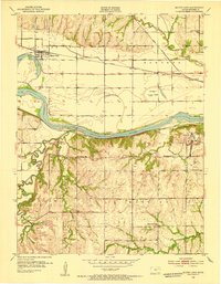
 1889 Topeka1889 Print · USGSEastern Kansas in the late nineteenth century was a landscape of rapid rail expansion and tribal land boundaries. Genealogists can trace family roots through the Pottawatomie Indian Reservation or old settlements like Holton, Rossville, and Agency.
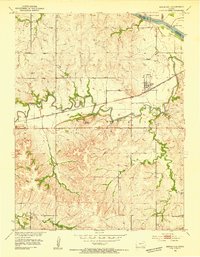
 - 1894 Map of Burlingame
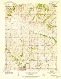
 1894 Burlingame1894 Print · USGSOsage County was a thriving rail and coal hub in the late nineteenth century, dominated by the intersecting tracks of major regional carriers. Researchers can trace the development of early Kansas towns like Scranton, Carbondale, and the river community of Quenemo.4 unique versions available
 - 1894 Map of Topeka
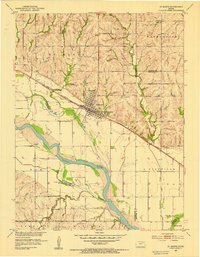
 1894 Topeka1894 Print · USGSTopeka and its northern reaches are captured here in the late nineteenth century, during a pivotal era of rail expansion and settlement. Local historians can trace the early layouts of Topeka and Silver Lake alongside the Pottawatomie Indian Reservation.5 unique versions available
 - 1894 Map of Wamego
 1894 Wamego1894 Print · USGSThe Kansas prairie in the late nineteenth century was a world of steam and river crossings, where the iron horse reshaped the frontier. Genealogists can trace family roots in established towns like Wamego, Alma, or the small settlement of Moodyville along Rock Creek.5 unique versions available
 - 1947 Map of Lawrence, 1954 Print
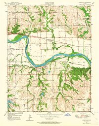
 1947 Lawrence1954 Print · USGSEastern Kansas and western Missouri thrive in the late 1940s, showing a landscape defined by major river valleys and a dense railway network. Genealogists can trace family settlements from Lawrence to Greenwood and locate landmarks like Olathe Navy and Lake Lotawana.
 - 1950 Map of Kansas City
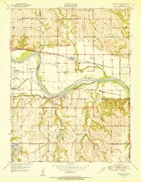
 1950 Kansas City1950 Print · USGSMid-century Kansas and Missouri are captured here during a period of industrial growth and shifting transportation. Genealogists and historians can trace rail lines like the Wabash RR or locate ancestral homes near the Potawatomi Indian Reservation and Horton.
 - 1950 Map of Lawrence
 1950 Lawrence1950 Print · USGSMid-century Kansas and Missouri come alive in this map of the river-valley corridors just as the interstate era was beginning. Researchers can trace the legacy of major rail lines like the Union Pacific RR and locate ancestral roots in towns from Lawrence to Harrisonville.
 - 1950 Map of Topeka, 1960 Print
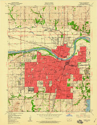 1950 Topeka1960 Print · USGSMid-century Topeka was a thriving rail hub and institutional center, bisected by the Kansas River and a massive network of steel. Genealogists and historians can trace local institutions like Washburn University and the Winter Veterans Hospital, or locate family plots in Mount Hope Fairlawn Cemetery.3 unique versions available
 - 1950 Map of Grantville, 1964 Print
 1950 Grantville1964 Print · USGSThe Kansas River valley at mid-century shows a landscape of busy rail lines and scattered rural schoolhouses. Researchers can trace the legacy of Grantville and Tecumseh along the Union Pacific tracks or locate the Frog Hatchery and Bethel Cem.4 unique versions available
 - 1951 Map of Grantville
 1951 Grantville1951 Print · USGSThe Kansas River valley in the early fifties shows a landscape of busy rail lines and rural school districts across the Shawnee and Jefferson county lines. Trace family roots at the Grantville Cem or locate former landmarks like Dawson Sch and the Power Plant at Tecumseh.2 unique versions available
 - 1951 Map of Topeka
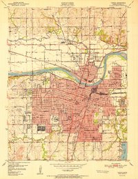 1951 Topeka1951 Print · USGSTopeka at the start of the fifties is a bustling capital hub defined by its river-valley railroads and expanding state institutions. Genealogists and historians can locate family homes near the State Capitol, Washburn University, or the sprawling Winter Veterans Hospital.2 unique versions available
 - 1952 Map of Auburn, 1953 Print
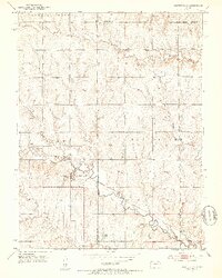
 1952 Auburn1953 Print · USGSThe rural landscape of southwest Shawnee County is captured here in the early fifties, centered on the river-fed valley of Auburn. Genealogists can trace the location of numerous country schools like Sixmile Sch and old burial grounds including Elevation Cem.4 unique versions available
 - 1952 Map of Rossville, 1953 Print
 1952 Rossville1953 Print · USGSThe rural borders of Shawnee and Jackson counties are captured here in the early fifties, a time when small country schoolhouses still dotted the prairie. You can trace family roots at Bohemian Cemetery, locate the Stone School, or follow the Union Pacific rail line.4 unique versions available
 - 1952 Map of Silver Lake, 1953 Print
 1952 Silver Lake1953 Print · USGSThe Kansas River valley west of Topeka is documented here just after the war, showing a landscape shaped by river transport and rail. You can trace the sites of rural schools like Golden Rule Sch, aviation at Shenk Landing Field, and the Union Pacific line serving Silver Lake.4 unique versions available
 - 1952 Map of Harveyville, 1953 Print
 1952 Harveyville1953 Print · USGSHarveyville and the surrounding prairie were captured in the early fifties as the local rail-and-water economy thrived. Genealogists and historians can trace the Atchison Topeka and Santa Fe line, the Bellview Sch (Abandoned), and the Cem north of town.3 unique versions available
 - 1952 Map of Elmont, 1953 Print
 1952 Elmont1953 Print · USGSNorth of Topeka in the early fifties, this rural landscape reveals the enduring imprint of the Potawatomi Old Reservation Boundary East. Researchers can trace old family sites near Elmont or locate vanished country schools like Rock Sch and North Highland Sch.5 unique versions available
 - 1952 Map of Dover, 1953 Print
 1952 Dover1953 Print · USGSShawnee County at the start of the fifties shows a landscape defined by old reservation lines and winding creek beds. Researchers can find numerous former local landmarks, including School No 6 (Abandoned), the Dover Cem, and the Girl Scout Camp near Mission Creek.3 unique versions available
 - 1952 Map of Burlingame, 1953 Print
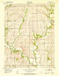
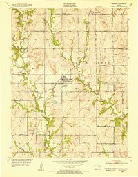
 1952 Burlingame1953 Print · USGSOsage County at the start of the fifties is defined here by its rail-linked settlements and early coal mining operations. Genealogists can trace family footprints near rural landmarks like Fair Plain Grange Hall, Supple Sch, and the Mine Dumps near Burlingame.3 unique versions available
 - 1952 Map of Grove, 1953 Print
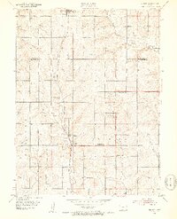
 1952 Grove1953 Print · USGSShawnee County's rural landscape is captured here in the early 1950s, showing a transition era for the Kansas prairie and its local schools. Genealogists can trace family landmarks like Bethel Chapel or locate the site of the Glen Valley Sch (Abandoned) along the banks of Soldier Creek.4 unique versions available
 - 1952 Map of Meriden, 1953 Print
 1952 Meriden1953 Print · USGSThe rural countryside around Meriden in the early fifties is mapped here in detail, showing the intersection of the Atchison Topeka and Santa Fe and local creek systems. Genealogists can trace historic school sites like Milligan Sch and Mt Bethel Sch.4 unique versions available
 - 1952 Map of Willard, 1954 Print
 1952 Willard1954 Print · USGSThe Kansas River valley at mid-century reveals a bustling corridor of competing rail lines and riverfront settlements. Researchers can trace the legacy of family farms and rural communities through landmarks like West Union Ch, Green Cem, and the Valencia townsite.4 unique versions available
 - 1953 Map of Maple Hill, 1954 Print
 1953 Maple Hill1954 Print · USGSWabaunsee County in the early fifties shows a landscape shaped by the winding Mill Creek and the busy Chicago Rock Island and Pacific railroad. Local historians can locate landmarks like Buffalo Mound, the settlement at Vera, and the rural Sunny Side Sch.2 unique versions available
 - 1953 Map of St Marys, 1954 Print
 1953 St Marys1954 Print · USGSThe Kansas River valley in the early 1950s centered on the hub of St Marys, where the rail and river economies met. Genealogists and historians can trace local rural infrastructure through sites like St Marys Seminary, Turkey Creek Sch, and Mt Calvary Cem.2 unique versions available
Showing maps 1-25 of 134
Top cities of Shawnee County
- Topeka historical maps
- Dover historical maps
- Menoken historical maps
- Silver Lake historical maps
- Auburn historical maps
- Tecumseh historical maps
See more
Frequently asked questions
- What are the different types of historical maps available for Shawnee County?
- What is the oldest map of Shawnee County?
- Where can I purchase historical maps of Shawnee County for my home or office?
- Where can I download high-res historical maps of Shawnee County?
- Are there historical topographic maps available for Shawnee County?
- Is there historical aerial imagery available for Shawnee County?
- Where are historical maps of Shawnee County sourced from?