2020s Maps of Sumner County, Kansas
Explore 30 historic maps of Sumner County from the 2020s. These maps offer a rare glimpse into what life looked like during the 2020s — showing old roads, neighborhoods, homes, and landmarks that have changed or disappeared over time.
Whether you're researching your family's past, planning a metal detecting trip, or studying how Sumner County's landscape evolved across the 2020s, these high-resolution maps are a powerful tool for exploring the history of this region.
- Focus on a specific era: All maps on this page are from the 2020s, giving you a focused view of this time period.
- See what’s changed: Compare century-old streets, trails, and buildings to today's modern landscape using overlays and satellite layers.
- Research with precision: Use these maps for genealogy, historical research, land use analysis, or educational projects.
- View, download, or print: Maps are fully viewable online in high resolution, and can be downloaded or printed for your own records.
Start exploring Sumner County's history through authentic maps from the 2020s. This is your window into the past.
Sumner County, KS maps
(30)- 2022 Map of Norwich, 2022 Print
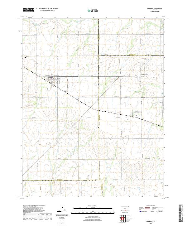 2022 Norwich2022 Print · USGSNorwich and the surrounding Kansas plains appear in great detail during this contemporary era. Genealogists and local researchers can trace family landmarks like Upchurch Cem, identify rural settlements such as Suppesville, and follow the path of Sandy Cr.
 - 2022 Map of South Haven NE, 2022 Print
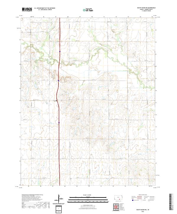 2022 South Haven NE2022 Print · USGSSumner County in the early twenty-first century is a landscape defined by its grid-work of rural roads and prairie drainage. Genealogists and local historians can locate Jordan Cem and trace the paths of Slate Cr and Snyder Cr through the countryside.
 - 2022 Map of Rome, 2022 Print
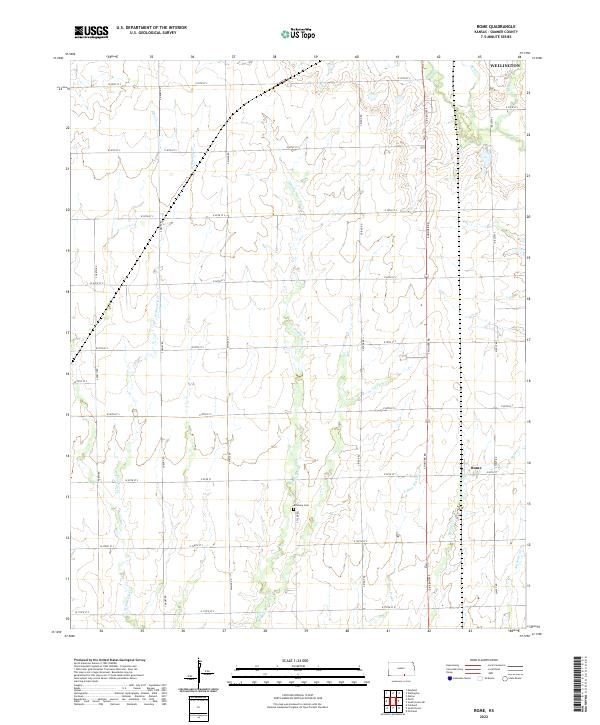 2022 Rome2022 Print · USGSSumner County at the start of the 2020s shows a deeply established agricultural grid defined by the Shoo Fly Creek system. Genealogists can locate the Attebery Cemetery and trace the rural surroundings of Rome and southern Wellington.
 - 2022 Map of South Haven, 2022 Print
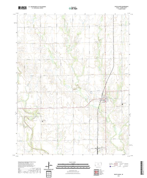 2022 South Haven2022 Print · USGSSumner County, Kansas, near the Oklahoma border, is captured here in its modern agricultural context. Researchers can trace family roots through Goodel Cem and Rose Hill Cem or locate sites in the settlements of South Haven, Hunnewell, and Drury.
 - 2022 Map of Caldwell, 2022 Print
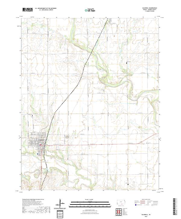 2022 Caldwell2022 Print · USGSThe Sumner County prairie near the Oklahoma border is documented here in the early twenty-first century, centered on the grid of Caldwell. Genealogists can locate family landmarks like Corzine Cem and Alton Cem among the bends of Bluff Cr.
 - 2022 Map of Mayfield, 2022 Print
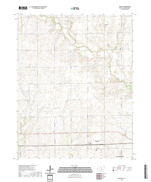 2022 Mayfield2022 Print · USGSSumner County’s agricultural heartland is documented here in the early twenty-first century as the prairie landscape meets growing local hubs. Family historians can trace rural roots through the Osborne Township Cem, the quiet settlement of Anson, and the rural reaches of Mayfield.
 - 2022 Map of Dalton, 2022 Print
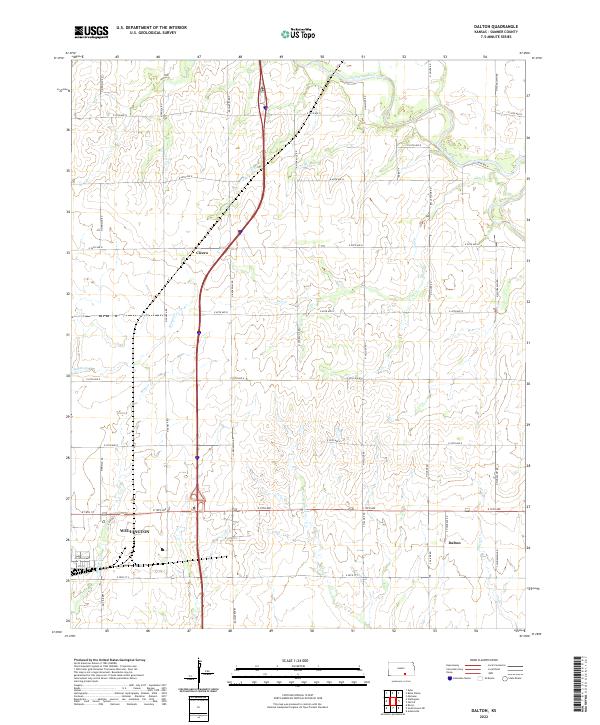 2022 Dalton2022 Print · USGSSumner County at the start of the 2020s shows a landscape of steady agriculture and small-town junctions. Genealogists and local historians can trace the rural reaches of Wellington and the quiet crossroads of Dalton and Cicero along the Ninnescah River.
 - 2022 Map of Oxford, 2022 Print
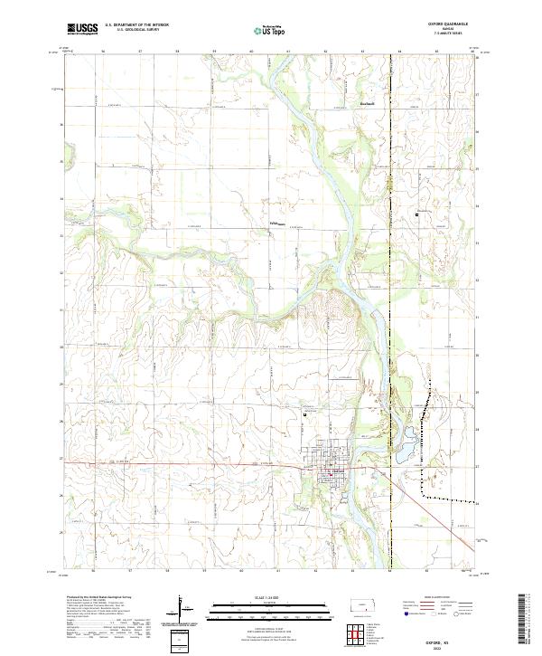 2022 Oxford2022 Print · USGSThe convergence of the Arkansas River and Ninnescah River defines this Kansas landscape in the early twenty-first century. Genealogists and local historians can locate Oxford Cem, the small community of Whitman, and the unique water path of the Mill Race.
 - 2022 Map of Bluff City East, 2022 Print
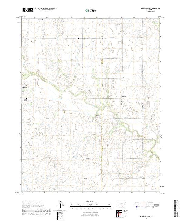 2022 Bluff City East2022 Print · USGSThe Harper and Sumner County border in South Central Kansas is captured here in a moment of rural continuity. Genealogists can locate family burial sites at Pleasant Hill Cemetery, Singer Cemetery, and Devore Cemetery, or trace the winding course of Bluff Creek through Bluff City.
 - 2022 Map of Freeport, 2022 Print
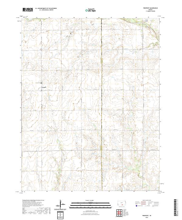 2022 Freeport2022 Print · USGSThe Kansas plains south of Anthony appear here in the early 2020s, showing a landscape of sectioned farmland and rural road grids. Researchers can locate the Freeport townsite and burial records at Freeport Cem or H and S Cem.
 - 2022 Map of Zyba, 2022 Print
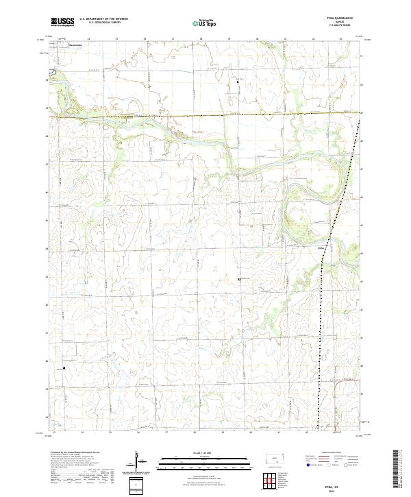 2022 Zyba2022 Print · USGSSumner County land records and prairie waterways come to life in this contemporary survey of the Zyba area. Genealogists can locate family sites near Porter Cem and Worden Cem or trace the winding course of the Ninnescah River.
 - 2022 Map of Portland, 2022 Print
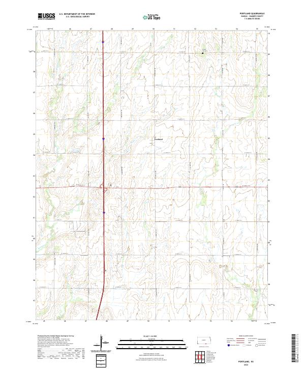 2022 Portland2022 Print · USGSSouthern Kansas farmstead patterns and drainage basins are captured here during the early twenty-first century. Genealogists and local historians can trace family land near Portland or locate burials at Forest Hill Cem along the banks of Bitter Cr.
 - 2022 Map of Caldwell NW, 2022 Print
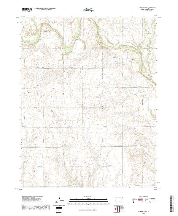 2022 Caldwell NW2022 Print · USGSSumner County’s agricultural landscape is captured here in the early 2020s, showing the enduring grid of section-line roads and prairie creeks. Researchers can locate the Morris Center Cem or trace the drainage of Spring Cr and Jordan Cr.
 - 2022 Map of Argonia, 2022 Print
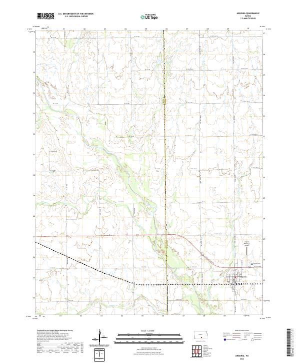 2022 Argonia2022 Print · USGSThe community of Argonia and the Sumner-Harper county line are captured here in a period of modern agricultural stability. Genealogists and local historians can trace family locations along Argonia Cr or find ancestral sites near the Argonia Cem.
 - 2022 Map of Conway Springs, 2022 Print
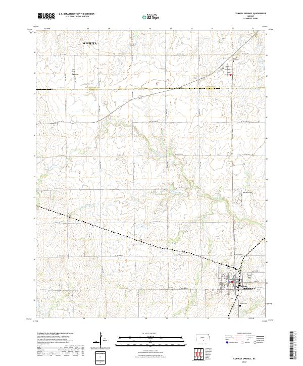 2022 Conway Springs2022 Print · USGSSumner and Sedgwick counties come into focus in the early twenty-first century, centered on the historic town site of Conway Springs. Local researchers can trace family landmarks like Viola Cemetery and Saint Josephs Cemetery or the rural reaches of Slate Creek.
 - 2022 Map of Doster, 2022 Print
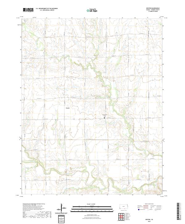 2022 Doster2022 Print · USGSSumner County in 2022 remains a landscape of high-plains agriculture organized by a meticulous grid of rural roads. Genealogists and local historians can locate the Cesko Slovanky Hrbitov Cem and trace the drainage of Bluff Cr near the settlement of Doster.
 - 2022 Map of Adamsville, 2022 Print
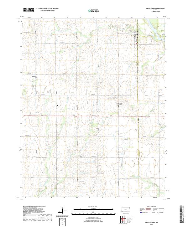
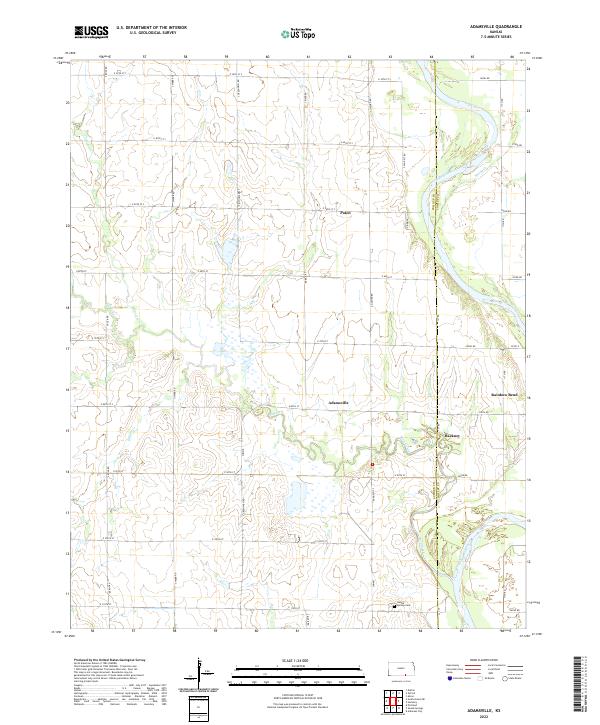 2022 Adamsville2022 Print · USGSThe Sumner and Cowley county line comes alive in the early twenty-first century as the Arkansas River and Slate Creek wind through a landscape of prairie farms. Researchers can trace rural lineages through the Geuda Springs Cem or locate the quiet crossroads of Adamsville and Paton.
 - 2022 Map of Wellington, 2022 Print
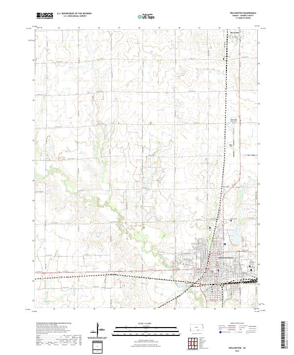 2022 Wellington2022 Print · USGSWellington and the surrounding Sumner County prairie are captured in this modern survey during a period of steady agricultural and civic life. Researchers can trace land tracts between Riverdale and Roland, or locate family sites near Fairview Cem and the Sumner County Courthouse.
 - 2022 Map of Milan, 2022 Print
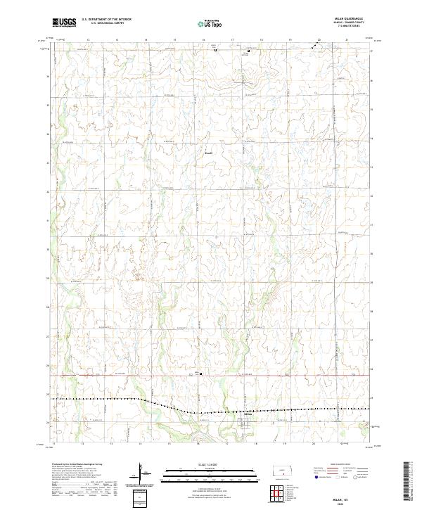 2022 Milan2022 Print · USGSSumner County as it appeared in the early 2020s shows a well-preserved rural landscape centered on the settlement of Milan. Genealogists and local historians can trace burial sites at Amish Cem and Spring Hill Cem while following the paths of Silver Cr and Shore Cr.
 - 2022 Map of Millerton, 2022 Print
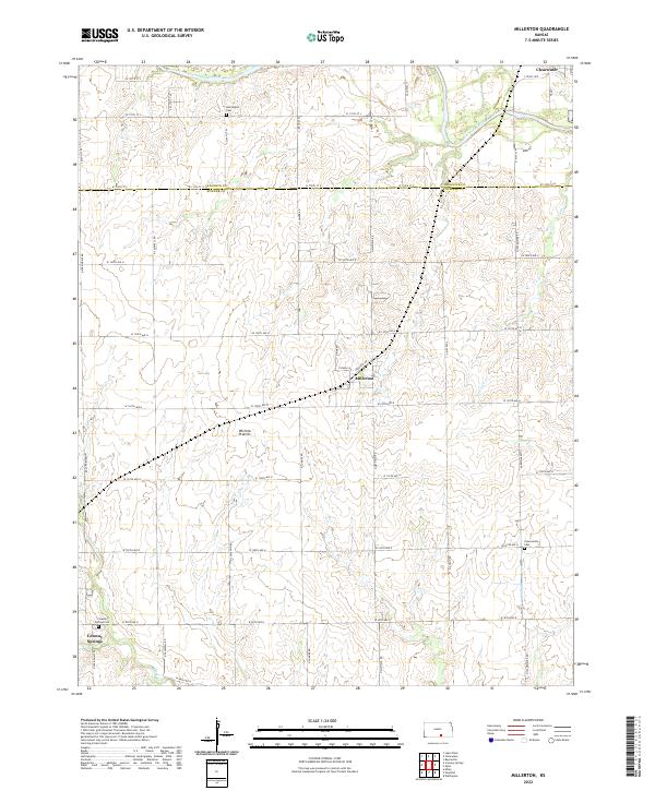 2022 Millerton2022 Print · USGSSumner County at the dawn of the 2020s remains a landscape of vast agricultural grids and quiet rural settlements. Researchers can trace family history through local burial grounds like Harrington Cem and Greencastle Cem along the Ninnescah River valley.
 - 2022 Map of Geuda Springs, 2022 Print
 2022 Geuda Springs2022 Print · USGSThe borderlands of Sumner and Cowley counties come into focus in this recent survey of the Kansas prairie. Genealogists can trace family footprints at Mount Hope Cem or Work Cem and explore the creek-fed landscape around Geuda Springs.
 - 2022 Map of Perth, 2022 Print
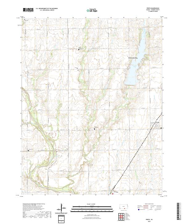 2022 Perth2022 Print · USGSSumner County remains a dedicated agricultural landscape in this modern record of the plains south of Wellington. Genealogists can locate several rural burial sites like Union Chapel Cem and Bethany Cem near the small communities of Perth and Corbin.
 - 2022 Map of Mulvane, 2022 Print
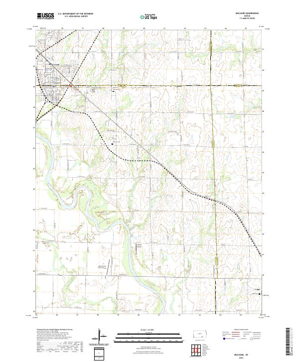 2022 Mulvane2022 Print · USGSThe Arkansas River valley near the Sumner and Cowley county lines is shown here in the early twenty-first century. Genealogists and local historians can trace family locations near Mulvane Cem, Littleton Cem, and the rural settlement of Udall.
 - 2022 Map of Belle Plaine, 2022 Print
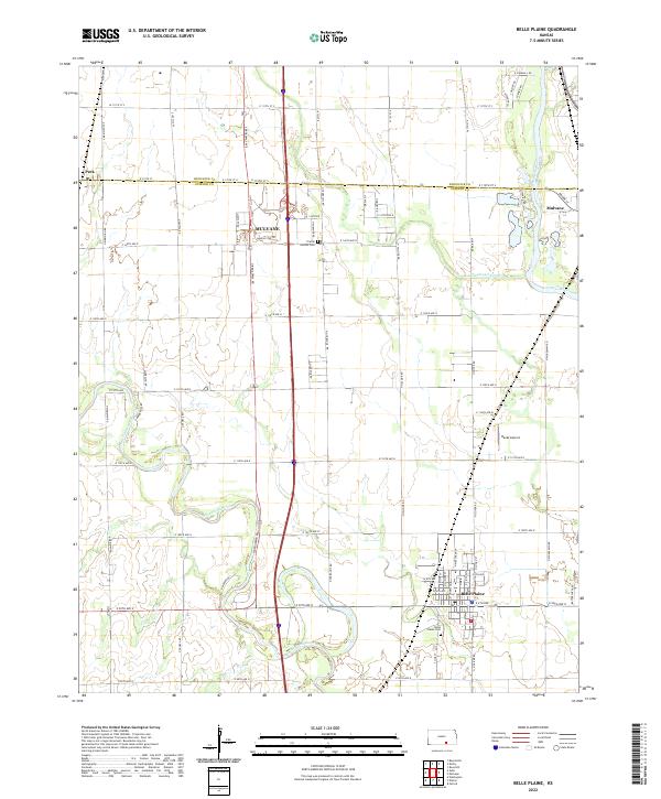 2022 Belle Plaine2022 Print · USGSSumner and Sedgwick Counties meet along the river valleys of southern Kansas in this modern study. Genealogists and local historians can trace family locations near Belle Plaine Cem, the growing grid of Mulvane, and the banks of the Ninnescah River.
 - 2022 Map of Medford NE, 2022 Print
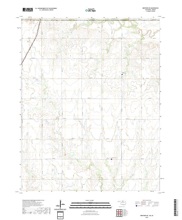 2022 Medford NE2022 Print · USGSThe Kansas-Oklahoma border comes alive in this 2020s survey of Grant and Sumner counties. Genealogists and local researchers can trace the rural landscape through the section-line roads and family histories tied to Spring Creek Cemetery and Williams Cemetery.
Showing maps 1-25 of 30
Top cities of Sumner County
- Wellington historical maps
- Belle Plaine historical maps
- Conway Springs historical maps
- Caldwell historical maps
- Oxford historical maps
- Argonia historical maps
See more
Frequently asked questions
- What are the different types of historical maps available for Sumner County?
- What is the oldest map of Sumner County?
- Where can I purchase historical maps of Sumner County for my home or office?
- Where can I download high-res historical maps of Sumner County?
- Are there historical topographic maps available for Sumner County?
- Is there historical aerial imagery available for Sumner County?
- Where are historical maps of Sumner County sourced from?