Old Maps of Washington County, Kansas for Hiking & Exploration
Hike through history with 158 historic maps of Washington County. Explore old trails, ghost towns, and forgotten backroads — perfect for outdoor adventurers and local explorers.
- Rediscover forgotten places: Map out old mining camps, roads, and footpaths that no longer exist on modern maps.
- Layer with modern tools: Combine with LiDAR or satellite views to plan hikes through historical terrain.
- Made for exploration: Popular among hikers, overlanders, and local history lovers.
Use these maps to find adventure and explore the hidden past of Washington County.
Washington County, KS maps
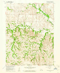
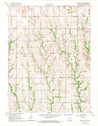
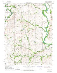
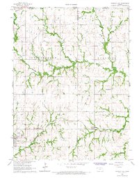
(158)- 1889 Map of Marysville
 1889 Marysville1889 Print · USGSMarshall County in the late nineteenth century was a bustling nexus of river trade and steam rail expansion. Genealogists and historians can trace early town sites like Marysville, Blue Rapids, and Irving along the Little Blue River and major rail lines.
 - 1893 Map of Washington
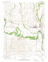
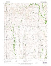
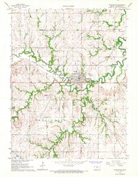
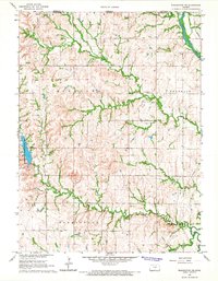
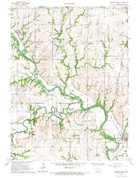
 1893 Washington1893 Print · USGSWashington County and its river valleys were being transformed by a massive expansion of rail lines in the 1890s. Researchers can trace the early footprints of settlements like Haddam, Clyde, and Linn along the Missouri Pacific Railway and the Republican River.4 unique versions available
 - 1894 Map of Marysville
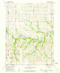
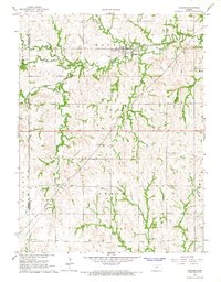
 1894 Marysville1894 Print · USGSMarshall County's river valleys and railroad corridors are intricately detailed in the 1880s, before modern highway expansion altered the rural landscape. Genealogists can locate family lands near Ballard Falls, Bremen, or the rail junctions at Marysville.4 unique versions available
 - 1955 Map of Manhattan, 1964 Print
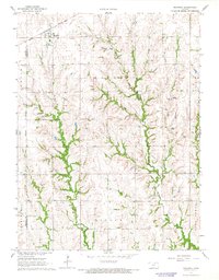
 1955 Manhattan1964 Print · USGSNorth Central Kansas is captured here in the mid-fifties, just as major flood control projects began reshaping the river valleys. Genealogists can locate family sites near St. Joseph Church, Sunset Cemetery, or along the busy tracks of the Rock Island RR.4 unique versions available
 - 1955 Map of Lincoln, 1967 Print
 1955 Lincoln1967 Print · USGSSoutheast Nebraska in the mid-fifties presents a landscape of thriving railroad towns and the expanding footprint of the capital city. Researchers can trace the legacy of the pioneer era at the Homestead National Monument of America or locate mid-century military infrastructure like Lincoln Air Force Base.5 unique versions available
 - 1956 Map of Manhattan
 1956 Manhattan1956 Print · USGSNorth-central Kansas in the mid-fifties reveals a landscape defined by the convergence of the Republican River and Smoky Hill River. Historians can trace the rail corridors of the Union Pacific RR and Missouri Pacific RR through towns like Manhattan and Clay Center.
 - 1957 Map of Manhattan
 1957 Manhattan1957 Print · USGSNortheast Kansas in the mid-1950s reveals a landscape of expanding military installations and new water projects. Genealogists and historians can trace the rail-to-river economy through the Union Pacific RR and old settlements like Clay Center or Marysville.
 - 1957 Map of Lincoln
 1957 Lincoln1957 Print · USGSSoutheastern Nebraska at mid-century shows a landscape of thriving rail towns and expanding infrastructure centered on Lincoln. Researchers can trace the path of the Chicago Burlington and Quincy railroad through communities like Weeping Water, Fairmont, and Seward.
 - 1958 Map of Lincoln
 1958 Lincoln1958 Print · USGSSoutheast Nebraska at the end of the 1950s shows a region defined by agricultural trade and the expansion of the state capital. Genealogists can trace family footprints across the Blue Valley and locate landmarks like the Lincoln AFB or the U.S. Veterans Hospital.
 - 1960 Map of Fairbury SW, 1961 Print
 1960 Fairbury SW1961 Print · USGSThe Jefferson County borderlands at the start of the 1960s reveal a landscape of rural schools and intersecting rail lines. Genealogists and historians can trace family roots through landmarks like Silver Creek Cem, Pleasant Valley Sch, and the Little Blue River valley.
 - 1960 Map of Reynolds, 1961 Print
 1960 Reynolds1961 Print · USGSJefferson County at the dawn of the sixties shows a landscape of rural school districts and dual rail lines. Genealogists can trace family footprints near Reynolds and Rose Creek Cem, or follow the path of the Chicago Burlington and Quincy railroad.2 unique versions available
 - 1965 Map of Clifton, 1966 Print
 1965 Clifton1966 Print · USGSThe Republican River valley in the mid-1960s reveals a landscape where the Chicago Rock Island and Pacific railroad links the communities of Clifton and Vining. Local historians can trace cemetery locations like St Marys Cem and follow the winding courses of Dry Creek and Scribner Creek.
 - 1965 Map of Brantford, 1966 Print
 1965 Brantford1966 Print · USGSThe rural borders of Washington and Republic Counties are captured in the mid-1960s, showing a landscape defined by small farming communities and country churches. Genealogists can trace family roots at numerous sites including St Bernards Cem, Zion Ch, and the settlement of Brantford.
 - 1966 Map of Washington NW, 1967 Print
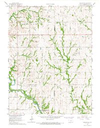
 1966 Washington NW1967 Print · USGSWashington County at the height of the mid-sixties reveals a landscape shaped by rural tradition and natural drainage. Genealogists and researchers can locate family landmarks such as SS Peter and Paul Ch and Greenfield Cem among the hills of Lowe.
 - 1966 Map of Morrowville, 1967 Print
 1966 Morrowville1967 Print · USGSMorrowville and the surrounding Washington County townships are captured here in the mid-1960s as a landscape of rail and stream. Researchers can trace family history through several local cemeteries including Hickory Grove Cem and Friends Cem near Enosdale.
 - 1966 Map of Washington, 1967 Print
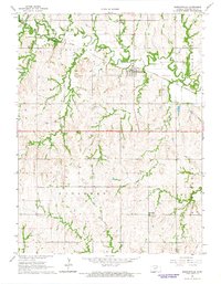
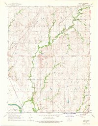
 1966 Washington1967 Print · USGSWashington and the surrounding North Central Kansas prairies are documented here in the mid-sixties at a peak of rail and river commerce. Researchers can trace the junction of the Chicago Burlington and Quincy and Missouri Pacific railroads or locate local burial sites like Mt Pleasant Cem and Merkey Cem.
 - 1966 Map of Hanover SE, 1967 Print
 1966 Hanover SE1967 Print · USGSWashington and Marshall County lands are shown here in the mid-1960s as the Little Blue River meets the Tuttle Creek Reservoir. Family historians can locate several rural landmarks, including Pecenka Cem, Evergreen Cem, and the Trinity Ch.2 unique versions available
 - 1966 Map of Hanover SW, 1967 Print
 1966 Hanover SW1967 Print · USGSWashington County at the height of the mid-sixties reveals a rural landscape defined by the Little Blue River and the Chicago Burlington and Quincy railroad. Researchers can locate local landmarks like the Townhall and family heritage sites at St Paul Cem.2 unique versions available
 - 1966 Map of Washington NE, 1967 Print
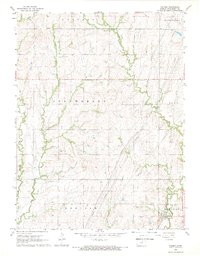
 1966 Washington NE1967 Print · USGSNorth-central Kansas farmland and river valleys are captured here in the mid-sixties. Researchers can trace land use patterns near Washington County State Park or locate family sites at Silver Cliff Cem and Gaskill Cem.
 - 1966 Map of Haddam, 1967 Print
 1966 Haddam1967 Print · USGSThe northern Kansas prairie is captured here in the mid-1960s, centered on the railroad town of Haddam. Researchers can trace the legacy of the Chicago Burlington and Quincy line or locate family sites like Haddam Cem and Oliver Cem.
 - 1966 Map of Mahaska, 1967 Print
 1966 Mahaska1967 Print · USGSThe northern Kansas prairie meets the Nebraska border in the mid-1960s, where rail lines and creek beds define the rural landscape. Researchers can trace the Chicago Rock Island and Pacific railroad through Mahaska or locate family plots at Mahaska Cem.
 - 1966 Map of Hanover West, 1967 Print
 1966 Hanover West1967 Print · USGSWashington County, Kansas, is shown in the mid-sixties at the confluence of the Little Blue River and Mill Creek. Genealogists can trace the Old Indian Treaty Boundary and locate family sites near Hollenberg, Spence, and Prall Cem.2 unique versions available
 - 1966 Map of Hanover East, 1967 Print
 1966 Hanover East1967 Print · USGSWashington County at the Nebraska border comes into focus in the mid-sixties, revealing a landscape defined by rail lines and historic trails. Trace the Old Indian Treaty Boundary or locate family roots at St Johns Cem and Trinity Ch.2 unique versions available
 - 1968 Map of Linn SW, 1969 Print
 1968 Linn SW1969 Print · USGSAgricultural life in late 1960s North Central Kansas is centered here at the border of Washington and Clay Counties. Genealogists can locate rural churches and burial sites like Faith United Ch, Norwegian Cem, and Garfield Center.
 - 1968 Map of Palmer, 1969 Print
 1968 Palmer1969 Print · USGSIn the late sixties, the town of Palmer remained a key hub for the local prairie economy along the Missouri Pacific railroad. Genealogists and historians can trace rural family roots at Reiter Cem, St Paul Cem, and the old Immanuel Sch.
Showing maps 1-25 of 158
Top cities of Washington County
- Washington historical maps
- Hanover historical maps
- Linn historical maps
- Greenleaf historical maps
- Haddam historical maps
- Morrowville historical maps
See more
Frequently asked questions
- What are the different types of historical maps available for Washington County?
- What is the oldest map of Washington County?
- Where can I purchase historical maps of Washington County for my home or office?
- Where can I download high-res historical maps of Washington County?
- Are there historical topographic maps available for Washington County?
- Is there historical aerial imagery available for Washington County?
- Where are historical maps of Washington County sourced from?