1960s Maps of Allen County, Kentucky
Explore 5 historic maps of Allen County from the 1960s. These maps offer a rare glimpse into what life looked like during the 1960s — showing old roads, neighborhoods, homes, and landmarks that have changed or disappeared over time.
Whether you're researching your family's past, planning a metal detecting trip, or studying how Allen County's landscape evolved across the 1960s, these high-resolution maps are a powerful tool for exploring the history of this region.
- Focus on a specific era: All maps on this page are from the 1960s, giving you a focused view of this time period.
- See what’s changed: Compare century-old streets, trails, and buildings to today's modern landscape using overlays and satellite layers.
- Research with precision: Use these maps for genealogy, historical research, land use analysis, or educational projects.
- View, download, or print: Maps are fully viewable online in high resolution, and can be downloaded or printed for your own records.
Start exploring Allen County's history through authentic maps from the 1960s. This is your window into the past.
Allen County, KY maps
(5)- 1965 Map of Austin, 1967 Print
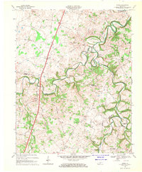
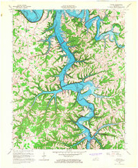 1965 Austin1967 Print · USGSBarren and Allen Counties are shown in the mid-1960s as the rising waters of the Barren River Reservoir reshaped the valley. Genealogists and local historians can trace family locations near Austin, Cedar Cross Cem, and Capitol Hill Ch.4 unique versions available
 - 1965 Map of Meador, 1967 Print
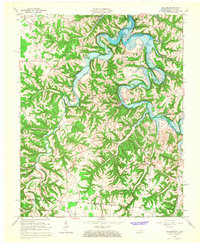
 1965 Meador1967 Print · USGSThe Barren River valley in the mid-1960s shows a landscape transformed by the creation of the Barren River Reservoir. Genealogists and local historians can trace family locations near Meador, Martinsville, and rural landmarks like Mt Zion Ch or the Martinsville Ford.
 - 1965 Map of Holland, 1967 Print
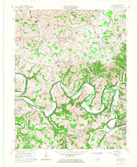
 1965 Holland1967 Print · USGSThe Barren River valley in the mid-1960s shows a landscape in transition as the new reservoir fills the winding river bends. Researchers can trace family roots through several rural churches and schools, such as Liberty Church, Highland Church, and the Mt Zion School.
 - 1967 Map of Hickory Flat, 1969 Print
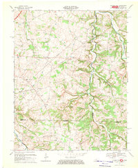 1967 Hickory Flat1969 Print · USGSThe Simpson and Allen County line at the Tennessee border was a network of rural hamlets and family farmsteads in the late sixties. Researchers can find numerous burial grounds and churches like Smyrna Ch, Loving Chapel Cem, and the Round Pond Sch.
 - 1968 Map of Drake, 1969 Print
 1968 Drake1969 Print · USGSThe rural borderlands of Warren and Simpson Counties are captured here in the late sixties, where small crossroads communities define the landscape. Researchers can locate family landmarks such as Marthas Chapel, the Barnes Sch, and the winding West Fork Drakes Creek.2 unique versions available
End of results
Showing maps 1-5 of 5
Top cities of Allen County
Frequently asked questions
- What are the different types of historical maps available for Allen County?
- What is the oldest map of Allen County?
- Where can I purchase historical maps of Allen County for my home or office?
- Where can I download high-res historical maps of Allen County?
- Are there historical topographic maps available for Allen County?
- Is there historical aerial imagery available for Allen County?
- Where are historical maps of Allen County sourced from?