Old Maps of Butler County, Kentucky for Metal Detecting
Plan your next treasure hunt with 112 historic maps of Butler County. Find old homesites, ghost towns, trails, and gathering spots that may be lost to time — perfect for identifying promising metal detecting locations.
- Locate forgotten sites: Uncover places like long-lost settlements, abandoned rail lines, or gathering spots.
- Plan better hunts: Use map overlays combined with LiDAR or satellite views to narrow in on historically rich areas.
- Made for detectorists: Thousands of hobbyists use these maps to discover relics, coins, and hidden history.
Use these historic maps to boost your research and find new opportunities beneath the surface of Butler County.
Butler County, KY maps
(112)- 1909 Map of Hartford
 1909 Hartford1909 Print · USGSOhio County and the Green River valley are captured here just after the turn of the century, when river ferries and coal rail lines drove the local economy. Trace the old ferry crossings like Stroud Ferry and mining centers at Taylor Mines and Render.2 unique versions available
 - 1911 Map of Dunmor
 1911 Dunmor1911 Print · USGSMuhlenberg and Butler Counties are shown here just before the Great War, when river ferries and small rural schools anchored local life. Genealogists can trace family footprints at Mining City, Ebenezer Church, and the river landings near Skilesville.
 - 1914 Map of Little Muddy
 1914 Little Muddy1914 Print · USGSThe river-driven economy of Butler and Warren Counties is captured here in the years before widespread bridge construction. Genealogists can locate family-named landmarks and rural hubs like Morgantown, Stevenson Chapel, and crossings at Doctors Ford.4 unique versions available
 - 1914 Map of Dunmor
 1914 Dunmor1914 Print · USGSWestern Kentucky in the early twentieth century is defined by the river-borne trade of the Green River and the rural industry of the Mud River Mine. Genealogists and historians can trace defunct post offices like Boston Herschel PO and family-named crossings including Arnolds Bridge and Doolins Ferry.
 - 1922 Map of Leitchfield
 1922 Leitchfield1922 Print · USGSGrayson and Edmonson counties in the early twenties were defined by a robust network of small schools and local industry. Genealogists can trace family connections through landmarks like Duvall Cemetery, the Kentucky Rock Asphalt Co Mine, and the Rogers Springs School.
 - 1922 Map of Brownsville
 1922 Brownsville1922 Print · USGSEdmonson and Warren Counties are mapped here in the early 1920s, showing a river-centered economy still reliant on ferries and landings. Genealogists can trace family footprints across dozens of country school sites like Poplar Spring School and historic crossings like Sadler Ford.
 - 1923 Map of Brownsville
 1923 Brownsville1923 Print · USGSThe river-driven economies of Edmonson and Warren counties are preserved here in the early twentieth century. Researchers can trace ancestral locations through dozens of named sites like Bethlehem Church, Dalton Ferry, and rural schoolhouses including Poplar Spring School.3 unique versions available
 - 1925 Map of Spring Lick
 1925 Spring Lick1925 Print · USGSButler and Ohio counties are shown here in the mid-1920s, featuring a landscape of rural schoolhouses and river bends. Genealogists can trace family connections through sites like Flener Chapel, Whiteoak School, and the Illinois Central rail stops.2 unique versions available
 - 1925 Map of Leitchfield
 1925 Leitchfield1925 Print · USGSGrayson and Edmonson counties are mapped in the mid-twenties as rural farming and coal communities. Genealogists can locate family landmarks like Rogers Springs School, the Meredith Coal Bank, and Beech Grove Church.2 unique versions available
 - 1951 Map of South Union, 1953 Print
 1951 South Union1953 Print · USGSSouth Union and the Gasper River valley appear here in the early fifties, showing a rural Logan County landscape defined by family farms and rail transport. Genealogists can locate several country churches and burial sites including Felts Cem, Liberty Ch, and the Gasper River Cem.2 unique versions available
 - 1953 Map of Dunmor, 1954 Print
 1953 Dunmor1954 Print · USGSThe rural borders of Muhlenberg, Butler, and Logan Counties are captured in the early fifties, showing a landscape of ridge-top settlements and river bottomlands. Researchers can find ancestral sites from Old Hebron Ch to Forgys Mill and Hollow Bill.2 unique versions available
 - 1953 Map of South Hill, 1954 Print
 1953 South Hill1954 Print · USGSButler County in the early fifties was a landscape of river-bend settlements and active extraction. Genealogists and historians can locate numerous family burial grounds like Webster Cem and Rone Cem, as well as the sites of Hickory Stand Sch and the southern Oil Field.2 unique versions available
 - 1953 Map of Quality, 1954 Print
 1953 Quality1954 Print · USGSButler and Logan Counties in the early fifties reveal a landscape of small rural settlements and an active network of country schools. Genealogists can trace family roots through landmarks like Duncan Cem, Tunnertown (Berrys Lick P O), and the Union Zion Sch.2 unique versions available
 - 1953 Map of Rochester, 1954 Print
 1953 Rochester1954 Print · USGSThe Green River valley in the early fifties shows a bustling network of river towns and rural school districts at the junction of three counties. Researchers can trace family sites near Rochester, find old schoolhouses like Mud River Mine Sch, or locate the Lock No 3 river works.2 unique versions available
 - 1953 Map of Ready, 1954 Print
 1953 Ready1954 Print · USGSEdmonson and Grayson Counties are captured here in the early fifties, showing a rural landscape defined by close-knit crossroads communities. Researchers can trace the locations of family landmarks and local institutions like Rabbit Flat Ch, Sunfish Sch, and the Woosley Cem.3 unique versions available
 - 1954 Map of Evansville
 1954 Evansville1954 Print · USGSThe Ohio River borderlands between Indiana and Kentucky appear here during a period of robust industrial and military growth. Genealogists and researchers can trace the rail corridors of the Illinois Central and find landmarks like US Lock and Dam No 48 or Camp Breckinridge.
 - 1954 Map of Spring Lick, 1955 Print
 1954 Spring Lick1955 Print · USGSGrayson and Butler counties are captured here in the mid-fifties, showing a rural landscape of small rail-side settlements and ridge-top farms. Local historians can trace family roots through numerous country landmarks like Goffs (Steff P.O.), Do Stop, and Smalls Grove Ch.
 - 1954 Map of Welchs Creek, 1955 Print
 1954 Welchs Creek1955 Print · USGSButler County ridge country was a network of small schoolhouses and family-named cemeteries during the mid-fifties. Genealogists and hikers can trace old landmarks like Skullbone Rockhouse, the Lumbustown Cem, and Indian Camp Sch.2 unique versions available
 - 1954 Map of Cromwell, 1955 Print
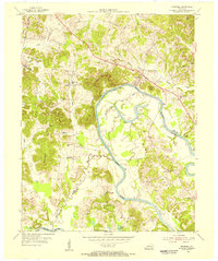 1954 Cromwell1955 Print · USGSThe Green River valley at the Butler and Ohio County border appears here in the mid-fifties, dominated by deep river bends and rural settlements. Family historians can trace ancestral sites like Paxton Cem, New Harmony Ch, and the old river crossing at Reeds Ferry.2 unique versions available
 - 1954 Map of Flener, 1955 Print
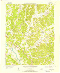 1954 Flener1955 Print · USGSThe Green River valley at the Butler and Ohio county line is captured here in the mid-1950s. Researchers can locate family landmarks like Daugherty Cem or trace rural life at Flener Chapel and Embry Sch.
 - 1954 Map of Rosine, 1955 Print
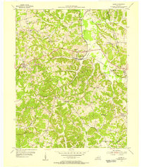 1954 Rosine1955 Print · USGSThe hill country of Ohio County in the mid-1950s is recorded here as the Illinois Central railroad connected rural hubs. Genealogists can trace family names at Boyd Cem or locate the old Leach Sch and settlements like Dogwalk.
 - 1954 Map of Reedyville, 1955 Print
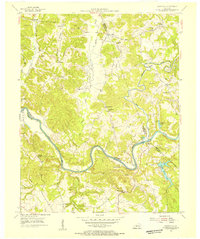 1954 Reedyville1955 Print · USGSButler and Edmonson Counties come alive in the mid-1950s as a landscape of river navigation and ridge-top farming. Genealogists and historians can trace family sites like Threlkel Cem, the busy Honakers Ferry, and Lock No 5 on the Green River.3 unique versions available
 - 1954 Map of Morgantown, 1956 Print
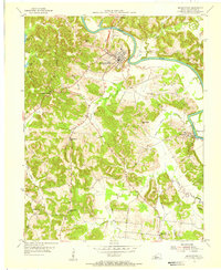 1954 Morgantown1956 Print · USGSButler County's river-driven economy and ridge-top settlements are captured here in the mid-1950s. Genealogists and researchers can locate family-named landmarks like Wade Cemetery, rural school sites such as Carved Rock School, and the river works at Lock No 4.2 unique versions available
 - 1954 Map of Sugar Grove, 1956 Print
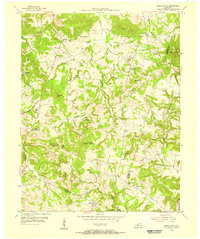 1954 Sugar Grove1956 Print · USGSButler and Warren counties are captured here in the mid-fifties, showing a rural landscape of small crossroads settlements and family farms. Researchers can locate many old burial grounds and country sanctuaries like Richland Ch, New Tuck Cem, and Shiloh Ch.2 unique versions available
 - 1954 Map of Riverside, 1956 Print
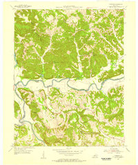 1954 Riverside1956 Print · USGSThe convergence of the Green and Barren Rivers defines this rural Kentucky landscape during the mid-fifties. Genealogists can trace family-named sites like Clark Landing and Leonard Oak Sch, or locate numerous country burial grounds such as Reedy Point Cem.3 unique versions available
Showing maps 1-25 of 112
Top cities of Butler County
Frequently asked questions
- What are the different types of historical maps available for Butler County?
- What is the oldest map of Butler County?
- Where can I purchase historical maps of Butler County for my home or office?
- Where can I download high-res historical maps of Butler County?
- Are there historical topographic maps available for Butler County?
- Is there historical aerial imagery available for Butler County?
- Where are historical maps of Butler County sourced from?